Calbuco
| Calbuco | ||||||
|---|---|---|---|---|---|---|
| City and Commune | ||||||
|
San Miguel Arcangel de Calbuco | ||||||
| ||||||
| Coordinates: 41°46′S 73°08′W / 41.767°S 73.133°W | ||||||
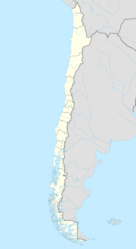
| Country | Chile | |||||
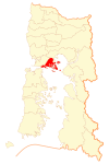
| Region | Los Lagos | |||||
| Province | Llanquihue | |||||
| Founded as | Fuerte San Miguel de Calbuco | |||||
| Founded | May, 1603 | |||||
| Government[1] | ||||||
| • Type | Municipality | |||||
| • Alcalde | Rubén Cárdenas Gómez (PRSD) | |||||
| Area[2] | ||||||
| • Total | 590.8 km2 (228.1 sq mi) | |||||
| Elevation | 7 m (23 ft) | |||||
| Population (2012 Census)[2] | ||||||
| • Total | 32,963 | |||||
| • Density | 56/km2 (140/sq mi) | |||||
| • Urban | 12,165 | |||||
| • Rural | 18,905 | |||||
| Sex[2] | ||||||
| • Men | 15,906 | |||||
| • Women | 15,164 | |||||
| Time zone | CLT (UTC−4) | |||||
| • Summer (DST) | CLST (UTC−3) | |||||
| Area code(s) | 56 + 65 | |||||
| Website | Municipality of Calbuco | |||||

Calbuco is a city and commune in southern Chile administered by the Municipality of Calbuco. Administratively Calbuco belongs to the Llanquihue Province of Los Lagos Region. The origin of the city was the Spanish Fort Calbuco founded in 1603, and became later an important fish market. The archaeological site of Monte Verde lies within the commune.
Calbuco Island is part of the commune and contains the city of Calbuco. There are thirteen other islands in the commune: Huar, Puluqui, Chidhuapi, Tabón, Mayelhue, Lín, Quenu, Quihua, Huapi Abtao, Chaullín, Caicué o lagartija, Tautil and Queullín.[3]
History
The settlement of Calbuco grew out of the fort Fuerte San Miguel de Calbuco which was founded in 1603 by Francisco Hernández Ortiz-Pizarro.
Calbuco was the capital of Calbuco Department, Chiloé between 1834 and 1855, and of Carelmapu Department between 1855 and 1928. It was capital of Calbuco Department, Llanquihue between 1937 and 1975.
Demographics
According to the 2002 census of the National Statistics Institute, Calbuco spans an area of 590.8 km2 (228 sq mi) and has 31,070 inhabitants (15,906 men and 15,164 women). Of these, 12,165 (39.2%) lived in urban areas and 18,905 (60.8%) in rural areas. The population grew by 15% (4,043 persons) between the 1992 and 2002 censuses.[2]
Settlements
Besides the town of Calbuco, Calbuco Comuna is also home to the settlements of: Pargua, Puluqui Island, San Rafael and Texas. The town of San Rafeal is across the estuary from the town of Calbuco. Texas was a refugee camp built after the 1960 earthquake on the outskirts of San Rafael; it has become semi-permanent.[4] Pargua is the ferry port and gateway to the Chiloé Archipelago and the big island of Chiloé. Pargua was considered rural until the 2002 census, and the 800+ people on Puluqui Island are still denominated as "rural" although clustered around the bay where the daily barge docks.
Administrative divisions
Calbuca Comuna is divided into twenty districts. Calbuco is the most populous with the highest population density, while Río Tambor is the largest at 141.1 square kilometres (54.5 sq mi) and has the lowest density. Alfaro, Quenu, Puluqui, Challahue, Machildad, Chucahua, Quetrolauquén, Aguantao, Huayún and Río Tambor are more sparcly population being further away from the towns of Calbuco and San Rafael.[5]
- Aguantao
- Alfaro
- Calbuco
- Caicaén
- Challahue
- Chechil
- Chidguapi
- Chucahue
- El Rosario
- Guayún
- Llaicha
- Machildad
- Puluqui
- Quenu
- Quetrulauquén
- Queullin
- Río Tambor
- San José de Quigua
- San Rafael
- Tabón
Administration
As a commune, Calbuco is a third-level administrative division of Chile administered by a municipal council, headed by an alcalde who is directly elected every four years. The 2008-2012 alcalde is Rubén Cárdenas Gómez (PRSD), and the council has the following members:[1]
- Pedro Yáñez (RN)
- Luis Garay (PPD)
- Doris Villarroel (PDC)
- Ramón Andrade Chávez (Ind./PS)
- Ana Celia Díaz Velásquez (UDI)
- Nelson Villarroel Castrillón (RN)
Within the electoral divisions of Chile, Calbuco is represented in the Chamber of Deputies by Marisol Turres (UDI) and Patricio Vallespín (PDC) as part of the 57th electoral district, (together with Puerto Montt, Cochamó and Maullín). The commune is represented in the Senate by Camilo Escalona Medina (PS) and Carlos Kuschel Silva (RN) as part of the 17th senatorial constituency (Los Lagos Region).
References
- 1 2 "Municipality of Calbuco" (in Spanish). Retrieved 7 September 2010.
- 1 2 3 4 "National Statistics Institute" (in Spanish). Retrieved 16 January 2010.
- ↑ "Caracterización de la Comuna" (PDF). Plan de Desarrollo Comunal Plan de Desarrollo Comunal Calbuco, 2009– 2013. Municipalidad Calbuco. 2009. p. 5. Archived (PDF) from the original on 7 September 2012.
- ↑ "Resumen histórico" (PDF). Plan de Desarrollo Comunal Plan de Desarrollo Comunal Calbuco, 2009– 2013. Municipalidad Calbuco. 2009. p. 4. Archived (PDF) from the original on 7 September 2012.
- ↑ "Distribución Urbano – Rural de la Población por Distritos Censales" (PDF). Plan de Desarrollo Comunal Plan de Desarrollo Comunal Calbuco, 2009– 2013. Municipalidad Calbuco. 2009. pp. 10–11. Archived (PDF) from the original on 7 September 2012.
External links
- (Spanish) Municipality of Calbuco

Coordinates: 41°46′S 73°08′W / 41.767°S 73.133°W