Osorno, Chile
| Osorno | ||||||
|---|---|---|---|---|---|---|
| City and Commune | ||||||
 | ||||||
| Coordinates (alcalde's office): 40°34′21″S 73°08′07″W / 40.57250°S 73.13528°WCoordinates: 40°34′21″S 73°08′07″W / 40.57250°S 73.13528°W | ||||||
| Country | Chile | |||||
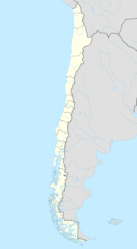
| Region | Los Lagos | |||||
| Province | Osorno | |||||
| Commune | Osorno | |||||
| Founded | 1558 | |||||
| Government[1] | ||||||
| • Type | Municipality | |||||
| • Alcalde | Jaime Alberto Bertin Valenzuela (DC) | |||||
| Area[2] | ||||||
| • Total | 951.3 km2 (367.3 sq mi) | |||||
| Elevation | 35 m (115 ft) | |||||
| Population (2002 Census)[2] | ||||||
| • Total | 145,475 | |||||
| • Estimate (2008) | 160,000 | |||||
| • Density | 150/km2 (400/sq mi) | |||||
| • Urban | 132,245 | |||||
| • Rural | 13,230 | |||||
| Demonym(s) | Osornian | |||||
| Sex[2] | ||||||
| • Men | 70,743 | |||||
| • Women | 74,732 | |||||
| Time zone | CLT (UTC−4) | |||||
| • Summer (DST) | CLST (UTC−3) | |||||
| Postal code | 5290000 | |||||
| Area code(s) | 56 + 64 | |||||
| Climate | Cfb | |||||
| Website | Official website (Spanish) | |||||
.svg.png)


Osorno is a city and commune in southern Chile and capital of Osorno Province in the Los Lagos Region. It had a population of 145,475, as of the 2002 census. It is located 945 kilometres (587 mi) south of the national capital of Santiago, 105 kilometres (65 mi) north of the regional capital of Puerto Montt and 260 kilometres (160 mi) west of the Argentine city of San Carlos de Bariloche, connected via International Route 215 through the Cardenal Antonio Samoré Pass.
Located at the confluence of Rahue and Damas River Osorno is the main service centre of agriculture and cattle farming in the northern Los Lagos Region. The city's cultural heritage is shaped by Spanish, Huilliche and German influences.
History
.jpg)
New Osorno
The city was originally planned to be founded in 1553, under the Government of Pedro de Valdivia by his companion of conquest, Lieutenant General Don Francisco de Villagra; with the name of Santa Marina de Gaete, on the site of a Huilliche village named Chauracavi. However, the death of Valdivia prevented the realization of this plan when he was about to materialize.
On March 27, 1558, the city is finally founded by the governor, García Hurtado de Mendoza; with the new name of Villa de San Mateo de Osorno, in honor of his grandfather, Count of Osorno. It was destroyed again by the indigenous Huilliche people in October 1602.
Old Osorno
On November 22, 1792, Tomás de Figueroa took possession of the ruins. Under the orders of Ambrosio O'Higgins, Osorno was again rebuilt by Juan Mackenna, and declared officially re-populated in 1796. O'Higgins, in turn, was awarded the title of Marquess of Osorno.
Osorno owes its legacy to fairly recent Chilean settlement, when the government subdued the region's indigenous Mapuche peoples in the mid-19th century and opened the land to Chilean and European immigration soon to follow. Large percentage of locals in Osorno are descendants of Spanish (the livestock grazing industry owes its foundation to the Basques) and other European immigrants.
Around 1850, the government of Chile began inviting German settlers to the colony to promote growth in the region; the settlers found Osorno's climate and geography to be very similar to their own. With their help, Osorno was made the home of the National Cattle ranch of Chile, boosting the regional economy significantly. Present-day Osorno has preserved 19th century architecture and urban layout, represented by six picturesque houses which have been designated national monuments.[3]
Osorno has a long history of rivalry with Valdivia, and in a 2006 referendum, the Osorno Province rejected its proposed incorporation into the new Los Ríos Region, of which Valdivia is now the capital.
Climate
Osorno has an oceanic climate (Köppen climate classification Cfb) with a drying trend in summer.[4] Winters are cool but mild with a July average of 7.6 °C (45.7 °F). Most of the precipitation falls during this time of the year with May to July being the wettest months, averaging around 180 millimetres (7 in) to 210 millimetres (8 in) of precipitation and humidity is high, averaging around 85%.[5] Snowfalls are rare.[5] Summers are drier and mild with a January average of 17.8 °C (64.0 °F) and during this time, precipitation is lower, averaging 48.9 millimetres (2 in) in January. In some years, many days can go without a day of precipitation such as the case in 1992 when only 1.1 millimetres (0 in) of precipitation was recorded in January while in other years, some summers can have several wet days in a row.[5] Temperatures can occasionally exceed 25 °C (77 °F) anytime from December to March.[6] The average annual precipitation is 1,318 millimetres (52 in) and there are 173 days with measureable precipitation. The record high was 36.1 °C (97.0 °F) in January 1975 and the record low was −8.0 °C (17.6 °F) in July 1954.[7]
| Climate data for Osorno, Chile (Cañal Bajo Carlos Hott Siebert Airport) 1970–2000, extremes 1952–present | |||||||||||||
|---|---|---|---|---|---|---|---|---|---|---|---|---|---|
| Month | Jan | Feb | Mar | Apr | May | Jun | Jul | Aug | Sep | Oct | Nov | Dec | Year |
| Record high °C (°F) | 36.1 (97) |
36.0 (96.8) |
34.5 (94.1) |
29.2 (84.6) |
21.5 (70.7) |
20.7 (69.3) |
18.6 (65.5) |
25.0 (77) |
24.4 (75.9) |
29.0 (84.2) |
36.0 (96.8) |
35.4 (95.7) |
36.1 (97) |
| Average high °C (°F) | 22.0 (71.6) |
22.0 (71.6) |
19.8 (67.6) |
16.2 (61.2) |
13.1 (55.6) |
10.7 (51.3) |
10.3 (50.5) |
11.6 (52.9) |
13.7 (56.7) |
15.9 (60.6) |
18.0 (64.4) |
20.4 (68.7) |
16.1 (61) |
| Daily mean °C (°F) | 17.8 (64) |
17.2 (63) |
15.4 (59.7) |
12.4 (54.3) |
10.1 (50.2) |
7.9 (46.2) |
7.6 (45.7) |
8.6 (47.5) |
10.4 (50.7) |
12.4 (54.3) |
14.4 (57.9) |
16.7 (62.1) |
12.6 (54.7) |
| Average low °C (°F) | 10.6 (51.1) |
9.6 (49.3) |
8.4 (47.1) |
6.9 (44.4) |
6.4 (43.5) |
4.4 (39.9) |
4.2 (39.6) |
4.3 (39.7) |
5.2 (41.4) |
6.8 (44.2) |
8.4 (47.1) |
10.3 (50.5) |
7.1 (44.8) |
| Record low °C (°F) | −2.0 (28.4) |
−5.2 (22.6) |
−5.1 (22.8) |
−5.2 (22.6) |
−7.9 (17.8) |
−7.2 (19) |
−8.0 (17.6) |
−5.6 (21.9) |
−5.0 (23) |
−4.3 (24.3) |
−4.0 (24.8) |
−4.0 (24.8) |
−8.0 (17.6) |
| Average precipitation mm (inches) | 48.9 (1.925) |
51.3 (2.02) |
63.3 (2.492) |
111.3 (4.382) |
195.9 (7.713) |
213.5 (8.406) |
180.9 (7.122) |
152.4 (6) |
102.1 (4.02) |
81.8 (3.22) |
58.8 (2.315) |
58.5 (2.303) |
1,318.7 (51.918) |
| Average precipitation days | 9 | 8 | 11 | 14 | 20 | 20 | 20 | 19 | 15 | 15 | 12 | 10 | 173 |
| Average relative humidity (%) | 64 | 67 | 72 | 79 | 85 | 87 | 86 | 81 | 75 | 72 | 69 | 66 | 75.3 |
| Source: Dirección Meteorológica de Chile[5][7] | |||||||||||||
The city

Osorno sits in sight of Volcán Osorno, an active but minor volcano. The city's most prominent geographical feature is the Rahue River that runs north-south through its center. A smaller stream breaks off as well, running east before turning south and giving the city some natural boundaries. Located near the river front on the east side is the city's heart, the Plaza de Armas, a large, one-block park with fountains, benches, and tree-lined avenues. On the park's east side is La Catedral of Saint Matthew, one of the city's major landmarks, notable for its modern architecture. The cathedral serves as mother church of the Catholic Diocese of Osorno. Along the south side is Juan Mackenna Avenue, the city's major city centre street. Other points of interest are the main campus of the Universidad de Los Lagos and the Osorno Rodeo Stadium. The recently opened casino Plaza Sol de los Lagos is a new popular attraction for tourists and locals alike.
Osorno hosts a number of annual celebrations. The Festival de la Carne y la Leche (Milk and Meat Festival) is a music festival held annually in late January, features performances by national music pop singers and bands. The Festival del Folklore Campesino (Country Folk Festival) held annually in mid-January, features performances of regional music folk artists.
Another celebration is the Feria Ganadera Sago Fisur (Sago-Fisur Cattle Fair) held annually in early November, hosted by the largest ranch in the area highlights the current state of agricultural activity. Fireworks displays are held every year around the city on September 18, the Chilean national Day, commemorating independence from Spain.

Osorno is also a gateway for many tourist attractions. Puyehue National Park is a major attraction, with pristine lakes, forests, and game preserves. The volcanic area provides natural hot springs, now the site of the Aguas Calientes spa. Puyehue Hot Springs is adjacent to the park.
Los Lagos Region was named for the many lakes in the area, many of which have tourist-friendly yet isolated beaches; closest to Osorno are Puyehue and Rupanco.[8] Antillanca ski resort, less than a hundred kilometers away, is one of the highest-quality resorts in Chile. Ecotourism is also encouraged by the indigenous Huilliche communities, who inhabit the Pacific coastal zone. Much of the funds brought in by tourism is being used to protect native plant and tree species, most notably the Alerce, a threatened Cypress. The thick forests open onto beautiful beaches and bays, such as Maicolpué, Bahía Mansa and Pucatrihue.
Sports
Football and basketball are popular sports in the city. Osorno fields a football team, Provincial Osorno, in the third level national football league. Provincial Osorno plays home games at the Estadio Ruben Marcos Peralta, which has a seating capacity of 10,800.
Osorno's official basketball team in one of the National Basketball Leagues is named Osorno Basquetbol. Their home games are held at the Gimnasio María Gallardo, which has a seating capacity of almost 4,500.
Chilean rodeo is popular in Osorno, as it is in most of the center-south zone of the country. Osorno's rodeo stadium, the Medialuna de Osorno, is considered one of the bests in the country, and was the qualifying arena for the southern region of the national rodeo in 2006.
Boxing is also one of the city's pastimes; Osorno produced Chile's boxing representative at the 1972 Summer Olympics, Martín Vargas. Additionally, the mountainous terrain surrounding Osorno is ideal for skiing and snowboarding, sports popularized by the large tide of German immigrants. It is the closest city to the Antillanca ski resort, only 98 km away.
Economy

Osorno is an important agricultural center, and agriculture makes up the bulk of the Osorno province's economic activity. Wheat and oats grow abundantly, but the land is also well-suited to the breeding of Chilean horses and cattle. Some of Chile's finest beef products originate in the Osorno ranches.
Osorno's proximity to the Cardenal Antonio Samoré Pass makes it a key place the national economy. The mountain pass connects Osorno to the Argentine city of Bariloche, and is one of primary arteries that ties the two countries' southern regions together. The pass is particularly important due to the fact that it crosses the Andes mountains at very low altitude, allowing it to remain open even when other passes are blocked by snow.
Despite all this, Osorno has seen some economic stagnation in the past several decades. Agriculture alone has not allowed it to keep pace with the booming, rapidly industrializing Chilean economy; Osorno lacks both industrial and information-services sectors. In one effort to combat this, the city has forged international business ties with several Dutch companies, after it was discovered that the local climate is ideal for the growing of tulips. Likewise, Osorno has recently entered the international meat market. Besides offering high-quality beef, the isolated region is also completely free of the recent rash of cattle plagues such as Mad Cow and foot-and-mouth disease, guaranteeing the safety of Chilean meats.
Osorno is now faced with a unique opportunity: the arable land is ideally suited for the growing of beets, soy, and corn, crops rising in popularity with the recent development of biocombustibles: fuels derived from crops, such as corn-derived ethanol. It is hoped that the Chilean government's announcement that it will not apply the same steep taxes to agricultural fuels as it does to petroleum products, as well as the increasing demand for more environment-friendly fuels, will mean that Osorno will again become a major economic hub.
As Chile continues to develop as one of South America's economic leaders and one of the most stable states in the region, tourism is on the rise, as visitors flock to Osorno's natural beauty and old-European atmosphere.
.jpg)
Transportation
The city is served by Canal Bajo Carlos Hott Siebert Airport, which offers 2-hour flights to Santiago. Buses also depart for the capital daily. The Cardenal Antonio Samoré Pass also marks the city as a major gateway to and from Argentina.
Education
International schools
- Lycée Claude Gay
- Instituto Aleman Osorno[9]
Demographics
According to the 2002 census of the National Statistics Institute, Osorno spans an area of 951.3 km2 (367 sq mi) and has 145,475 inhabitants (70,743 men and 74,732 women). Of these, 132,245 (90.9%) lived in urban areas and 13,230 (9.1%) in rural areas. The population grew by 13.9% (17,706 persons) between the 1992 and 2002 censuses.[2]
Notable residents
- Tomás Burgos, Philanthropist
- Luis "Colin" Ramirez, Singer, Musician, Actor
- Eleuterio Ramírez, Chilean Army officer during de Pacific War against Perú and Bolivia. Also called Hero of Tarapacá.
- Martín Vargas, Olympic boxer
- Juan Mackenna, Governor of Osorno, hero of Chilean independence.
Administration
As a commune, Osorno is a third-level administrative division of Chile administered by a municipal council, headed by an alcalde who is directly elected every four years. The 2008-2012 alcalde is Jaime Alberto Bertin Valenzuela.[1]
Within the electoral divisions of Chile, Osorno is represented in the Chamber of Deputies by Mr. Javier Hernández (UDI) and Mr. Sergio Ojeda (PDC) as part of the 55th electoral district, (together with San Juan de la Costa and San Pablo). The commune is represented in the Senate by Rabindranath Quinteros Lara (PS) and Iván Alejandro Moreira Barros (UDI) as part of the 17th senatorial constituency (Los Lagos Region).
Gallery
 Osorno neighbourhood from a viewpoint
 Catedral de San Mateo
 Bosque de Chile
 Antillanca Ski Resort
 Estadio Ruben Marcos Peralta
References
- 1 2 "Municipality of Osorno" (in Spanish). Retrieved 13 December 2010.
- 1 2 3 4 "National Statistics Institute" (in Spanish). Retrieved 13 December 2010.
- ↑ Embassy of Chile, Washington, DC. "South; Araucaria, Lakes & Volcanoes". Chile. Retrieved 2007-06-06.
- ↑ Kottek, M.; J. Grieser; C. Beck; B. Rudolf; F. Rubel (2006). "World Map of the Köppen-Geiger climate classification updated" (PDF). Meteorol. Z. 15 (3): 259–263. doi:10.1127/0941-2948/2006/0130. Retrieved December 22, 2012.
- 1 2 3 4 "Estadistica Climatologica Tomo II" (PDF) (in Spanish). Dirección General de Aeronáutica Civil. March 2001. Retrieved December 25, 2012.
- ↑ "Average Weather For Osorno, Chile". Bay Area, California: WeatherSpark. Section: "Temperature". Retrieved 14 August 2014.
- 1 2 "Temperatura Mensual Histórica de Cañal Bajo, Osorno Ad. (400009)". Sistema de Administración de Datos Climatológicos (in Spanish). Dirección Meteorológica de Chile. Retrieved May 25, 2016.
- ↑ Turistel; map found here.
- ↑ "Deutscher Bundestag 4. Wahlperiode Drucksache IV/3672" (Archive). Bundestag (West Germany). 23 June 1965. Retrieved on 12 March 2016. p. 22/51.
External links
| Wikimedia Commons has media related to Osorno. |
- (Spanish) Municipality of Osorno
- Information and Pictures of Osorno
- (Spanish) Diario Austral de Osorno Osorno's major newspaper
- (Spanish) OsornoChile.Net - Information and Pictures of Osorno
- Images of Osorno Chileno's Chile Travel Blog
- (Spanish) Osorno Sports and News Portal
- Osorno on Google Maps

Railway stations in Southern Chile | ||
|---|---|---|
| Main line | ||
| Ramal Valdivia–Antilhue | ||
| Ramal Los Lagos–Riñihue | ||