Flat Rock, Henderson County, North Carolina
| Flat Rock, North Carolina | |
|---|---|
| Village | |
 Location of Flat Rock, North Carolina | |
| Coordinates: 35°16′0″N 82°27′12″W / 35.26667°N 82.45333°WCoordinates: 35°16′0″N 82°27′12″W / 35.26667°N 82.45333°W | |
| Country | United States |
| State | North Carolina |
| County | Henderson |
| Area | |
| • Total | 7.9 sq mi (20.6 km2) |
| • Land | 7.8 sq mi (20.3 km2) |
| • Water | 0.1 sq mi (0.3 km2) |
| Elevation | 2,205 ft (672 m) |
| Population (2010) | |
| • Total | 3,114 |
| • Density | 327.1/sq mi (126.3/km2) |
| Time zone | Eastern (EST) (UTC-5) |
| • Summer (DST) | EDT (UTC-4) |
| ZIP code | 28731 |
| Area code(s) | 828 |
| FIPS code | 37-23600[1] |
| GNIS feature ID | 0985174[2] |
Flat Rock is a village in Henderson County, North Carolina, United States. The population was 3,114 at the 2010 census. It is part of the Asheville Metropolitan Statistical Area.
History
A post office called Flat Rock has been in operation since 1829.[3] The village was named for granite rock formations which dotted the landscape.[4]
A number of buildings in the village are included in the Flat Rock Historic District listed on the National Register of Historic Places. Also on the Register are Brookland and Carl Sandburg Home National Historic Site.[5]
Geography
Flat Rock is located at 35°16′0″N 82°27′12″W / 35.26667°N 82.45333°W (35.266605, -82.453425).[6]
According to the United States Census Bureau, the village has a total area of 7.9 square miles (20 km2), of which, 7.8 square miles (20 km2) of it is land and 0.1 square miles (0.26 km2) of it (1.26%) is water.
The elevation of Flat Rock is 2,205 feet (672 m).[7]
Demographics
| Historical population | |||
|---|---|---|---|
| Census | Pop. | %± | |
| 1960 | 1,808 | — | |
| 1970 | 1,688 | −6.6% | |
| 1980 | 1,922 | 13.9% | |
| 1990 | 1,812 | −5.7% | |
| 2000 | 2,565 | 41.6% | |
| 2010 | 3,114 | 21.4% | |
| Est. 2015 | 3,313 | [8] | 6.4% |
As of the census[1] of 2000, there were 2,565 people, 1,169 households, and 937 families residing in the village. The population density was 327.1 people per square mile (126.3/km²). There were 1,459 housing units at an average density of 186.0 per square mile (71.9/km²). The racial makeup of the village was 98.83% White, 0.47% African American, 0.04% Native American, 0.12% Asian, 0.04% from other races, and 0.51% from two or more races. Hispanic or Latino of any race were 1.17% of the population.
There were 1,169 households out of which 15.3% had children under the age of 18 living with them, 76.5% were married couples living together, 1.8% had a female householder with no husband present, and 19.8% were non-families. 18.0% of all households were made up of individuals and 10.9% had someone living alone who was 65 years of age or older. The average household size was 2.19 and the average family size was 2.46.
In the village the population was spread out with 13.6% under the age of 18, 2.3% from 18 to 24, 13.4% from 25 to 44, 34.9% from 45 to 64, and 35.8% who were 65 years of age or older. The median age was 58 years. For every 100 females there were 99.3 males. For every 100 females age 18 and over, there were 95.0 males.
The median income for a household in the village was $67,813, and the median income for a family was $81,811. Males had a median income of $55,263 versus $34,375 for females. The per capita income for the village was $42,222. About 0.3% of families and 1.5% of the population were below the poverty line, including none of those under age 18 and 2.5% of those age 65 or over.
Arts and culture
Flat Rock is home to the Flat Rock Playhouse, the State Theatre of North Carolina. The Associate Reformed Presbyterian Church retreat Bonclarken is located in Flat Rock. It also is home to the main campus of the Blue Ridge Community College.
Notable residents
- Mitchell Campbell King (1815–1901), planter and physician
- Christopher Memminger, the first Secretary of the Treasury for the Confederate States of America, had his summer home there, which he called "Rock Hill". He is interred in Flat Rock.
- Carl Sandburg lived in the village from 1945 until his death in 1967. His home, once owned by Christopher Memminger, is part of the Carl Sandburg Home National Historic Site and a major tourist attraction in the village.
- George A. Trenholm, a summer resident, was the second Secretary of the Treasury for the Confederacy from July 18, 1864 to April 27, 1865.
References
- 1 2 "American FactFinder". United States Census Bureau. Archived from the original on September 11, 2013. Retrieved 2008-01-31.
- ↑ "US Board on Geographic Names". United States Geological Survey. 2007-10-25. Retrieved 2008-01-31.
- ↑ "Henderson County". Jim Forte Postal History. Retrieved 23 May 2015.
- ↑ Kramp, Penn (Feb 22, 1987). "Tuxedo: It's not formal wear". The Times-News. p. 27. Retrieved 23 May 2015.
- ↑ National Park Service (2010-07-09). "National Register Information System". National Register of Historic Places. National Park Service.
- ↑ "US Gazetteer files: 2010, 2000, and 1990". United States Census Bureau. 2011-02-12. Retrieved 2011-04-23.
- ↑ U.S. Geological Survey Geographic Names Information System: Flat Rock, Henderson County, North Carolina
- ↑ "Annual Estimates of the Resident Population for Incorporated Places: April 1, 2010 to July 1, 2015". Retrieved July 2, 2016.
- ↑ "Census of Population and Housing". Census.gov. Archived from the original on January 1, 1970. Retrieved June 4, 2015.
External links
- Official Flat Rock, NC website
- CarlSandburg.net: A Research Website for Sandburg Studies
- Henderson County Partnership for Economic Development
Municipalities and communities of Henderson County, North Carolina, United States | ||
|---|---|---|
| Cities | 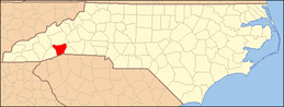 | |
| Towns | ||
| Village | ||
| CDPs | ||
| Unincorporated communities | ||
| Footnotes | ‡This populated place also has portions in an adjacent county or counties | |