Tuxedo, North Carolina
| Tuxedo | |
|---|---|
| Unincorporated community | |
  Location of Tuxedo in North Carolina | |
| Coordinates: 35°13′31″N 82°25′46″W / 35.22528°N 82.42944°WCoordinates: 35°13′31″N 82°25′46″W / 35.22528°N 82.42944°W[1] | |
| Country | United States |
| State | North Carolina |
| County | Henderson County |
| Government | |
| • Type | Democracy |
| Elevation[1] | 2,054 ft (626 m) |
| Time zone | Eastern Standard Time (UTC-5) |
Tuxedo is an unincorporated community in Henderson County, North Carolina, United States, which was originally called Lakewood.
Etymology
Tuxedo is a corruption of an Indian phrase, p tauk suttough, meaning "place of the bears."[2]
History
Early in the 20th century, the small town of Lakewood, North Carolina, changed its name to Tuxedo (after a park in New York City) to avoid confusion with a similarly named town in North Carolina.[3] A large mill, the Green River Manufacturing plant, employed some 250 area workers after its completion in 1910.[3] That same year, the "Tuxedo" post office was established, and remained in operation until 1993.[4] The mill, at the time called WestPoint Pepperell–Tuxedo, closed for good in 1990.[3]
Camp Arrowhead, located in Tuxedo, was listed on the National Register of Historic Places in 2005.[5] Tuxedo is also home to camps Mondamin, Green Cove, Talisman, Greystone and Falling Creek Camp.
Location
Tuxedo is located on U.S. Route 25 and U.S. Route 176 about 9 miles (14 km) north of the South Carolina border, at 2,054 feet (626 m) above sea level. It is home to North Carolina's Green River Nature Preserve.[3]
Nearby Lake Summit was formed by an impoundment of the Green River when additional power was needed for area businesses in the past.[3]
References
- 1 2 "Tuxedo". Geographic Names Information System. United States Geological Survey. Retrieved February 19, 2011.
- ↑ Kramp, Penn (Feb 22, 1987). "Tuxedo: It's Not Formal Wear". The Times-News. p. 27. Retrieved May 23, 2015.
- 1 2 3 4 5 History of Lake Summit & Tuxedo, NC; History of Henderson County website; The "Official site of Henderson County Tourism Development Authority;" accessed November 2015
- ↑ "Henderson County". Jim Forte Postal History. Retrieved May 23, 2015.
- ↑ National Register Information System; National Register of Historic Places; National Park Service; archived July 2010.
Municipalities and communities of Henderson County, North Carolina, United States | ||
|---|---|---|
| Cities | 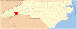 | |
| Towns | ||
| Village | ||
| CDPs | ||
| Unincorporated communities | ||
| Footnotes | ‡This populated place also has portions in an adjacent county or counties | |