Balfour, North Carolina
| Balfour, North Carolina | |
|---|---|
| CDP | |
 Location of Balfour, North Carolina | |
| Coordinates: 35°20′46″N 82°28′37″W / 35.34611°N 82.47694°WCoordinates: 35°20′46″N 82°28′37″W / 35.34611°N 82.47694°W | |
| Country | United States |
| State | North Carolina |
| County | Henderson |
| Area | |
| • Total | 1.8 sq mi (4.8 km2) |
| • Land | 1.8 sq mi (4.8 km2) |
| • Water | 0.0 sq mi (0.0 km2) |
| Elevation | 2,116 ft (645 m) |
| Population (2000) | |
| • Total | 1,200 |
| • Density | 652.3/sq mi (251.9/km2) |
| Time zone | Eastern (EST) (UTC-5) |
| • Summer (DST) | EDT (UTC-4) |
| FIPS code | 37-03220[1] |
| GNIS feature ID | 1018938[2] |
Balfour is a census-designated place (CDP) in Henderson County, North Carolina, United States. The population was 1,200 at the 2000 census. It is part of the Asheville Metropolitan Statistical Area.
History
A post office called Balfour has been in operation since 1893.[3] The community derives its name from Captain William Balfour, the original owner of the town site.[4]
Geography
Balfour is located at 35°20′46″N 82°28′37″W / 35.346017°N 82.476941°W.[5]
According to the United States Census Bureau, the CDP has a total area of 1.8 square miles (4.7 km2), all of it land.
Demographics
As of the census[1] of 2000, there were 1,200 people, 481 households, and 320 families residing in the CDP. The population density was 652.3 people per square mile (251.8/km2). There were 527 housing units at an average density of 286.5 per square mile (110.6/km2). The racial makeup of the CDP was 90.25% White, 4.75% African American, 0.50% Native American, 1.58% Asian, 2.17% from other races, and 0.75% from two or more races. Hispanic or Latino of any race were 5.92% of the population.
There were 481 households out of which 22.5% had children under the age of 18 living with them, 50.3% were married couples living together, 12.1% had a female householder with no husband present, and 33.3% were non-families. 28.5% of all households were made up of individuals and 13.9% had someone living alone who was 65 years of age or older. The average household size was 2.26 and the average family size was 2.75.
In the CDP the population was spread out with 17.8% under the age of 18, 8.1% from 18 to 24, 29.3% from 25 to 44, 25.7% from 45 to 64, and 19.3% who were 65 years of age or older. The median age was 42 years. For every 100 females there were 109.8 males. For every 100 females age 18 and over, there were 111.8 males.
The median income for a household in the CDP was $28,889, and the median income for a family was $40,721. Males had a median income of $28,611 versus $20,139 for females. The per capita income for the CDP was $16,010. About 3.0% of families and 5.1% of the population were below the poverty line, including none of those under age 18 and 2.0% of those age 65 or over.
References
- 1 2 "American FactFinder". United States Census Bureau. Archived from the original on 2013-09-11. Retrieved 2008-01-31.
- ↑ "US Board on Geographic Names". United States Geological Survey. 2007-10-25. Retrieved 2008-01-31.
- ↑ "Henderson County". Jim Forte Postal History. Retrieved 23 May 2015.
- ↑ Kramp, Penn (Feb 22, 1987). "Tuxedo: It's not formal wear". The Times-News. p. 27. Retrieved 23 May 2015.
- ↑ "US Gazetteer files: 2010, 2000, and 1990". United States Census Bureau. 2011-02-12. Retrieved 2011-04-23.
Municipalities and communities of Henderson County, North Carolina, United States | ||
|---|---|---|
| Cities | 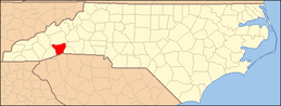 | |
| Towns | ||
| Village | ||
| CDPs | ||
| Unincorporated communities | ||
| Footnotes | ‡This populated place also has portions in an adjacent county or counties | |