Barker Heights, North Carolina
| Barker Heights, North Carolina | |
|---|---|
| CDP | |
 Location of Barker Heights, North Carolina | |
| Coordinates: 35°18′27″N 82°26′28″W / 35.30750°N 82.44111°WCoordinates: 35°18′27″N 82°26′28″W / 35.30750°N 82.44111°W | |
| Country | United States |
| State | North Carolina |
| County | Henderson |
| Area | |
| • Total | 1.1 sq mi (2.7 km2) |
| • Land | 1.1 sq mi (2.7 km2) |
| • Water | 0.0 sq mi (0.0 km2) |
| Elevation | 2,123 ft (647 m) |
| Population (2000) | |
| • Total | 1,237 |
| • Density | 1,176.8/sq mi (454.4/km2) |
| Time zone | Eastern (EST) (UTC-5) |
| • Summer (DST) | EDT (UTC-4) |
| FIPS code | 37-03640[1] |
| GNIS feature ID | 1018965[2] |
Barker Heights is a census-designated place (CDP) in Henderson County, North Carolina, United States. The population was 1,237 at the 2000 census. It is part of the Asheville Metropolitan Statistical Area.
Geography
Barker Heights is located at 35°18′27″N 82°26′28″W / 35.30750°N 82.44111°W (35.307597, -82.441221).[3]
According to the United States Census Bureau, the CDP has a total area of 1.0 square mile (2.6 km2), all of it land.
Demographics
As of the census[1] of 2000, there were 1,237 people, 482 households, and 348 families residing in the CDP. The population density was 1,176.8 people per square mile (454.9/km²). There were 533 housing units at an average density of 507.1/sq mi (196.0/km²). The racial makeup of the CDP was 77.12% White, 4.85% African American, 0.97% Native American, 1.46% Asian, 0.08% Pacific Islander, 13.10% from other races, and 2.43% from two or more races. Hispanic or Latino of any race were 21.34% of the population.
There were 482 households out of which 35.1% had children under the age of 18 living with them, 49.8% were married couples living together, 16.2% had a female householder with no husband present, and 27.8% were non-families. 24.7% of all households were made up of individuals and 10.4% had someone living alone who was 65 years of age or older. The average household size was 2.57 and the average family size was 3.00.
In the CDP the population was spread out with 27.9% under the age of 18, 10.3% from 18 to 24, 31.0% from 25 to 44, 19.6% from 45 to 64, and 11.2% who were 65 years of age or older. The median age was 33 years. For every 100 females there were 105.5 males. For every 100 females age 18 and over, there were 103.7 males.
The median income for a household in the CDP was $26,726, and the median income for a family was $32,143. Males had a median income of $26,573 versus $20,288 for females. The per capita income for the CDP was $13,307. About 11.4% of families and 13.4% of the population were below the poverty line, including 14.2% of those under age 18 and 19.7% of those age 65 or over.
References
- 1 2 "American FactFinder". United States Census Bureau. Archived from the original on September 11, 2013. Retrieved 2008-01-31.
- ↑ "US Board on Geographic Names". United States Geological Survey. 2007-10-25. Retrieved 2008-01-31.
- ↑ "US Gazetteer files: 2010, 2000, and 1990". United States Census Bureau. 2011-02-12. Retrieved 2011-04-23.
Municipalities and communities of Henderson County, North Carolina, United States | ||
|---|---|---|
| Cities | 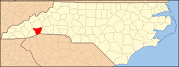 | |
| Towns | ||
| Village | ||
| CDPs | ||
| Unincorporated communities | ||
| Footnotes | ‡This populated place also has portions in an adjacent county or counties | |