Fayetteville, Ohio
| Fayetteville, Ohio | |
|---|---|
| Village | |
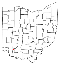 Location of Fayetteville, Ohio | |
 Location of Fayetteville in Brown County | |
| Coordinates: 39°11′13″N 83°55′55″W / 39.18694°N 83.93194°WCoordinates: 39°11′13″N 83°55′55″W / 39.18694°N 83.93194°W | |
| Country | United States |
| State | Ohio |
| County | Brown |
| Township | Perry |
| Area[1] | |
| • Total | 0.52 sq mi (1.35 km2) |
| • Land | 0.52 sq mi (1.35 km2) |
| • Water | 0 sq mi (0 km2) |
| Elevation[2] | 948 ft (289 m) |
| Population (2010)[3] | |
| • Total | 330 |
| • Estimate (2012[4]) | 326 |
| • Density | 634.6/sq mi (245.0/km2) |
| Time zone | Eastern (EST) (UTC-5) |
| • Summer (DST) | EDT (UTC-4) |
| ZIP code | 45118 |
| Area code(s) | 513 |
| FIPS code | 39-26796[5] |
| GNIS feature ID | 1040400[2] |
Fayetteville is a village in Brown County, Ohio, United States. The population was 330 at the 2010 census.
History
In 1883, Fayetteville contained two churches, two schools, two hotels, several stores and saloons, and two drug stores.[6]
Geography
Fayetteville is located at 39°11′13″N 83°55′55″W / 39.18694°N 83.93194°W (39.186870, -83.932083).[7]
According to the United States Census Bureau, the village has a total area of 0.52 square miles (1.35 km2), all land.[1] It also rests on a bend of the East Fork Little Miami River.
Gallery
-

Aerial view of Fayetteville and surrounding countryside.
-

Fayetteville corporation limit sign
-

Looking west on Pike Street (US Highway 50)
-

Pike Street
-
Pike Street
-

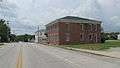
Fayetteville Municipal Building and Police Department
-

Family Dollar and Skyline Chili
-

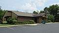
Perry Township Community Center
-

Fayetteville Fire and EMS Station
-
Fayetteville Library
-

Dollar General
-

Fayetteville Post Office
-

Fayetteville High School
-
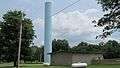
Water tower
-

Water tower
-

St. Patrick Catholic Church
-

Fayetteville United Methodist Church
-

Fayetteville Cemetery
-

Fayetteville Cemetery
-

Fayetteville Perry Township Park
-

Fayetteville Perry Township Park
-

Fayetteville Perry Township Park
-

Fayetteville Perry Township Park
Demographics
| Historical population | |||
|---|---|---|---|
| Census | Pop. | %± | |
| 1850 | 317 | — | |
| 1860 | 399 | 25.9% | |
| 1870 | 397 | −0.5% | |
| 1880 | 390 | −1.8% | |
| 1900 | 323 | — | |
| 1910 | 370 | 14.6% | |
| 1920 | 349 | −5.7% | |
| 1930 | 330 | −5.4% | |
| 1940 | 394 | 19.4% | |
| 1950 | 401 | 1.8% | |
| 1960 | 389 | −3.0% | |
| 1970 | 415 | 6.7% | |
| 1980 | 478 | 15.2% | |
| 1990 | 393 | −17.8% | |
| 2000 | 372 | −5.3% | |
| 2010 | 330 | −11.3% | |
| Est. 2015 | 321 | [8] | −2.7% |
2010 census
As of the census[3] of 2010, there were 330 people, 128 households, and 85 families residing in the village. The population density was 634.6 inhabitants per square mile (245.0/km2). There were 157 housing units at an average density of 301.9 per square mile (116.6/km2). The racial makeup of the village was 99.4% White, 0.3% African American, and 0.3% from other races. Hispanic or Latino of any race were 1.2% of the population.
There were 128 households of which 39.8% had children under the age of 18 living with them, 49.2% were married couples living together, 11.7% had a female householder with no husband present, 5.5% had a male householder with no wife present, and 33.6% were non-families. 28.9% of all households were made up of individuals and 12.5% had someone living alone who was 65 years of age or older. The average household size was 2.58 and the average family size was 3.14.
The median age in the village was 36.8 years. 26.4% of residents were under the age of 18; 7.9% were between the ages of 18 and 24; 23.7% were from 25 to 44; 28.2% were from 45 to 64; and 13.9% were 65 years of age or older. The gender makeup of the village was 49.1% male and 50.9% female.
2000 census
As of the census[5] of 2000, there were 372 people, 142 households, and 93 families residing in the village. The population density was 742.4 people per square mile (287.3/km²). There were 154 housing units at an average density of 307.3 per square mile (118.9/km²). The racial makeup of the village was 99.46% White, 0.27% African American, and 0.27% from two or more races.
There were 142 households out of which 33.8% had children under the age of 18 living with them, 52.1% were married couples living together, 10.6% had a female householder with no husband present, and 34.5% were non-families. 26.8% of all households were made up of individuals and 11.3% had someone living alone who was 65 years of age or older. The average household size was 2.62 and the average family size was 3.28.
In the village the population was spread out with 29.0% under the age of 18, 10.8% from 18 to 24, 32.0% from 25 to 44, 19.9% from 45 to 64, and 8.3% who were 65 years of age or older. The median age was 32 years. For every 100 females there were 93.8 males. For every 100 females age 18 and over, there were 94.1 males.
The median income for a household in the village was $34,375, and the median income for a family was $50,000. Males had a median income of $35,694 versus $26,667 for females. The per capita income for the village was $18,717. About 7.6% of families and 8.5% of the population were below the poverty line, including 8.6% of those under age 18 and 15.0% of those age 65 or over.
Education
Fayetteville is served by Fayetteville-Perry High School.
References
- 1 2 "US Gazetteer files 2010". United States Census Bureau. Archived from the original on January 24, 2012. Retrieved 2013-01-06.
- 1 2 "US Board on Geographic Names". United States Geological Survey. 2007-10-25. Retrieved 2008-01-31.
- 1 2 "American FactFinder". United States Census Bureau. Retrieved 2013-01-06.
- ↑ "Population Estimates". United States Census Bureau. Archived from the original on June 17, 2013. Retrieved 2013-06-17.
- 1 2 "American FactFinder". United States Census Bureau. Retrieved 2008-01-31.
- ↑ The History of Brown County, Ohio. Higginson Book Company. 1883. p. 491.
- ↑ "US Gazetteer files: 2010, 2000, and 1990". United States Census Bureau. 2011-02-12. Retrieved 2011-04-23.
- ↑ "Annual Estimates of the Resident Population for Incorporated Places: April 1, 2010 to July 1, 2015". Retrieved July 2, 2016.
- ↑ "Census of Population and Housing". Census.gov. Archived from the original on May 11, 2015. Retrieved June 4, 2015.
External links
Municipalities and communities of Brown County, Ohio, United States | ||
|---|---|---|
| Villages | 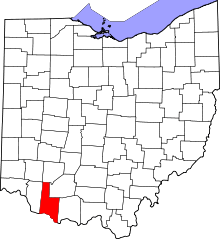 | |
| Townships | ||
| CDPs | ||
| Unincorporated communities | ||
| Footnotes | ‡This populated place also has portions in an adjacent county or counties | |