Farm to Market Road 50
| ||||
|---|---|---|---|---|
| Route information | ||||
| Length: | 51.378 mi[1] (82.685 km) | |||
| Existed: | 1942[1] – present | |||
| Major junctions | ||||
| South end: |
| |||
|
| ||||
| North end: |
| |||
| Location | ||||
| Counties: | Washington, Burleson, Brazos, Robertson | |||
| Highway system | ||||
| ||||

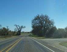
Farm to Market Road 50 (FM 50) is a Farm to Market Road in the U.S. state of Texas maintained by the Texas Department of Transportation (TxDOT). The 52.9-mile (85.1 km) route begins at State Highway 105 near Brenham and passes to the north through Independence to U.S. Route 79 and U.S. Route 190 near Hearne. The road has a brief concurrency with SH 21 along a bridge crossing the Brazos River. The road is in Washington, Burleson, Brazos, and Robertson counties.
The road was originally designated in 1942 along the portion of the present route north of SH 21. The road was briefly extended through Snook to SH 36 at Lyons before being rerouted over its current route through Independence to SH 105.
History
The portion of FM 50 south of Independence was originally designated SH 211 sometime between 1933[2] and 1936.[3] By 1939 that highway was decommissioned but reinstated in 1940.[4]
FM 50 was first designated in 1942 between US 79 and SH 21 and then extended later that year to the intersection of the present FM 60 known before then as SH 230 and then continued to the southwest along the current FM 60 through Snook and Center Line to SH 36 at Lyons.[1] SH 230 was then decommissioned[5] being replaced by FM 50 to Lyons and the newly designated FM 60 to College Station.[6]
The following year, the stretch of road to Lyons was added as an extension of FM 60, and FM 50 was rerouted southward through Independence incorporating SH 211 to the former SH 90, now SH 105, near Brenham.[1]
Route description
FM 50 begins at SH 105 3.0 miles (4.8 km) northeast of Brenham in Washington County.[1] The road proceeds to the north passing Brenham Municipal Airport and intersecting FM 2621 near Prairie Hill before crossing FM 390 at Independence. The road continues northward passing through Jerry's Quarters and crossing Yegua Creek where the road enters Burleson County. North of the creek, the road crosses the Burlington Northern and Santa Fe Railway at Clay.[7]
Further north, FM 50 intersects FM 1361 at Wilcox. After crossing Old River, the road changes course to the northwest crossing FM 60 north of Snook and FM 166 near Foster Store. Further northwest, the road passes through Grant before merging with SH 21. The combined route to the northeast crosses the Brazos River entering Brazos County with FM 50 separating from SH 21 on the other side. The route then goes to the north largely following the Union Pacific Railroad through Law, Sims, an intersection with FM 1687 at Mudville, and Mooring.[8]
North of Mooring, FM 50 crosses into Robertson County and crosses merging Union Pacific tracks at Mumford. The road then follows along the railroad to the northwest crossing the tracks immediately before the road terminates at the combined route of US 79 and US 190 southeast of Hearne.[9]
Major intersections
| County | Location | mi[10] | km | Destinations | Notes |
|---|---|---|---|---|---|
| Washington | | 0 | 0.0 | Southern terminus | |
| | 3.6 | 5.8 | |||
| Independence | 8.6 | 13.8 | |||
| Burleson | Wilcox | 18.2 | 29.3 | ||
| | 26.6 | 42.8 | |||
| | 27.4 | 44.1 | |||
| | 34.8 | 56.0 | West end of SH 21 overlap | ||
| Brazos | | 36.2 | 58.3 | East end of SH 21 overlap | |
| Mudville | 39.4 | 63.4 | |||
| Robertson | | 52.9 | 85.1 | Northern terminus | |
| 1.000 mi = 1.609 km; 1.000 km = 0.621 mi | |||||
References
- 1 2 3 4 5 Transportation Planning and Programming Division (n.d.). "Farm to Market Road No. 50". Highway Designation Files. Texas Department of Transportation. Retrieved 2010-11-11.
- ↑ Official Map of the Highway System of Texas (Map) (June 15, 1933 ed.). ⅞"=30 mi. Cartography by R. M. Stene. Texas State Highway Commission. § N23. Retrieved 2010-11-11.
- ↑ Official Map of the Highway System of Texas (Map) (Centennial ed.). 1"=29 mi. Cartography by R. M. Stene. Texas State Highway Commission. Corrected to March 1, 1936. Retrieved 2010-11-11. Check date values in:
|date=(help) - ↑ Transportation Planning and Programming Division (n.d.). "State Highway No. 211". Highway Designation Files. Texas Department of Transportation. Retrieved 2010-11-11.
- ↑ Transportation Planning and Programming Division (n.d.). "State Highway No. 230". Highway Designation Files. Texas Department of Transportation. Retrieved 2010-11-11.
- ↑ Transportation Planning and Programming Division (n.d.). "Farm to Market Road No. 60". Highway Designation Files. Texas Department of Transportation. Retrieved 2010-11-11.
- ↑ TxDOT County Grid Map (Map) (2010 ed.). 1:120,000. Texas Department of Transportation. p. 517. Retrieved 2010-11-11.
- ↑ TxDOT County Grid Map (Map) (2010 ed.). 1:120,000. Texas Department of Transportation. p. 516. Retrieved 2010-11-11.
- ↑ TxDOT County Grid Map (Map) (2010 ed.). 1:120,000. Texas Department of Transportation. p. 515. Retrieved 2010-11-11.
- ↑ Google (2010-11-11). "Route of FM 50" (Map). Google Maps. Google. Retrieved 2010-11-11.