Fairview, Erie County, Pennsylvania
| Fairview, Pennsylvania | |
| Census-designated place | |
| Country | United States |
|---|---|
| State | Pennsylvania |
| County | Erie |
| Township | Fairview |
| Elevation | 794 ft (242 m) [1] |
| Coordinates | 42°1′43.2″N 80°14′51.2″W / 42.028667°N 80.247556°WCoordinates: 42°1′43.2″N 80°14′51.2″W / 42.028667°N 80.247556°W [1] |
| Area | 3.54 sq mi (9 km2) |
| - land | 3.52 sq mi (9 km2) |
| - water | 0.03 sq mi (0 km2) |
| Population | 2,348 (2010) |
| Density | 667.5/sq mi (258/km2) |
| Settled | 1797 [2] |
| - Incorporated | 1868 [2] |
| - Unincorporated | January 1998 |
| Timezone | Eastern (UTC-5) |
| - summer (DST) | Eastern (UTC-4) |
| ZIP code | 16415 |
| Area code | 814 |
 Location in Erie County and the state of Pennsylvania | |
Fairview is an unincorporated community and census-designated place (CDP) in central Fairview Township, Erie County, Pennsylvania, United States. It is served by the 16415 ZIP code and the Fairview School District. It was incorporated as a separate borough in 1868 with an area of about a square mile and a population of roughly 400. After a referendum in 1994, it was decided to dissolve the borough; dissolution was completed in January 1998.[3] As of the 2010 census the population was 2,348,[4] out of a total 10,102 residents in Fairview Township.
Geography
Fairview is located west of the center of Erie County, in the west-central part of Fairview Township. It is bordered to the north by the unincorporated community of Avonia. U.S. Route 20 (West Ridge Road) passes through the center of Fairview, leading northeast 11 miles (18 km) into Erie and southwest 4 miles (6 km) to Girard. Pennsylvania Route 98 (Avonia Road) crosses US 20 in the center of Fairview, leading north 1.2 miles (1.9 km) to Avonia and south 2 miles (3 km) to Interstate 90 Exit 16.
According to the U.S. Census Bureau, the Fairview CDP has an area of 3.54 square miles (9.18 km2), of which 0.03 square miles (0.07 km2), or 0.75%, is water.[4]
Notable people
- Jim Hart, Major League Baseball manager for the Louisville Colonels and the Boston Beaneaters
References
- 1 2 "Fairview". Geographic Names Information System. United States Geological Survey. Retrieved May 24, 2011.
- 1 2 Hottenstein, JoAnne; Welch, Sibyl (1965). "Erie County". Incorporation dates of Pennsylvania municipalities (PDF). Harrisburg: Bureau of Municipal Affairs, Pennsylvania Department of Internal Affairs. pp. 59–60. Retrieved May 23, 2011.
- ↑ 1990s Boundary Changes Geographic Change Notes: Pennsylvania, United States Census Bureau, n.d. Accessed 2011-03-30.
- 1 2 "Geographic Identifiers: 2010 Census Summary File 1 (G001): Fairview CDP, Pennsylvania". American Factfinder. U.S. Census Bureau. Retrieved March 22, 2016.
Municipalities and communities of Erie County, Pennsylvania, United States | ||
|---|---|---|
| Cities | 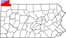 | |
| Boroughs | ||
| Townships | ||
| CDPs | ||
| Unincorporated communities | ||