Corry, Pennsylvania
| Corry | |
|---|---|
| City | |
| City of Corry | |
|
| |
 Location in Erie County and the state of Pennsylvania. | |
 Corry  Corry Location in Erie County and the state of Pennsylvania. | |
| Coordinates: 41°55′13.2″N 79°38′25.2″W / 41.920333°N 79.640333°WCoordinates: 41°55′13.2″N 79°38′25.2″W / 41.920333°N 79.640333°W | |
| Country | United States |
| State | Pennsylvania |
| County | Erie |
| Founded | May 27, 1861 |
| Incorporated | March 8, 1866 |
| Named for | misspelling of founder Hiram Cory's name |
| Government | |
| • Mayor | Jason Monn (R) |
| Area | |
| • Total | 6.1 sq mi (16 km2) |
| Population (2010) | |
| • Total | 6,605 |
| • Density | 1,100/sq mi (420/km2) |
| Time zone | EST (UTC-4) |
| • Summer (DST) | EDT (UTC-5) |
| ZIP code | 16407 |
| Area code(s) | 814 |
| Website |
www |

Corry is a city located in northwestern Pennsylvania in the United States. With a population of 6,605 at the 2010 United States Census, it is the second largest city in Erie County. Corry is a part of the Erie, PA Metropolitan Statistical Area. The city became famous in the late-19th and early-20th centuries for being the manufacturer of Climax locomotives.
History
Erie County was formed from parts of Allegheny County on March 12, 1800.[1] On May 27, 1861, tracks owned by the Atlantic and Great Western Railroad intersected with those of the Sunbury and Erie Railroad and was called the "Atlantic and Erie Junction".[2][3] Land at the junction was owned by Hiram Cory, who sold a portion to the Atlantic and Great Western in October 1861. The railroad constructed a ticket office at the junction and named it for Cory, but through a misspelling it became Corry.[2]
The combination of railroad growth and the discovery of oil in nearby Titusville contributed greatly to Corry's development. This boomtown was chartered as a borough in 1863 and designated as a city in 1866. Industry has played a big part in Corry's growth, and the Corry Area Historical Society maintains a museum where one of the Climax locomotives (the steam engine used in logging operations that brought fame to Corry) is on display.
Corry has been named a Tree City USA for seven consecutive years.[4]
The Corry Armory was listed on the National Register of Historic Places in 1991.[5]
Demographics
| Historical population | |||
|---|---|---|---|
| Census | Pop. | %± | |
| 1870 | 6,809 | — | |
| 1880 | 5,277 | −22.5% | |
| 1890 | 5,677 | 7.6% | |
| 1900 | 5,369 | −5.4% | |
| 1910 | 5,991 | 11.6% | |
| 1920 | 7,228 | 20.6% | |
| 1930 | 7,152 | −1.1% | |
| 1940 | 6,935 | −3.0% | |
| 1950 | 7,911 | 14.1% | |
| 1960 | 7,744 | −2.1% | |
| 1970 | 7,435 | −4.0% | |
| 1980 | 7,149 | −3.8% | |
| 1990 | 7,216 | 0.9% | |
| 2000 | 6,834 | −5.3% | |
| 2010 | 6,605 | −3.4% | |
| Est. 2015 | 6,420 | [6] | −2.8% |
| Sources:[7][8][9] | |||
As of the census[8] of 2000, there were 6,834 people, 2,660 households, and 1,763 families residing in the city. The population density was 1,120.5 people per square mile (432.6/km²). There were 2,868 housing units at an average density of 470.2 per square mile (181.5/km²). The racial makeup of the city was 98.19% White, 0.29% African American, 0.29% Native American, 0.16% Asian, 0.01% Pacific Islander, 0.09% from other races, and 0.97% from two or more races. Hispanic or Latino of any race were 0.91% of the population. The U.S. Census Bureau estimated Corry's population at 6,331 in 2009.
There were 2,660 households, out of which 32.1% had children under the age of 18 living with them, 48.5% were married couples living together, 13.8% had a female householder with no husband present, and 33.7% were non-families. 29.3% of all households were made up of individuals, and 13.2% had someone living alone who was 65 years of age or older. The average household size was 2.49 and the average family size was 3.07.
In the city the population was spread out, with 27.3% under the age of 18, 8.6% from 18 to 24, 25.5% from 25 to 44, 21.8% from 45 to 64, and 16.8% who were 65 years of age or older. The median age was 36 years. For every 100 females there were 88.4 males. For every 100 females age 18 and over, there were 83.1 males.
The median income for a household in the city was $30,967, and the median income for a family was $35,375. Males had a median income of $30,220 versus $22,127 for females. The per capita income for the city was $15,143. About 14.2% of families and 16.4% of the population were below the poverty line, including 21.4% of those under age 18 and 8.2% of those age 65 or over.
Geography and climate
Corry is located at 41°55′30″N 79°38′26″W / 41.92500°N 79.64056°W (41.924947, -79.640511).[10] According to the United States Census Bureau, the city has a total area of 6.1 square miles (16 km2), all of it land.
| Climate data for Corry, Pennsylvania | |||||||||||||
|---|---|---|---|---|---|---|---|---|---|---|---|---|---|
| Month | Jan | Feb | Mar | Apr | May | Jun | Jul | Aug | Sep | Oct | Nov | Dec | Year |
| Record high °F (°C) | 70 (21) |
69 (21) |
82 (28) |
88 (31) |
91 (33) |
99 (37) |
110 (43) |
100 (38) |
96 (36) |
91 (33) |
78 (26) |
70 (21) |
110 (43) |
| Average high °F (°C) | 32.3 (0.2) |
34.7 (1.5) |
44.2 (6.8) |
57.7 (14.3) |
69.4 (20.8) |
77.6 (25.3) |
81.5 (27.5) |
79.5 (26.4) |
73.0 (22.8) |
61.9 (16.6) |
47.6 (8.7) |
35.8 (2.1) |
58.2 (14.6) |
| Average low °F (°C) | 16.2 (−8.8) |
16.1 (−8.8) |
23.7 (−4.6) |
34.0 (1.1) |
43.2 (6.2) |
52.3 (11.3) |
56.7 (13.7) |
55.2 (12.9) |
49.0 (9.4) |
39.1 (3.9) |
31.2 (−0.4) |
21.4 (−5.9) |
36.7 (2.6) |
| Record low °F (°C) | −30 (−34) |
−30 (−34) |
−19 (−28) |
−5 (−21) |
19 (−7) |
28 (−2) |
33 (1) |
30 (−1) |
25 (−4) |
11 (−12) |
−2 (−19) |
−22 (−30) |
−30 (−34) |
| Average rainfall inches (mm) | 3.32 (84.3) |
2.82 (71.6) |
3.65 (92.7) |
3.92 (99.6) |
3.74 (95) |
4.47 (113.5) |
4.30 (109.2) |
3.98 (101.1) |
3.92 (99.6) |
3.69 (93.7) |
4.21 (106.9) |
3.92 (99.6) |
45.96 (1,167.4) |
| Average snowfall inches (cm) | 27.2 (69.1) |
21.6 (54.9) |
17.5 (44.5) |
5.1 (13) |
0.2 (0.5) |
0 (0) |
0 (0) |
0 (0) |
0 (0) |
1.3 (3.3) |
14.8 (37.6) |
30.5 (77.5) |
117.5 (298.5) |
| Source: Pennsylvania State University[11] | |||||||||||||
Government
The city of Corry is incorporated as a 3rd class city under Pennsylvania law.[12] Third class cities are governed by a commission, in which the mayor and four other members of the city council constitute the commission. The mayor serves as the president of the council.[12] Charles Campbell is the mayor of the city of Corry. The other members of the Corry City Council are Steven G. Bresler, Alex Gernovich, and Charles Campbell.[13] Tom Winchell is city treasurer and Diane L. Cowles is city controller.
Corry is in Pennsylvania's 5th congressional district and is currently represented in the United States House of Representatives by Republican Glenn Thompson, who was elected in 2008. Republican Scott Hutchinson of the 21st District has represented Corry in the Pennsylvania State Senate since 2013. Corry is contained by the 4th District of the Pennsylvania House of Representatives and is represented by Republican Curt Sonney.
Education

Corry is within the Corry Area School District, which operates a middle school, high school, one elementary school, but two abandoned elementary schools, and a career and technical center. Higher education is locally available through the Corry branch of Mercyhurst College, which offers advanced college credits for high school students and an associate degree in business administration. Adult education and training are offered through the Corry Higher Education Council.
Notable people
- Emery Bopp (1924–2007), artist
- William Wallace Brown (1836–1926), member of the United States House of Representatives
- Ryan Buell (1982−), paranormal investigator
- Fred Marsh (1924-2006), Major League Baseball player
- Charles F. Ritchel (1840–1911), inventor
- James Alexander Robertson (1873−1939), academic historian, archivist and bibliographer[14]
- Karen Smyers (1961−), triathlete
See also
References
- ↑ Hottenstein, JoAnne; Welch, Sibyl (1965). "Erie County". Incorporation dates of Pennsylvania municipalities (PDF). Harrisburg: Bureau of Municipal Affairs, Pennsylvania Department of Internal Affairs. Retrieved June 15, 2011.
- 1 2 Springirth, Kenneth (June 13, 2011). "Railroads that helped Corry thrive could be key to city's prosperity". Erie Times-News. Retrieved June 15, 2011.
- ↑ Bates, p. 809.
- ↑ Sear, Stephen (April 20, 2011). "Tree City honors roll 7 in Corry". The Corry Journal. Retrieved June 15, 2011.
- ↑ National Park Service (2010-07-09). "National Register Information System". National Register of Historic Places. National Park Service.
- ↑ "Annual Estimates of the Resident Population for Incorporated Places: April 1, 2010 to July 1, 2015". Retrieved July 2, 2016.
- ↑ "Census of Population and Housing". U.S. Census Bureau. Archived from the original on 11 May 2015. Retrieved 11 December 2013.
- 1 2 "American FactFinder". United States Census Bureau. Archived from the original on 2013-09-11. Retrieved 2008-01-31.
- ↑ "Incorporated Places and Minor Civil Divisions Datasets: Subcounty Resident Population Estimates: April 1, 2010 to July 1, 2012". Population Estimates. U.S. Census Bureau. Archived from the original on 17 June 2013. Retrieved 11 December 2013.
- ↑ "US Gazetteer files: 2010, 2000, and 1990". United States Census Bureau. 2011-02-12. Retrieved 2011-04-23.
- ↑ "Corry Local Climatological Data". Pennsylvania State Climatologist. College of Earth and Mineral Sciences, Pennsylvania State University. Retrieved June 15, 2011.
- 1 2 The Pennsylvania Manual, p. 6-5.
- ↑ "Erie County Elected Officials", p. 7.
- ↑ Shavit, David (1990). The United States in Asia: a historical dictionary. Westport, CT: Greenwood Press. p. 424. ISBN 0-313-26788-X. OCLC 21522840.
Sources
- Bates, Samuel P (1882). History of Erie County. Chicago: Warner, Beers & Co. Retrieved June 15, 2011.
- "Erie County Elected Officials" (PDF). Government of Erie County. Archived from the original (PDF) on July 21, 2011. Retrieved June 15, 2011.
- Trostle, Sharon, ed. (2009). The Pennsylvania Manual. 119. Harrisburg, Pennsylvania: Pennsylvania Department of General Services. ISBN 0-8182-0334-X.
External links
| Wikimedia Commons has media related to Corry, Pennsylvania. |
- City of Corry
- Corry Chamber of Commerce
- Corry Area Historical Society & Museum
- The Corry Journal
- Corry Area School District
Municipalities and communities of Erie County, Pennsylvania, United States | ||
|---|---|---|
| Cities | 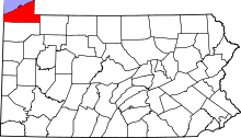 | |
| Boroughs | ||
| Townships | ||
| CDPs | ||
| Unincorporated communities | ||