Elkhead Mountains
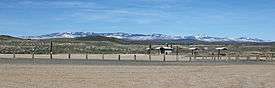
The Elkhead Mountains are a mountain range in Colorado. The mountain range is considered to be low altitude within Colorado as the mountains are under 11,000 feet (3,400 m).[1] Located within Routt and Moffat counties, the mountain range is far from metropolitan areas and has few lakes and streams, so it attracts few visitors. The mountain range is a volcanic range and all of the peaks were formed by volcanic action.[2] The mountain range extends approximately 16 miles (26 km) east to west and 10 miles (16 km) north to south, and its center is located at 40°46′27″N 107°19′17″W / 40.77404°N 107.32132°WCoordinates: 40°46′27″N 107°19′17″W / 40.77404°N 107.32132°W,[3] approximately 20 miles (32 km) northeast of Craig and north of Hayden, Colorado 13 miles (21 km) south of the Wyoming border. Almost all of the peaks within the Elkhead Mountains are a part of Routt National Forest. Significant peaks are: Bears Ears, Sugar Loaf, Saddle Mountain, Black Mountain, Pilot Knob, and Meaden Peak.
