Eastern Heights, Queensland
| Eastern Heights Ipswich, Queensland | |||||||||||||
|---|---|---|---|---|---|---|---|---|---|---|---|---|---|
 Eastern Heights | |||||||||||||
| Coordinates | 27°37′33″S 152°46′28″E / 27.62583°S 152.77444°ECoordinates: 27°37′33″S 152°46′28″E / 27.62583°S 152.77444°E | ||||||||||||
| Population | 3,735 (2011)[1] | ||||||||||||
| Postcode(s) | 4305 | ||||||||||||
| Location | |||||||||||||
| LGA(s) | City of Ipswich | ||||||||||||
| State electorate(s) | Ipswich | ||||||||||||
| Federal Division(s) | Blair | ||||||||||||
| |||||||||||||
Eastern Heights is a residential suburb of Ipswich, Queensland, Australia. It is bordered to the west by Queens and Limestone Park. At the 2011 Australian Census the suburb recorded a population of 3,735.[1]
The origin of the suburb name is from a high ridge on the eastern side of the Ipswich CBD.[2]
Transport
Eastern Heights is serviced by a regular bus service.
Education
There are no schools in Eastern Heights, Silkstone Primary lie just to the east in Silkstone, while Ipswich Central Primary lie just to the west. Bremer State High School used to lie in the east as with Skilstone Primary, but has since moved further south-west of the suburb.
Parks and sports facilities
- Jim Donald Memorial Park (soccer)
- Hancock Park
- Scout Hall
Places of worship
- St Peters Anglican Church, Lloyd George St
- Our Lady of the Miraculous Medal Catholic Church (OLMM), Robertson Road
Heritage listings
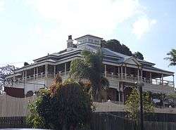
Fairy Knoll residence, 2015
Eastern Heights has a number of heritage-listed sites, including:
- 2A Robertson Road: Fairy Knoll[3]
- 59 Whitehill Road: Garowie[4]
References
- 1 2 Australian Bureau of Statistics (31 October 2012). "Eastern Heights (State Suburb)". 2011 Census QuickStats. Retrieved 18 October 2015.
- ↑ Place name details
- ↑ "Fairy Knoll (entry 600600)". Queensland Heritage Register. Queensland Heritage Council. Retrieved 9 July 2013.
- ↑ "Garowie (entry 600599)". Queensland Heritage Register. Queensland Heritage Council. Retrieved 9 July 2013.
External links
| Wikimedia Commons has media related to Eastern Heights, Queensland. |
This article is issued from Wikipedia - version of the 10/16/2016. The text is available under the Creative Commons Attribution/Share Alike but additional terms may apply for the media files.