Sadliers Crossing, Queensland
| Sadliers Crossing Ipswich, Queensland | |||||||||||||
|---|---|---|---|---|---|---|---|---|---|---|---|---|---|
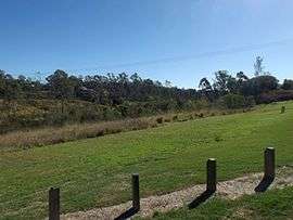 Bremer River parkland, 2016 | |||||||||||||
 Sadliers Crossing | |||||||||||||
| Coordinates | 27°37′S 152°45′E / 27.617°S 152.750°ECoordinates: 27°37′S 152°45′E / 27.617°S 152.750°E | ||||||||||||
| Population | 1,075 (2011)[1] | ||||||||||||
| Postcode(s) | 4305 | ||||||||||||
| Location | |||||||||||||
| LGA(s) | City of Ipswich | ||||||||||||
| State electorate(s) | Electoral district of Ipswich | ||||||||||||
| Federal Division(s) | Blair | ||||||||||||
| |||||||||||||
Sadliers Crossing is a suburb of Ipswich, Queensland, Australia. At the 2011 Australian Census the suburb recorded a population of 1,075.[1]
The origin of the suburb name is from an early property owner by the name of Thomas Sadlier.[2]
Transport
Thomas Street Railway Station provides Queensland Rail City network services to Rosewood, Ipswich and Brisbane via Ipswich.
Heritage listings
Sadliers Crossing has a number of heritage-listed sites, including:
- over Bremer River between Tallon Street, Sadliers Crossing and Dixon Street, Wulkuraka: Sadliers Crossing Railway Bridge[3]
Education
Unlike most Queensland state schools which are named for the suburb/locality that they serve, the Queensland state primary school in Sadliers Crossing is called Blair State School in honour of Sir James Blair who was instrumental in the establishment of the school.[4]
References
- 1 2 Australian Bureau of Statistics (31 October 2012). "Sadliers Crossing (State Suburb)". 2011 Census QuickStats. Retrieved 25 September 2014.
- ↑ Place name details
- ↑ "Sadliers Crossing Railway Bridge (entry 602569)". Queensland Heritage Register. Queensland Heritage Council. Retrieved 9 July 2013.
- ↑ "Our School". Blair State School. Retrieved 29 October 2015.
External links
This article is issued from Wikipedia - version of the 9/6/2016. The text is available under the Creative Commons Attribution/Share Alike but additional terms may apply for the media files.