Springfield Lakes, Queensland
| Springfield Lakes Queensland | |||||||||||||
|---|---|---|---|---|---|---|---|---|---|---|---|---|---|
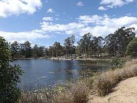 Spring Lake, 2014 | |||||||||||||
| Population | 14,149 (2014) | ||||||||||||
| Postcode(s) | 4300 | ||||||||||||
| Location |
| ||||||||||||
| LGA(s) | City of Ipswich | ||||||||||||
| State electorate(s) | Bundamba | ||||||||||||
| Federal Division(s) | Oxley | ||||||||||||
| |||||||||||||
Springfield Lakes is a suburb in the City of Ipswich, Queensland, Australia.[1] At the 2011 Australian Census the suburb recorded a population of 10,149.[2]
History
Springfield Lakes is one of the suburbs created within Greater Springfield,[3] a 2,850 hectare site which is Australia’s largest master planned community.[4] For comparison purposes this is more than half the size of Cairns. The suburb was specifically located to reduce growth along the Brisbane-Gold Coast corridor in South East Queensland.
Geography
The Centenary Motorway forms the north-western boundary of the suburb. The Springfield railway line runs immediately parallel and north of the highway.[5]
Transport
The suburb is serviced by bus route 522 which links Goodna station with Springfield Central station.[6] Apart from bus services, the suburb also has access to rail services with the northern part of Springfield Lakes being serviced by Springfield railway station while the southern part of the suburb is serviced by Springfield Central railway station across from Orion Springfield Central shopping centre.[7][8]
Neighbourhoods (villages)
Springfield Lakes was developed by Lend Lease as a series of smaller neighbourhoods (villages). As of November 2015 these neighbourhoods are: Bridgewater Chase (Springfield), Clancy's Crossing (Springfield), The Escarpment (Springfield), Lakeside, Eden's Homestead, Olive Springs, Butterfly Green, The Promenade, Waterside at The Promenade, The Peninsula, The Summit, Aspect, Creekside, Lakes Entrance, Wildflower Ridge, Park Edge, Tea Trees, Central Walk, and The Sanctuary. The Peninsula is the final neighbourhood of Springfield Lakes developed immediately behind Regatta Lake and Discovery Lake.[9]
References
- ↑ "Springfield Lakes (entry 49505)". Queensland Place Names. Queensland Government. Retrieved 27 August 2015.
- ↑ Australian Bureau of Statistics (31 October 2012). "Springfield Lakes (State Suburb)". 2011 Census QuickStats. Retrieved 10 September 2014.
- ↑ "Residential". Springfield Land Corporation. Retrieved 19 March 2014.
- ↑ Lend Lease | Springfield Lakes | Community Vision
- ↑ "Queensland Globe". State of Queensland. Retrieved 27 August 2015.
- ↑ Route 522 | TransLink
- ↑ Springfield Station | TransLink
- ↑ Springfield Central Station | TransLink
- ↑ "The Peninsula". Lend Lease. Retrieved 7 January 2016.
External links
| Wikimedia Commons has media related to Springfield Lakes, Queensland. |
- Springfield Lakes
- Springfield Lakes - Community
- University of Queensland: Queensland Places: Springfield Lakes
Coordinates: 27°41′S 152°55′E / 27.683°S 152.917°E