East Greenville, Pennsylvania
| Borough of East Greenville | |
| Borough | |
| Country | United States |
|---|---|
| State | Pennsylvania |
| County | Montgomery |
| Elevation | 410 ft (125.0 m) |
| Coordinates | 40°24′20″N 75°30′15″W / 40.40556°N 75.50417°WCoordinates: 40°24′20″N 75°30′15″W / 40.40556°N 75.50417°W |
| Area | 0.5 sq mi (1.3 km2) |
| - land | 0.5 sq mi (1 km2) |
| - water | 0.0 sq mi (0 km2), 0% |
| Population | 5,424 (2010) |
| Density | 5,978.9/sq mi (2,308.5/km2) |
| Government | Council-manager |
| Mayor | Ryan J. Sloyer |
| Timezone | EST (UTC-5) |
| - summer (DST) | EDT (UTC-4) |
| ZIP Code | 18041 |
| Area code | 215, 610 |
 Location of East Greenville in Montgomery County | |
 Location of East Greenville in Pennsylvania | |
 Location of Pennsylvania in the United States | |
| Website: http://www.egreenville.org/ | |
East Greenville is a borough in Montgomery County, Pennsylvania, United States. The population was 2,951 at the 2010 census.
It is part of the Upper Perkiomen School District.
It is part of the strip of small towns that run together along Route 29; Red Hill, Pennsburg and East Greenville.
Geography
East Greenville is located at 40°24′20″N 75°30′15″W / 40.40556°N 75.50417°W (40.405626, -75.504144).[1]
According to the United States Census Bureau, the borough has a total area of 0.5 square miles (1.3 km2), all of it land.
Demographics
| Historical population | |||
|---|---|---|---|
| Census | Pop. | %± | |
| 1880 | 331 | — | |
| 1890 | 589 | 77.9% | |
| 1900 | 894 | 51.8% | |
| 1910 | 1,235 | 38.1% | |
| 1920 | 1,620 | 31.2% | |
| 1930 | 1,749 | 8.0% | |
| 1940 | 1,776 | 1.5% | |
| 1950 | 1,945 | 9.5% | |
| 1960 | 1,931 | −0.7% | |
| 1970 | 2,003 | 3.7% | |
| 1980 | 2,456 | 22.6% | |
| 1990 | 3,117 | 26.9% | |
| 2000 | 3,103 | −0.4% | |
| 2010 | 2,951 | −4.9% | |
| Est. 2015 | 2,985 | [2] | 1.2% |
| Sources:[3][4][5] | |||
As of the 2010 census, the borough was 93.7% White, 2.3% Black or African American, 0.1% Native American, 1.0% Asian, and 1.9% were two or more races. 3.3% of the population were of Hispanic or Latino ancestry .
As of the census[4] of 2000, there were 3,103 people, 1,124 households, and 805 families residing in the borough. The population density was 5,978.9 people per square mile (2,304.0/km2). There were 1,173 housing units at an average density of 2,260.1 per square mile (871.0/km2). The racial makeup of the borough was 96.78% White, 0.90% African American, 0.13% Native American, 0.52% Asian, 0.90% from other races, and 0.77% from two or more races. Hispanic or Latino of any race were 2.64% of the population.
There were 1,124 households, out of which 43.6% had children under the age of 18 living with them, 53.4% were married couples living together, 13.3% had a female householder with no husband present, and 28.3% were non-families. 22.7% of all households were made up of individuals, and 7.4% had someone living alone who was 65 years of age or older. The average household size was 2.76 and the average family size was 3.24.
In the borough the population was spread out, with 31.4% under the age of 18, 7.6% from 18 to 24, 36.5% from 25 to 44, 16.6% from 45 to 64, and 7.8% who were 65 years of age or older. The median age was 32 years. For every 100 females there were 94.9 males. For every 100 females age 18 and over, there were 90.2 males.
The median income for a household in the borough was $46,875, and the median income for a family was $48,824. Males had a median income of $35,525 versus $29,358 for females. The per capita income for the borough was $19,066. About 3.6% of families and 5.1% of the population were below the poverty line, including 5.8% of those under age 18 and 5.0% of those age 65 or over.
Politics and government
East Greenville has a city manager form of government with a mayor and borough council.
The borough is part of the Sixth Congressional District (represented by Rep. Jim Gerlach), Pennsylvania's 147th Representative District (represented by Rep. Marcy Toepel,) and the 24th State Senate District (represented by Sen. Bob Mensch.) Ryan Sloyer is currently the mayor.
| Year | Republican | Democratic |
|---|---|---|
| 2012 | 49.2% 539 | 49.1% 538 |
| 2008 | 42.9% 499 | 55.7% 648 |
| 2004 | 50.5% 542 | 49.1% 527 |
| 2000 | 52.5% 434 | 43.4% 359 |
Notable people
- Jean Faut, baseball player, was born in East Greenville.
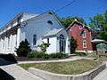
Gallery
 East Greenville Borough Hall.
 East Greenville Plaza on Main St.
 World War I Memorial Plaque on East Greenville Plaza.
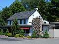 Farmhouse (ca. 1745).
References
- ↑ "US Gazetteer files: 2010, 2000, and 1990". United States Census Bureau. 2011-02-12. Retrieved 2011-04-23.
- ↑ "Annual Estimates of the Resident Population for Incorporated Places: April 1, 2010 to July 1, 2015". Retrieved July 2, 2016.
- ↑ "Census of Population and Housing". U.S. Census Bureau. Retrieved 11 December 2013.
- 1 2 "American FactFinder". United States Census Bureau. Retrieved 2008-01-31.
- ↑ "Incorporated Places and Minor Civil Divisions Datasets: Subcounty Resident Population Estimates: April 1, 2010 to July 1, 2012". Population Estimates. U.S. Census Bureau. Retrieved 11 December 2013.
External links
| Wikimedia Commons has media related to East Greenville, Pennsylvania. |