Dixieland, California
Coordinates: 32°47′27″N 115°46′13″W / 32.79083°N 115.77028°W
| Dixieland | |
|---|---|
| Unincorporated community | |
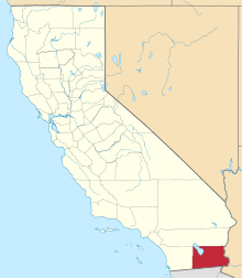
 Dixieland  Dixieland Location in California | |
| Coordinates: 32°47′27″N 115°46′13″W / 32.79083°N 115.77028°W | |
| Country | United States |
| State | California |
| County | Imperial County |
| Elevation[1] | -36 ft (-11 m) |
Dixieland is an unincorporated community in Imperial County, California.[1] It is located 5 miles (8 km) east of Plaster City,[2] at an elevation of 36 feet (11 m) below sea level.[1]
A post office operated at Dixieland from 1912 to 1935.[2]
References
This article is issued from Wikipedia - version of the 7/5/2016. The text is available under the Creative Commons Attribution/Share Alike but additional terms may apply for the media files.