Calexico, California
| Calexico, California | ||
|---|---|---|
| City | ||
| City of Calexico | ||
|
The Old Calexico City Hall in 2007 | ||
| ||
|
Nickname(s): The International Gateway City Where California and Mexico Meet | ||
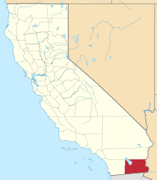
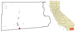 Location of Calexico, California | ||
 Calexico, California Location in the United States | ||
| Coordinates: 32°40′44″N 115°29′56″W / 32.67889°N 115.49889°WCoordinates: 32°40′44″N 115°29′56″W / 32.67889°N 115.49889°W[1] | ||
| Country | United States | |
| State | California | |
| County | Imperial | |
| Incorporated | April 16, 1908[2] | |
| Government | ||
| • Type | Council–manager government[3] | |
| • Mayor | Joong S. Kim[4] | |
| Area[5] | ||
| • Total | 8.391 sq mi (21.733 km2) | |
| • Land | 8.391 sq mi (21.733 km2) | |
| • Water | 0 sq mi (0 km2) 0% | |
| Elevation[1] | 3 ft (0.9 m) | |
| Population (2010) | ||
| • Total | 38,572 | |
| • Density | 4,600/sq mi (1,800/km2) | |
| Time zone | PST (UTC-8) | |
| • Summer (DST) | PDT (UTC-7) | |
| ZIP codes | 92231–92232 | |
| Area code(s) | 760/442 | |
| FIPS code | 06-09710 | |
| GNIS feature IDs | 1652680, 2409958 | |
| Website |
www | |


Calexico is a city in Imperial County, California. The population was 38,572 at the 2010 census, up from 27,109 at the 2000 census. Calexico is about 122 miles (196 km) east of San Diego and 62 miles (100 km) west of Yuma, Arizona. The name of the city is a portmanteau of California and Mexico, which, like that of its adjacent sister city of Mexicali, emphasizes its identity as a border city.
Major events every year are the Mariachi festival on March 25 followed by the SDSU "Perspective of the Latino Race" art exhibition on April 3.
Geography
According to the United States Census Bureau, at the 2010 census, the city had a total area of 6.2 square miles (16 km2), all land. Calexico is located 230 miles (370 km) southeast of Los Angeles, 125 miles (201 km) east of San Diego, 260 miles (420 km) west of Phoenix, and adjacent to Mexicali, Baja California, Mexico.
Calexico's location provides easy overnight trucking access to all those transportation hubs plus the ports of Long Beach, California, and Ensenada, Baja California, Mexico.
Calexico is served by State Routes 98, 7 and 111, with direct connection to Interstate 8 (5 miles north) and State Route 86. There are eighteen regular and irregular common carriers for intrastate and interstate truck service to Calexico.
Rail service is provided by Union Pacific Railroad, and connects with the main line to Portland, Oregon; Rock Island, Illinois; Tucumcari, New Mexico; St. Louis, Missouri; and New Orleans, Louisiana.
Within city limits is Calexico International Airport, the U.S. Customs and Border Protection check-point for private passenger and air-cargo flights entering the U.S. from Mexico. Private charter services are also available there.
General aviation facilities and scheduled passenger and air-cargo service to San Diego International Airport, Bob Hope Airport in Burbank, and other points are available at Imperial County Airport (Boley Field), located 17 miles (27 km) north.
Climate
Calexico has a subtropical hot-desert climate (BWh), according to the Köppen climate classification system. In December 1932, the city experienced a rare snowfall. Rainfall usually occurs in the winter months of December, January and February. Although Summer is extremely dry in Calexico, there are occasional thunderstorms. In 2008, during the months of July and August there were several heavy thunderstorms that let down large amounts of rain and hail. Summer rainfall in the city is infrequent. During winter time, Calexico is sometimes affected by winter rain showers.
The summer temperatures in Calexico are very hot, with most of those days being in the triple digits. However, the hot desert climate seen in Calexico is actually not unusual for similar parallels, seen in Baghdad, Iraq for example.
The area has a large amount of sunshine year round due to its stable descending air and high pressure.
| Climate data for Calexico, California | |||||||||||||
|---|---|---|---|---|---|---|---|---|---|---|---|---|---|
| Month | Jan | Feb | Mar | Apr | May | Jun | Jul | Aug | Sep | Oct | Nov | Dec | Year |
| Record high °F (°C) | 90 (32) |
93 (34) |
101 (38) |
109 (43) |
116 (47) |
121 (49) |
122 (50) |
120 (49) |
120 (49) |
112 (44) |
98 (37) |
95 (35) |
122 (50) |
| Average high °F (°C) | 70 (21) |
75 (24) |
79 (26) |
86 (30) |
94 (34) |
103 (39) |
107 (42) |
106 (41) |
101 (38) |
91 (33) |
78 (26) |
70 (21) |
88 (31) |
| Average low °F (°C) | 41 (5) |
45 (7) |
49 (9) |
54 (12) |
61 (16) |
68 (20) |
76 (24) |
77 (25) |
71 (22) |
59 (15) |
47 (8) |
41 (5) |
57 (14) |
| Record low °F (°C) | 18 (−8) |
24 (−4) |
29 (−2) |
34 (1) |
36 (2) |
47 (8) |
52 (11) |
54 (12) |
48 (9) |
33 (1) |
24 (−4) |
22 (−6) |
18 (−8) |
| Average precipitation inches (mm) | 0.51 (13) |
0.36 (9.1) |
0.31 (7.9) |
0.05 (1.3) |
0.03 (0.8) |
0.01 (0.3) |
0.06 (1.5) |
0.32 (8.1) |
0.36 (9.1) |
0.35 (8.9) |
0.17 (4.3) |
0.43 (10.9) |
2.96 (75.2) |
| Source: [6] | |||||||||||||
History
Calexico began as a tent city of the Imperial Land Company, was founded in 1899, and incorporated in 1908. The Imperial Land Company converted desert land into a fertile setting for year-round agriculture. The originally proposed names were Santo Tomas or Thomasville. The first post office in Calexico opened in 1902.[7]
Hundreds of acres are now being devoted to industrial parks, and commercial and incentives are offered to encourage industrial development. The name Calexico was coined from a combination of the words California and Mexico. Mexicali is a similarly named city directly across the international border from Calexico.
2010 earthquake
On 4 April 2010, the El Mayor earthquake caused moderate to heavy damage throughout Calexico and across the border in Mexicali. Measuring 7.2 on the Richter scale, the quake was centered about 40 miles south of the U.S.-Mexico border near Mexicali.[8] A state of emergency was declared and officials cordoned off First and Second streets between Paulin and Heber Avenues. Glass and debris littered the streets of downtown Calexico and two buildings partially collapsed. The Calexico water treatment plant sustained severe damage.[9]
Government
The City of Calexico operates under a City Council/City Manager form of government. The City Council consists of five Council Members, elected to overlapping four-year term. The Mayor and Mayor Pro-Tem are chosen from among the five council members and rotate on an annual basis.
The Mayor presides at council meetings, where all official policies and laws of the City are enacted. The members of the Calexico City Council set policy and appoint commissions and committees that study the present and future needs of Calexico.
The other two elected officials in the City of Calexico are the City Clerk and City Treasurer. Each of them is elected directly by the voters and serves a four-year term.
The Calexico branch of the Imperial County Superior Court system was officially renamed on Saturday, December 19, 1992 in honor of Legaspi family members Henry, Victor and Luis Legaspi as the Legaspi Municipal Court Complex.[10]
Demographics
| Historical population | |||
|---|---|---|---|
| Census | Pop. | %± | |
| 1910 | 797 | — | |
| 1920 | 6,223 | 680.8% | |
| 1930 | 6,299 | 1.2% | |
| 1940 | 5,415 | −14.0% | |
| 1950 | 6,433 | 18.8% | |
| 1960 | 7,992 | 24.2% | |
| 1970 | 10,625 | 32.9% | |
| 1980 | 14,412 | 35.6% | |
| 1990 | 18,633 | 29.3% | |
| 2000 | 27,109 | 45.5% | |
| 2010 | 38,572 | 42.3% | |
| Est. 2015 | 40,053 | [11] | 3.8% |
The 2010 United States Census reported that Calexico had a population of 38,572. The population density was 4,596.7 people per square mile (1,774.8/km²). The racial makeup of Calexico was 23,150 (60.0%) White, 134 (0.3%) African American, 204 (0.5%) Native American, 504 (1.3%) Asian, 21 (0.1%) Pacific Islander, 12,920 (33.5%) from other races, and 1,639 (4.2%) from two or more races. Hispanic or Latino of any race were 37,354 persons (96.8%).
The Census reported that 38,472 people (99.7% of the population) lived in households, 100 (0.3%) lived in non-institutionalized group quarters, and 0 (0%) were institutionalized.
There were 10,116 households, out of which 5,759 (56.9%) had children under the age of 18 living in them, 5,767 (57.0%) were opposite-sex married couples living together, 2,319 (22.9%) had a female householder with no husband present, 595 (5.9%) had a male householder with no wife present. There were 316 (3.1%) unmarried opposite-sex partnerships, and 61 (0.6%) same-sex married couples or partnerships. 1,200 households (11.9%) were made up of individuals and 675 (6.7%) had someone living alone who was 65 years of age or older. The average household size was 3.80. There were 8,681 families (85.8% of all households); the average family size was 4.09.
The population was spread out with 12,011 people (31.1%) under the age of 18, 4,262 people (11.0%) aged 18 to 24, 9,332 people (24.2%) aged 25 to 44, 8,559 people (22.2%) aged 45 to 64, and 4,408 people (11.4%) who were 65 years of age or older. The median age was 31.8 years. For every 100 females there were 89.6 males. For every 100 females age 18 and over, there were 84.2 males.
There were 10,651 housing units at an average density of 1,269.3 per square mile (490.1/km²), of which 5,430 (53.7%) were owner-occupied, and 4,686 (46.3%) were occupied by renters. The homeowner vacancy rate was 2.6%; the rental vacancy rate was 3.1%. 22,155 people (57.4% of the population) lived in owner-occupied housing units and 16,317 people (42.3%) lived in rental housing units.[13]
Politics
In the state legislature, Calexico is in the 40th Senate District, represented by Democrat Ben Hueso,[14] and the 56th Assembly District, represented by Democrat Eduardo Garcia.[15]
Federally, Calexico is in California's 51st congressional district, represented by Democrat Juan Vargas.[16]
The current mayor is Maritza Hurtado, and the Mayor Pro Term is Bill Hodge. The other council members are: John Moreno, Luis J. Castro, and Joong S. Kim.[3]
Education
Colleges and universities
Post-secondary education is available at the San Diego State University Imperial Valley Campus of San Diego State University, and at Imperial Valley College. In addition, there are more than 20 local agencies and programs providing vocational training which can be tailored to the specific needs of potential employers.
Public schools
The Calexico Unified School District serves city residents.
Elementary
- Grades K-6
- Kennedy Gardens Elementary - Home of the Eagles
- Allen and Helen Mains Elementary - Home of the Trojans
- Rockwood Elementary - Home of the Rockets
- Blanche Charles Elementary - Home of the Dolphins
- Jefferson Elementary - Home Of the Tigers
- Dool Elementary - Home of the Cougars
- Cesar Chavez Elementary - Home of the Lobos
Junior high schools
Grades 7-8
- Willam Moreno Jr. High - Home of the Aztecs
- Enrique Camarena Junior High School - Home of the Firebirds
Grade 9
- De Anza 9th Grade Academy - Home of the Bullpups (Now part of Calexico High School)
Secondary schools
- Grades 10-12
- Calexico High School - Home of the Bulldogs
- Aurora High School - Home of the Eagles
Public charter school (Independent Study)
RAI Online Charter School--raicharter.net (K-12, tuition-free)
Adult education schools
- Robert F. Morales Adult Education Center
- Independent Studies Office
Private schools
Calexico Mission School, a Seventh-day Adventist Academy operated by the Southeastern California Conference in Riverside, CA provides private religious education in Calexico from K-12.
Our Lady of Guadalupe Academy (Home to the Bees), and Vincent Memorial Catholic High School (Home to the Scots), Roman Catholic schools operated by the Roman Catholic Diocese of San Diego, are also in Calexico.
Transportation
Calexico is served by the privately owned Calexico Transit, LA Shuttle and Numero Uno Shuttle and the publicly owned Imperial Valley Transit for local transit.[17] Calexico is also served by Greyhound Lines.
Notable people
- Anita Álvarez de Williams, anthropologist and photographer
- Dan Navarro, singer/songwriter
- Enrique Castillo, actor
- Enrique Camarena, DEA agent
- Mariano-Florentino Cuéllar, Associate Justice of the Supreme Court of California, advisor on immigration policy to President Obama, and professor of law at Stanford University.[18]
- Emilio Delgado, actor
- Bob Huff, California senator[19]
- Takashi Kijima, photographer
- Ruben Niebla, baseball player[20]
- Allen Strange, composer
- Eugenio Elorduy Walther, Governor of Baja California
- Bob Wilson, US Congressman[21]
- Isaac Acuña, soccer player (Club America)
- Louis A. Fuentes, 101st Mayor, Appointed by Governor Arnold Schwarzenegger to the Imperial County Board of Supervisors for District 1 Calexico. Chairman of the Board 2010.
- Danny Villanueva, graduated from Calexico High school is a former American football placekicker and punter in the National Football League for the Los Angeles Rams and the Dallas Cowboys.
In popular culture
- Curtis Hanson's Losin' It was filmed in Calexico.
- The band Calexico is named after the town.
- A narcotics officer in Michael Connelly's The Black Ice is named after the town.
- On ABC's hit show Modern Family, characters Cameron and Mitchell said to having adopted their second child, a Latino boy, from Calexico.
- In the episode of Defiance, "The Serpent's Egg", the lawkeeper travels to Calexico.
- 1997 film The Game starring Michael Douglas; some scenes in Mexicali were shot through the chain link fence (camera and crew in Calexico) between the US and Mexico.
- Rock band Red Hot Chili Peppers sing about Calexico on their song "Encore" from their 2016 album, The Getaway
- The town is featured in the Knightrider TV Series during the episode "The Mouth of The Snake". Michael Knight travels there to meet with the widow of a murdered federal lawyer.
References
- 1 2 "Calexico". Geographic Names Information System. United States Geological Survey.
- ↑ "California Cities by Incorporation Date". California Association of Local Agency Formation Commissions. Archived from the original (Word) on November 3, 2014. Retrieved April 8, 2013.
- 1 2 "About the City Council". City of Calexico. Retrieved April 9, 2013.
- ↑ "Mayor and City Council". City of Calexico, California. Retrieved 3 December 2015.
- ↑ "2010 Census U.S. Gazetteer Files – Places – California". United States Census Bureau.
- ↑ "Historical Averages for Calexico, CA". Retrieved 2015-05-08.
- ↑ Durham, David L. (1998). California's Geographic Names: A Gazetteer of Historic and Modern Names of the State. Clovis, Calif.: Word Dancer Press. p. 1401. ISBN 1-884995-14-4.
- ↑
- ↑ Imperial Valley Press blog
- ↑ “Calexico Chronicle” Vol. 90, No. 21, December 24, 1992.
- ↑ "Annual Estimates of the Resident Population for Incorporated Places: April 1, 2010 to July 1, 2015". Retrieved July 2, 2016.
- ↑ "Census of Population and Housing". Census.gov. Archived from the original on May 11, 2015. Retrieved June 4, 2015.
- ↑ "2010 Census Interactive Population Search: CA - Calexico city". U.S. Census Bureau. Retrieved July 12, 2014.
- ↑ "Senators". State of California. Retrieved April 8, 2013.
- ↑ "Members Assembly". State of California. Retrieved April 8, 2013.
- ↑ "California's 51st Congressional District - Representatives & District Map". Civic Impulse, LLC. Retrieved April 8, 2013.
- ↑ Huitt-Zollars, Inc.; PRM Consulting, Inc. CALEXICO BORDER INTERMODAL TRANSPORTATION CENTER FEASIBILITY STUDY (PDF).
- ↑ Hendricks, Tyche (November 22, 2008). "Stanford professor leads Obama immigration team". The San Francisco Chronicle.
- ↑ "SENATOR ROBERT 'BOB' S. HUFF'S BIOGRAPHY". Project Vote Smart. Retrieved December 3, 2012.
- ↑ "RUBEN NIEBLA". The Baseball cube. Retrieved December 3, 2012.
- ↑ "WILSON, Robert Carlton (Bob), (1916 - 1999)". Biographical Directory of the United States Congress. Retrieved December 7, 2012.
External links
- Official website
- Calexico Chamber of Commerce
- Calexico Unified School District
- Camarena Memorial Library website
- San Diego State University-Imperial Valley Campus
| Wikimedia Commons has media related to Calexico, California. |