Diéma, Mali
| Diéma | |
|---|---|
| Commune and town | |
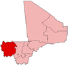
 Diéma Location in Mali | |
| Coordinates: ML 14°32′20″N 9°11′24″W / 14.539°N 9.190°WCoordinates: ML 14°32′20″N 9°11′24″W / 14.539°N 9.190°W | |
| Country |
|
| Region | Kayes Region |
| Cercle | Diéma Cercle |
| Area[1] | |
| • Total | 1,183 km2 (457 sq mi) |
| Population (2009 census)[2] | |
| • Total | 30,592 |
| • Density | 26/km2 (67/sq mi) |
| Time zone | GMT (UTC+0) |
Diéma is a rural commune and small town in the Cercle of Diéma in the Kayes Region of western Mali. Diéma is also the administrative center (chef-lieu) of the Diéma Cercle. As well as the main town, the commune contains the villages of Tinkaré, Kana, Guemou, Fangouné Bambara, Fangouné Kagoro, Fangouné Massassi, Dampa, Lacklal, Garambougou, Bougoudéré Niandé, Bougoudéré Mahomet, Bilibani, Mambourké, Madina-Maure and Nafadji. In the 2009 census the commune had a population of 30,592.
References
- ↑ Plan de Sécurite Alimentaire Commune Rurale de Diéma 2007-2011 (PDF) (in French), Commissariat à la Sécurité Alimentaire, République du Mali, USAID-Mali, 2006.
- ↑ Resultats Provisoires RGPH 2009 (Région de Kayes) (PDF) (in French), République de Mali: Institut National de la Statistique.
This article is issued from Wikipedia - version of the 3/7/2013. The text is available under the Creative Commons Attribution/Share Alike but additional terms may apply for the media files.