Kourouninkoto
| Kourouninkoto | |
|---|---|
| Commune and town | |
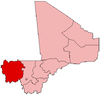
 Kourouninkoto Location in Mali | |
| Coordinates: 13°51′28″N 9°34′37″W / 13.85778°N 9.57694°WCoordinates: 13°51′28″N 9°34′37″W / 13.85778°N 9.57694°W[1] | |
| Country |
|
| Region | Kayes Region |
| Cercle | Kita Cercle |
| Area[2] | |
| • Total | 847 km2 (327 sq mi) |
| Elevation | 267 m (876 ft) |
| Population (2009 census)[3] | |
| • Total | 5,335 |
| • Density | 6.3/km2 (16/sq mi) |
| Time zone | GMT (UTC+0) |
Kourouninkoto is a small town and urban commune in the Cercle of Kita in the Kayes Region of south-western Mali.
Climate
The urban district has a Sudano Sahelian climate. The average annual rainfall is around 350 mm with nearly all of it falling between late June and mid September.[4]
Hydrography
The town is watered by the river Baoulé located 20 km from the town. There are temporary streams during the rainy season.[4] There is a water purification plant in Kourouninkoto that provides potable water through a robine system.
Geography
Kourouninkoto is located in a valley surrounded by the Sokaroba mountain to the east, Kouroubonda mountain to the North, and Satankourou mountain to the west.[4]
Population
In the 2009 census Kourouninkoto had a population of 5,335 inhabitants.[3] This population consists of multiple ethnic groups; Malinke (majority), Bambara, Kakolos, Peulh, Sarakolé, Diawambé.[4]
Economy
Kourouninkoto's economy is agriculture based. Farming is practiced by 96 percent of the workforce. Major crops are cotton, corn, millet, rice, and peanuts.[4]
Transportation
The town is served by a large section of Regional Road 12. Transport vehicles leave daily from Kita to Kourouninkoto.[4]
References
- ↑ "Common and Fundamental Operational Datasets Registry: Mali", United Nations Office for the Coordination of Humanitarian Affairs https://web.archive.org/web/20120106202217/http://cod.humanitarianresponse.info/country-region/mali, archived from the original on January 6, 2012 Missing or empty
|title=(help). See cheflieu_mali.zip - ↑ "Common and Fundamental Operational Datasets Registry: Mali", United Nations Office for the Coordination of Humanitarian Affairs https://web.archive.org/web/20120106202217/http://cod.humanitarianresponse.info/country-region/mali, archived from the original on January 6, 2012 Missing or empty
|title=(help). commune_mali.zip (Originally from the Direction Nationale des Collectivités Territoriales, République du Mali) - 1 2 Resultats Provisoires RGPH 2009 (Région de Kayes) (in French), République de Mali: Institut National de la Statistique, archived from the original (PDF) on September 19, 2012.
- 1 2 3 4 5 6 Plan de Sécurité Alimentaire Commune Rurale de Kourouninkoto 2007-2011 (PDF) (in French), Commissariat à la Sécurité Alimentaire, République du Mali, USAID-Mali, 2006.