Coosawhatchie, South Carolina
Coordinates: 32°26′N 81°01′W / 32.433°N 81.017°W Coosawhatchie (koos-uh-HATCH-ee) is an unincorporated community located in Jasper County, South Carolina at the northern head of the Broad River. It served as the headquarters for General Robert E. Lee during the early part of the American Civil War. It is accessible from Interstate 95 via Exit 28.
History
The area derives its name from its original inhabitants, the Coosaw band of Native Americans and their word for river, hatchie.[1] A sub-group of the Muskogees, they spoke a mixture of the Muskogee and Koasati languages. Located on the King's Highway that stretched from Boston to Charleston, Coosawhatchie was settled by trappers in the 1740s. The town grew around a store owned by rice planter brothers, Henry and Daniel DeSaussure.[2] During the Revolutionary War, much of the town was burned by British troops in 1779. It became the seat of Beaufort District in 1788.
In 1810, the local court of equity was relocated to Coosawhatchie. Seven years later a new courthouse was constructed in town. Designed by British architect William Jay, the two story structure remained in use until 1840, when the county seat was moved to nearby Gillisonville. After 1840 Coosawhatchie declined somewhat due to the perception that its marshy terrain was unhealthy.[3]
During the Civil War, it was the site of several small battles. Robert E. Lee made his headquarters in Coosawhatchie when he was fortifying the coastal defenses of South Carolina and Georgia during late 1861 and early 1862.[4] To protect the railroad bridge in Coosawhatchie against Federal gunboats coming up the Broad River, Lee's troops dug massive earthworks along its banks. Lee bought and named his famous horse Traveller in Coosawhatchie.[5]
In 1912, Coosawhatchie became part of newly created Jasper County.[3]
Demographics
According to the 2000 census, Coosawhatchie has a population of 11,407. It has 4,164 households with an average household income of $30,240. 44.47% of the population is White, 51.47% is African American, 3.8% is Hispanic, 0.33% is Asian and 0.35% is Native American. 54.4% of inhabitants are male while 45.6% are female.
Notable residents
- William F. Colcock, politician
- Mary Gordon Ellis, politician, first woman elected to the South Carolina legislature - lived nearby with her husband[6]
- James L. Petigru, politician and judge[7]
References
- ↑ Hoyt, William D. (1952). "To Coosawhatchie in December 1861". The South Carolina Historical Magazine. 52 (1): 6–12.
- ↑ Migliazzo, Arlin C.; Lawrence S. Rowland (2007). To Make this Land Our Own: Community, Identity, and Cultural Adaptation in Purrysburg Township, South Carolina, 1732-1865. University of South Carolina Press. p. 295. ISBN 1-57003-682-9.
- 1 2 Coleman Karesh Law Library. "Coosawhatchie Courthouse". University of South Carolina School of Law. Retrieved January 26, 2010.
- ↑ Stone, H. David (2008). Vital rails: the Charleston & Savannah Railroad and the Civil War in coastal South Carolina. University of South Carolina Press. ISBN 1-57003-716-7.
- ↑ Johnson, Clint (2001). In the footsteps of Robert E. Lee. John F. Blair. pp. 152–4. ISBN 0-89587-235-8.
- ↑ Marjorie Julian Spruill; Valinda W. Littlefield; Joan Marie Johnson (2012). South Carolina Women: Their Lives and Times. University of Georgia Press. pp. 52–. ISBN 978-0-8203-4215-3.
- ↑ Pease, Jane H.; William Henry Pease (2002). James Louis Petigru: Southern conservative, Southern dissenter. University of South Carolina Press. p. 20. ISBN 1-57003-491-5.
Municipalities and communities of Jasper County, South Carolina, United States | ||
|---|---|---|
| City | 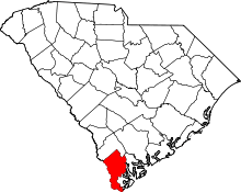 | |
| Town | ||
| Unincorporated communities |
| |
| Footnotes | ‡This populated place also has portions in an adjacent county or counties | |