Clinton station (CTA Blue Line)
For other 'L' stations on the Chicago Transit Authority named Clinton, see Clinton (disambiguation) § CTA stations.
| |||||||||||||||||||||||||||||||||||||||||||||||||||
|---|---|---|---|---|---|---|---|---|---|---|---|---|---|---|---|---|---|---|---|---|---|---|---|---|---|---|---|---|---|---|---|---|---|---|---|---|---|---|---|---|---|---|---|---|---|---|---|---|---|---|---|
 | |||||||||||||||||||||||||||||||||||||||||||||||||||
| Location |
426 South Clinton Street Chicago, Illinois 60607 | ||||||||||||||||||||||||||||||||||||||||||||||||||
| Coordinates | 41°52′32″N 87°38′28″W / 41.875539°N 87.640984°W | ||||||||||||||||||||||||||||||||||||||||||||||||||
| Owned by | City of Chicago | ||||||||||||||||||||||||||||||||||||||||||||||||||
| Line(s) | |||||||||||||||||||||||||||||||||||||||||||||||||||
| Platforms | 1 island platform | ||||||||||||||||||||||||||||||||||||||||||||||||||
| Tracks | 2 | ||||||||||||||||||||||||||||||||||||||||||||||||||
| Connections |
Union Station (2 blocks north) CTA and Greyhound Buses | ||||||||||||||||||||||||||||||||||||||||||||||||||
| Construction | |||||||||||||||||||||||||||||||||||||||||||||||||||
| Structure type | Subway | ||||||||||||||||||||||||||||||||||||||||||||||||||
| Depth | 66 ft | ||||||||||||||||||||||||||||||||||||||||||||||||||
| History | |||||||||||||||||||||||||||||||||||||||||||||||||||
| Opened | June 22, 1958 | ||||||||||||||||||||||||||||||||||||||||||||||||||
| Traffic | |||||||||||||||||||||||||||||||||||||||||||||||||||
| Passengers (2015) |
1,174,021[1] | ||||||||||||||||||||||||||||||||||||||||||||||||||
| Rank | 63 out of 143[lower-alpha 1] | ||||||||||||||||||||||||||||||||||||||||||||||||||
| Services | |||||||||||||||||||||||||||||||||||||||||||||||||||
| |||||||||||||||||||||||||||||||||||||||||||||||||||
| |||||||||||||||||||||||||||||||||||||||||||||||||||
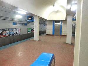
Clinton is a subway station on the Chicago Transit Authority's 'L' system, serving the Blue Line and the West Loop neighborhood of the larger Near West Side community area. The Congress Branch of the Blue line opened in June 1958, and connected to the existing Dearborn subway at LaSalle. It is the closest 'L' station to Union Station, the terminal for several Metra and Amtrak trains and the Chicago Greyhound Bus Terminal. It is also the deepest station on the CTA system.[2]
Bus connections
- 7 Harrison
- 37 Sedgwick
- 60 Blue Island/26th (Owl Service)
- 157 Streeterville/Taylor
- 192 University of Chicago Hospitals Express
- Two blocks southwest

Notes and references
Notes
- ↑ Due to possible double-counting of physically-connected stations, the CTA's official 2015 tally of stations was 146, but for ridership purposes reported having only 143 stations.
References
- ↑ "Monthly Ridership Report – December 2015" (PDF). Chicago Transit Authority Ridership Analysis and Reporting. January 11, 2016. Retrieved March 11, 2016.
- ↑ "CTA Blue Line Facts". world.nycsubway.org.
- ↑ http://www.greyhound.com/en/locations/terminal.aspx?city=560252 Chicago Greyhound Terminal
External links
This article is issued from Wikipedia - version of the 11/8/2016. The text is available under the Creative Commons Attribution/Share Alike but additional terms may apply for the media files.