Chelsea, Wisconsin
| Chelsea, Wisconsin | |
|---|---|
| Town | |
 Location of Chelsea, Wisconsin | |
| Coordinates: 45°15′43″N 90°21′32″W / 45.26194°N 90.35889°W | |
| Country | United States |
| State | Wisconsin |
| County | Taylor |
| Area[1] | |
| • Total | 0.46 sq mi (1.19 km2) |
| • Land | 0.46 sq mi (1.19 km2) |
| • Water | 0 sq mi (0 km2) |
| Elevation[2] | 1,490 ft (454 m) |
| Population (2010)[3] | |
| • Total | 113 |
| • Density | 245.7/sq mi (94.9/km2) |
| Time zone | Central (CST) (UTC-6) |
| • Summer (DST) | CDT (UTC-5) |
| Area code(s) | 715 & 534 |
| FIPS code | 55-14200[4] |
| GNIS feature ID | 1582948[2] |
| PLSS township | T32N R1E |
Chelsea is a town in Taylor County, Wisconsin, United States. The population was 113 at the 2010 census. The census-designated places of Chelsea and Whittlesey are located in the town.
Geography
According to the United States Census Bureau, the CDP has a total area of 0.46 square miles (1.19 km2), all of it land.[1]
Most of Chelsea is hilly, with small glacial lakes. It lies within the Perkinstown terminal moraine, which is described under Taylor County.
History
The six by seven mile square that would become Chelsea was first surveyed in 1861 by a crew working for the U.S. government. Then in April 1862 another crew marked all the section corners in the township, walking through the woods and swamps, measuring with chain and compass.[5][6] When done, the deputy surveyor filed this general description:
The Surface of this Township is generally rolling and considerably Swampy. Timber principally Hemlock mixed with Birch Sugar Spruce (?) Tamarac Cedar and White Pine. It is watered by numerous Small Streams which unite and form two of considerable size one running in a Southerly direction and the other running NW and becoming a tributary of Chipewa river. The Township on the whole would not be very well adapted to agricultural purposes. [7]
When Taylor County was formed in 1875, Chelsea was six miles north to south, but it spanned the full width of the county, including all modern towns from Pershing to Greenwood.[8]
In 1933 much of the northwest quarter of Chelsea was designated part of the Chequamegon National Forest[9]
Demographics
Coordinates: 45°17′25″N 90°18′27″W / 45.29028°N 90.30750°W
2010 census
As of the census[3] of 2010, there were 113 people, 43 households, and 31 families residing in the CDP. The population density was 245.7 inhabitants per square mile (94.9/km2). There were 51 housing units at an average density of 110.9 per square mile (42.8/km2). The racial makeup of the CDP was 99.1% White and 0.9% from other races. Hispanic or Latino of any race were 0.9% of the population.
There were 43 households out of which 23.3% had children under the age of 18 living with them, 53.5% were married couples living together, 9.3% had a female householder with no husband present, 9.3% had a male householder with no wife present, and 27.9% were non-families. 18.6% of all households were made up of individuals and 4.7% had someone living alone who was 65 years of age or older. The average household size was 2.63 and the average family size was 2.94.
The median age in the CDP was 37.8 years. 23.9% of residents were under the age of 18; 11.5% were between the ages of 18 and 24; 20.4% were from 25 to 44; 27.5% were from 45 to 64; and 16.8% were 65 years of age or older. The gender makeup of the CDP was 44.2% male and 55.8% female.
2000 census
As of the census[4] of 2000, there were 719 people, 274 households, and 201 families residing in the town. The population density was 17.8 people per square mile (6.9/km²). There were 310 housing units at an average density of 7.7 per square mile (3.0/km²). The racial makeup of the town was 99.58% White, 0.14% Asian, and 0.28% from two or more races. Hispanic or Latino of any race were 0.42% of the population.
There were 274 households out of which 34.7% had children under the age of 18 living with them, 59.5% were married couples living together, 7.3% had a female householder with no husband present, and 26.6% were non-families. 21.9% of all households were made up of individuals and 7.7% had someone living alone who was 65 years of age or older. The average household size was 2.62 and the average family size was 3.10.
In the town the population was spread out with 26.3% under the age of 18, 8.2% from 18 to 24, 30.6% from 25 to 44, 22.3% from 45 to 64, and 12.7% who were 65 years of age or older. The median age was 38 years. For every 100 females there were 95.9 males. For every 100 females age 18 and over, there were 103.1 males.
The median income for a household in the town was $44,659, and the median income for a family was $50,000. Males had a median income of $32,500 versus $26,429 for females. The per capita income for the town was $19,798. About 0.9% of families and 3.5% of the population were below the poverty line, including 2.2% of those under age 18 and 2.2% of those age 65 or over.
Notable people
- Joseph Schmittfranz, Wisconsin State Assemblyman, was born in the town.[10]
References
- 1 2 "US Gazetteer files 2010". United States Census Bureau. Archived from the original on 2012-01-24. Retrieved 2012-11-18.
- 1 2 "US Board on Geographic Names". United States Geological Survey. 2007-10-25. Retrieved 2008-01-31.
- 1 2 "American FactFinder". United States Census Bureau. Retrieved 2012-11-18.
- 1 2 "American FactFinder". United States Census Bureau. Archived from the original on 2013-09-11. Retrieved 2008-01-31.
- ↑ "Land Survey Information". Board of Commissioners of Public Lands. Retrieved 31 May 2011.
- ↑ "Field Notes for T32N R1E". Original Field Notes and Plat Maps, 1833-1866. Board of Commissioners of Public Lands. Retrieved 31 May 2011.
- ↑ Daugherty, William E. "Interior Field Notes (Apr. 1862)". Board of Commissioners of Public Lands. Retrieved 3 June 2011.
- ↑ Dahl, Ole Rasmussen (1880). Map of Chippewa, Price & Taylor Counties and the northern part of Clark County. Milwaukee, Wisconsin: The Milwaukee Litho & Engr Co.
- ↑ "Nicolet National Forest"
- ↑ 'Wisconsin Blue Book 1931,' Biographical Sketch of Joseph Schmittfranz, pg. 216
Municipalities and communities of Taylor County, Wisconsin, United States | ||
|---|---|---|
| City | 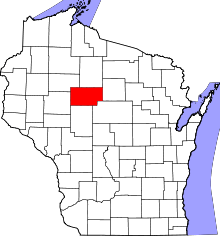 | |
| Villages | ||
| Towns | ||
| CDPs | ||
| Unincorporated communities | ||
| Footnotes | ‡This populated place also has portions in an adjacent county or counties | |