Pershing, Wisconsin
| Pershing, Wisconsin | |
|---|---|
| Town | |
 Location of Pershing, Wisconsin | |
| Coordinates: 45°14′59″N 90°52′55″W / 45.24972°N 90.88194°WCoordinates: 45°14′59″N 90°52′55″W / 45.24972°N 90.88194°W | |
| Country | United States |
| State | Wisconsin |
| County | Taylor |
| Area | |
| • Total | 35.8 sq mi (92.8 km2) |
| • Land | 35.7 sq mi (92.4 km2) |
| • Water | 0.2 sq mi (0.4 km2) |
| Elevation[1] | 1,188 ft (362 m) |
| Population (2000) | |
| • Total | 180 |
| • Density | 5.0/sq mi (1.9/km2) |
| Time zone | Central (CST) (UTC-6) |
| • Summer (DST) | CDT (UTC-5) |
| Area code(s) | 715 & 534 |
| FIPS code | 55-62100[2] |
| GNIS feature ID | 1583911[1] |
| PLSS township | T32N R4W |
Pershing is a town in Taylor County, Wisconsin, United States. The population was 180 at the 2000 census. The unincorporated community of Donald is located in the town.
Geography
According to the United States Census Bureau, the town has a total area of 35.8 square miles (92.8 km²), of which 35.7 square miles (92.4 km²) is land and 0.2 square miles (0.4 km²) (0.45%) is water.
The water consists mostly of man-made flowages in the Pershing Wildlife Area, and the Fisher River, which crosses Pershing from east to west.
History
The six mile square that would become Pershing was first surveyed in 1847 by a crew working for the U.S. government, then again in 1852. Then in 1855 another crew marked all the section corners in the township, walking through the woods and slogging through the swamps on foot, measuring with chain and compass.[3][4] When done, the deputy surveyor filed this general description:
This Township contains several swamps and one in the SE corner of considerable extent. They are all unfit for cultivation. The meadow and Alder bottoms are all subject to be overflowed to a depth of 1 to 2 feet and are good for Hay. The surface is generally low and level a part is upland where the soil is 2d rate. This township is heavily timbered and is chiefly {{sic}} composed of Hemlock and Y. Birch on low level land and on uplands Sugar, Linden W. Pine and Balsam. The undergrowth is Generally thick and is composed of Hemlock Balsam and Hazel. Balsam and Elm line the margins of the Meadow and Alder bottoms. There is no improvements on this Township.[5]
Pershing was logged starting in the late 1800s. Around 1903 the Eau Claire, Chippewa Falls, and Northeastern Railway (a.k.a. Omaha) built its line across the township, roughly following the current CTH M. Around 1905 the Wisconsin Central Railway built the line which would become the Soo Line and on which trains run to this day. At the junction of the two lines the community of Donald rose. Donald declined after logging waned and the Omaha shut down in 1939.[6]
In early August 1936 more than two thirds of Pershing was burned by wildfires, forcing fifteen families to flee their homes.[7]
Now much of Pershing is farmed by families: dairy, beef and crops. One third of the town is occupied by the Pershing Wildlife Area, managed by the state of Wisconsin.[8]
Demographics
As of the census[2] of 2000, there were 180 people, 70 households, and 45 families residing in the town. The population density was 5.0 people per square mile (1.9/km²). There were 92 housing units at an average density of 2.6 per square mile (1.0/km²). The racial makeup of the town was 100.00% White. Hispanic or Latino of any race were 0.56% of the population.
There were 70 households out of which 28.6% had children under the age of 18 living with them, 50.0% were married couples living together, 10.0% had a female householder with no husband present, and 34.3% were non-families. 28.6% of all households were made up of individuals and 14.3% had someone living alone who was 65 years of age or older. The average household size was 2.57 and the average family size was 3.22.
In the town the population was spread out with 27.8% under the age of 18, 8.3% from 18 to 24, 22.8% from 25 to 44, 20.6% from 45 to 64, and 20.6% who were 65 years of age or older. The median age was 41 years. For every 100 females there were 109.3 males. For every 100 females age 18 and over, there were 120.3 males.
The median income for a household in the town was $27,083, and the median income for a family was $60,833. Males had a median income of $33,750 versus $35,417 for females. The per capita income for the town was $14,607. About 8.8% of families and 14.2% of the population were below the poverty line, including 11.6% of those under the age of eighteen and 22.2% of those sixty-five or over.
References
- 1 2 "US Board on Geographic Names". United States Geological Survey. 2007-10-25. Retrieved 2008-01-31.
- 1 2 "American FactFinder". United States Census Bureau. Retrieved 2008-01-31.
- ↑ "Land Survey Information". Board of Commissioners of Public Lands. Retrieved 26 March 2011.
- ↑ "Field Notes for T32N R4W". Original Field Notes and Plat Maps, 1833-1866. Board of Commissioners of Public Lands. Retrieved 26 March 2011.
- ↑ White, Delos M. "Interior Field Notes (Nov. 1854)". Board of Commissioners of Public Lands. Retrieved 26 March 2011.
- ↑ Nagel, Paul. S.M.&P. RY. - The Stanley, Merrill and Phillips Railway, 1979.
- ↑ The Star News. 1936-08-13. Missing or empty
|title=(help) - ↑ "Pershing Wildlife Area". Wisconsin Department of Natural Resources. Retrieved 2011-03-26.
Municipalities and communities of Taylor County, Wisconsin, United States | ||
|---|---|---|
| City | 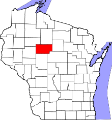 | |
| Villages | ||
| Towns | ||
| CDPs | ||
| Unincorporated communities | ||
| Footnotes | ‡This populated place also has portions in an adjacent county or counties | |