Champ, Missouri
| Champ, Missouri | |
|---|---|
| Village | |
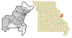 Location of Champ, Missouri | |
| Coordinates: 38°44′37″N 90°27′5″W / 38.74361°N 90.45139°WCoordinates: 38°44′37″N 90°27′5″W / 38.74361°N 90.45139°W | |
| Country | United States |
| State | Missouri |
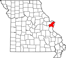
| County | St. Louis |
| Area[1] | |
| • Total | 0.81 sq mi (2.10 km2) |
| • Land | 0.81 sq mi (2.10 km2) |
| • Water | 0 sq mi (0 km2) |
| Elevation | 614 ft (187 m) |
| Population (2010)[2] | |
| • Total | 13 |
| • Estimate (2012[3]) | 13 |
| • Density | 16.0/sq mi (6.2/km2) |
| Time zone | Central (CST) (UTC-6) |
| • Summer (DST) | CDT (UTC-5) |
| FIPS code | 29-13078[4] |
| GNIS feature ID | 0755878[5] |
Champ is a village in St. Louis County, Missouri, United States. The population was 13 at the 2010 census.[6]
History
Champ was founded in 1959 by Bill Bangert, a former track and field athlete who was once mayor of Berkeley, Missouri. Bangert was the mayor of Champ for 18 years, and later moved to California.[7][8]
Geography
Champ is located at 38°44′37″N 90°27′5″W / 38.74361°N 90.45139°W (38.743529, -90.451309).[9]
According to the United States Census Bureau, the village has a total area of 0.81 square miles (2.10 km2), all of it land.[1]
Demographics
| Historical population | |||
|---|---|---|---|
| Census | Pop. | %± | |
| 1960 | 50 | — | |
| 1970 | 19 | −62.0% | |
| 1980 | 28 | 47.4% | |
| 1990 | 11 | −60.7% | |
| 2000 | 12 | 9.1% | |
| 2010 | 13 | 8.3% | |
| Est. 2015 | 13 | [10] | 0.0% |
2010 census
As of the census[2] of 2010, there were 13 people, 6 households, and 3 families residing in the village. The population density was 16.0 inhabitants per square mile (6.2/km2). There were 6 housing units at an average density of 7.4 per square mile (2.9/km2). The racial makeup of the village was 100.0% White.
There were 6 households of which 16.7% had children under the age of 18 living with them, 50.0% were married couples living together, and 50.0% were non-families. 50.0% of all households were made up of individuals. The average household size was 2.17 and the average family size was 3.33.
The median age in the village was 57.5 years. 15.4% of residents were under the age of 18; 7.7% were between the ages of 18 and 24; 23.1% were from 25 to 44; 30.8% were from 45 to 64; and 23.1% were 65 years of age or older. The gender makeup of the village was 53.8% male and 46.2% female.
2000 census
As of the census[4] of 2000, there were 12 people, 4 households, and 4 families residing in the village. The population density was 14.4 people per square mile (5.5/km²). There were 6 housing units at an average density of 7.2 per square mile (2.8/km²). The racial makeup of the village was 66.67% White, and 33.33% from two or more races.
There were 4 households out of which 50.0% had children under the age of 18 living with them, 100.0% were married couples living together, and 0.0% were non-families. No households were made up of individuals and none had someone living alone who was 65 years of age or older. The average household size was 3.00 and the average family size was 3.00.
In the village the population was spread out with 25.0% under the age of 18, 8.3% from 18 to 24, 33.3% from 25 to 44, 25.0% from 45 to 64, and 8.3% who were 65 years of age or older. The median age was 36 years. For every 100 females there were 140.0 males. For every 100 females age 18 and over, there were 125.0 males.
The median income for a household in the village was $75,487, and the median income for a family was $75,487. Males had a median income of $75,487 versus $0 for females. The per capita income for the village was $18,762. None of the population and none of the families were below the poverty line.
References
- 1 2 "US Gazetteer files 2010". United States Census Bureau. Archived from the original on 2012-01-24. Retrieved 2012-07-08.
- 1 2 "American FactFinder". United States Census Bureau. Retrieved 2012-07-08.
- ↑ "Population Estimates". United States Census Bureau. Archived from the original on 2013-06-17. Retrieved 2013-05-30.
- 1 2 "American FactFinder". United States Census Bureau. Archived from the original on 2013-09-11. Retrieved 2008-01-31.
- ↑ "US Board on Geographic Names". United States Geological Survey. 2007-10-25. Retrieved 2008-01-31.
- ↑ "Race, Hispanic or Latino, Age, and Housing Occupancy: 2010 Census Redistricting Data (Public Law 94-171) Summary File (QT-PL), Champ village, Missouri". U.S. Census Bureau, American FactFinder 2. Archived from the original on September 11, 2013. Retrieved October 25, 2011.
- ↑ Olson, Leonard T. (2001). Masters Track and Field: A History. McFarland. p. 61. ISBN 978-0-7864-0889-4.
- ↑ http://www.stltoday.com/news/local/metro/bill-bangert-dies-world-s-strongest-mayor-created-champ/article_79624cf4-353e-5e5f-b4c9-595fffeee048.html
- ↑ "US Gazetteer files: 2010, 2000, and 1990". United States Census Bureau. 2011-02-12. Retrieved 2011-04-23.
- ↑ "Annual Estimates of the Resident Population for Incorporated Places: April 1, 2010 to July 1, 2015". Retrieved July 2, 2016.
- ↑ "Census of Population and Housing". Census.gov. Archived from the original on May 11, 2015. Retrieved June 4, 2015.