Sappington, Missouri
| Sappington, Missouri | |
|---|---|
| CDP | |
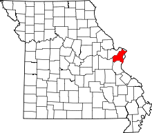
 Location of Sappington, Missouri | |
| Coordinates: 38°31′45″N 90°22′30″W / 38.52917°N 90.37500°WCoordinates: 38°31′45″N 90°22′30″W / 38.52917°N 90.37500°W | |
| Country | United States |
| State | Missouri |
| County | St. Louis |
| Area | |
| • Total | 2.6 sq mi (6.8 km2) |
| • Land | 2.6 sq mi (6.6 km2) |
| • Water | 0.1 sq mi (0.2 km2) |
| Elevation | 597 ft (182 m) |
| Population (2010) | |
| • Total | 7,580 |
| • Density | 2,900/sq mi (1,100/km2) |
| Time zone | Central (CST) (UTC-6) |
| • Summer (DST) | CDT (UTC-5) |
| FIPS code | 29-65954[1] |
| GNIS feature ID | 0756691[2] |
Sappington is an unincorporated census-designated place in St. Louis County, Missouri, United States. The population was 7,580 at the 2010 census.[3]
History
Sappington was named for a family of pioneer settlers.[4]
Geography
Sappington is located at 38°31′45″N 90°22′30″W / 38.52917°N 90.37500°W (38.529036, -90.374980).[5]
According to the United States Census Bureau, the community has a total area of 2.6 square miles (6.7 km2), of which 0.1 square miles (0.26 km2), or 2.30%, is water.
Demographics
| Historical population | ||
|---|---|---|
| Year | Pop. | ±% |
| 2000 | 7,287 | — |
| 2010 | 7,580 | +4.0% |
As of the census[1] of 2000, there were 7,287 people, 3,403 households, and 2,038 families residing in the community. The population density was 2,850.5 people per square mile (1,099.0/km²). There were 3,530 housing units at an average density of 1,380.8/sq mi (532.4/km²). The racial makeup of the community was 96.53% White, 0.64% African American, 0.11% Native American, 1.83% Asian, 0.12% from other races, and 0.77% from two or more races. Hispanic or Latino of any race were 1.03% of the population.
There were 3,403 households out of which 21.1% had children under the age of 18 living with them, 49.3% were married couples living together, 8.2% had a female householder with no husband present, and 40.1% were non-families. 36.5% of all households were made up of individuals and 19.7% had someone living alone who was 65 years of age or older. The average household size was 2.14 and the average family size was 2.81.
In the CDP the population was spread out with 18.5% under the age of 18, 6.7% from 18 to 24, 23.3% from 25 to 44, 25.6% from 45 to 64, and 25.9% who were 65 years of age or older. The median age was 46 years. For every 100 females there were 85.3 males. For every 100 females age 18 and over, there were 80.0 males.
The median income for a household in the community was $44,117, and the median income for a family was $57,897. Males had a median income of $43,565 versus $30,906 for females. The per capita income for the community was $26,727. About 2.1% of families and 2.9% of the population were below the poverty line, including 3.7% of those under age 18 and 3.7% of those age 65 or over.
References
- 1 2 "American FactFinder". United States Census Bureau. Retrieved 2008-01-31.
- ↑ "US Board on Geographic Names". United States Geological Survey. 2007-10-25. Retrieved 2008-01-31.
- ↑ "Race, Hispanic or Latino, Age, and Housing Occupancy: 2010 Census Redistricting Data (Public Law 94-171) Summary File (QT-PL), Sappington CDP, Missouri". U.S. Census Bureau, American FactFinder 2. Retrieved October 26, 2011.
- ↑ Eaton, David Wolfe (1918). How Missouri Counties, Towns and Streams Were Named. The State Historical Society of Missouri. p. 360.
- ↑ "US Gazetteer files: 2010, 2000, and 1990". United States Census Bureau. 2011-02-12. Retrieved 2011-04-23.