Castle Point, Missouri
| Castle Point, Missouri | |
|---|---|
| CDP | |
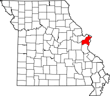
 Location of Castle Point, Missouri | |
| Coordinates: 38°45′21″N 90°14′54″W / 38.75583°N 90.24833°WCoordinates: 38°45′21″N 90°14′54″W / 38.75583°N 90.24833°W | |
| Country | United States |
| State | Missouri |
| County | St. Louis |
| Area | |
| • Total | 0.7 sq mi (1.8 km2) |
| • Land | 0.7 sq mi (1.8 km2) |
| • Water | 0.0 sq mi (0.0 km2) |
| Elevation | 499 ft (152 m) |
| Population (2010) | |
| • Total | 3,962 |
| • Density | 5,700/sq mi (2,200/km2) |
| Time zone | Central (CST) (UTC-6) |
| • Summer (DST) | CDT (UTC-5) |
| FIPS code | 29-11908[1] |
| GNIS feature ID | 1867335[2] |
Castle Point is a census-designated place (CDP) in St. Louis County, Missouri, United States. The population was 3,962 at the 2010 census.[3]
Geography
Castle Point is located at 38°45′21″N 90°14′54″W / 38.75583°N 90.24833°W (38.755950, -90.248210).[4]
According to the United States Census Bureau, the CDP has a total area of 0.7 square miles (1.8 km2), all of it land.
Demographics
2010 census
As of the 2010 census, Castle Point had a population of 3,962. The ethnic makeup of the population was 92.9% non-Hispanic African-American, 4.7% non-Hispanic white, 0.1% Native American, 0.3% Asian, 1.6% from two or more races and 0.6% Hispanic or Latino.[5]
2000 census
As of the census[1] of 2000, there were 4,559 people, 1,408 households, and 1,163 families residing in the CDP. The population density was 6,653.9 people per square mile (2,551.1/km²). There were 1,571 housing units at an average density of 2,292.9/sq mi (879.1/km²). The racial makeup of the CDP was 9.54% White, 88.66% African American, 0.31% Native American, 0.04% Asian, 0.04% from other races, and 1.40% from two or more races. Hispanic or Latino of any race were 0.42% of the population.
There were 1,408 households out of which 44.4% had children under the age of 18 living with them, 36.7% were married couples living together, 40.0% had a female householder with no husband present, and 17.4% were non-families. 14.8% of all households were made up of individuals and 3.7% had someone living alone who was 65 years of age or older. The average household size was 3.24 and the average family size was 3.55.
In the CDP the population was spread out with 37.6% under the age of 18, 9.6% from 18 to 24, 25.9% from 25 to 44, 20.7% from 45 to 64, and 6.3% who were 65 years of age or older. The median age was 27 years. For every 100 females there were 85.0 males. For every 100 females age 18 and over, there were 75.8 males.
The median income for a household in the CDP was $31,081, and the median income for a family was $33,281. Males had a median income of $29,919 versus $21,113 for females. The per capita income for the CDP was $11,386. About 22.6% of families and 24.6% of the population were below the poverty line, including 36.4% of those under age 18 and 18.3% of those age 65 or over.
References
- 1 2 "American FactFinder". United States Census Bureau. Archived from the original on 2013-09-11. Retrieved 2008-01-31.
- ↑ "US Board on Geographic Names". United States Geological Survey. 2007-10-25. Retrieved 2008-01-31.
- ↑ "Race, Hispanic or Latino, Age, and Housing Occupancy: 2010 Census Redistricting Data (Public Law 94-171) Summary File (QT-PL), Castle Point CDP, Missouri". U.S. Census Bureau, American FactFinder 2. Archived from the original on September 11, 2013. Retrieved October 26, 2011.
- ↑ "US Gazetteer files: 2010, 2000, and 1990". United States Census Bureau. 2011-02-12. Retrieved 2011-04-23.
- ↑ 2010 census figures for Castel Point, Missouri