Carrollwood (CDP), Florida
| Carrollwood (CDP), Florida | |
|---|---|
| CDP | |
 U.S. Census map of Carrollwood (CDP), Florida | |
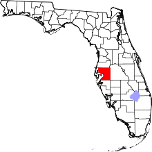
 Location in Hillsborough County and the state of Florida | |
| Coordinates: 28°3′29″N 82°30′55″W / 28.05806°N 82.51528°WCoordinates: 28°3′29″N 82°30′55″W / 28.05806°N 82.51528°W | |
| Country | United States |
| State | Florida |
| County | Hillsborough |
| Area | |
| • Total | 10.3 sq mi (26.7 km2) |
| • Land | 9.6 sq mi (24.8 km2) |
| • Water | 0.7 sq mi (1.9 km2) |
| Population (2010) | |
| • Total | 33,365 |
| • Density | 3,254.3/sq mi (1,255.4/km2) |
| Time zone | Eastern (EST) (UTC-5) |
| • Summer (DST) | EDT (UTC-4) |
| ZIP Code | 33612, 33618 and 33624 |
| Area code(s) | 813 |
| FIPS code | 12-27313[1] |
Carrollwood is a census-designated place and an unincorporated census area located in northwestern Hillsborough County, Florida, United States. The population was 33,365 at the 2010 census.[2] The census area includes the smaller community of Carrollwood and neighboring Carrollwood Village. The 2000 census data was enumerated under the name Greater Carrollwood,[3] which had a population of 33,519.[2] A similar area was listed as Lake Carroll in 1970 and 1980; for the 1990 census it was split into smaller Carrollwood and Carrollwood Village CDPs.
ZIP code
The ZIP Codes encompassing the CDP area are 33612, 33618 and 33624.[4]
Geography
Carrollwood is located at 28°3′29″N 82°30′55″W / 28.05806°N 82.51528°W (28.058166, -82.515413);[5] or approximately seven miles north-northwest of Tampa. The census boundaries are Citrus Park to the west, Egypt Lake-Leto and Town 'n' Country to the south, Northdale to the north and Lake Magdalene and Forest Hills (Tampa) to the east.
According to the United States Census Bureau, the community has a total area of 10.3 square miles (27 km2), of which 9.6 square miles (25 km2) is land and 0.7 square miles (1.8 km2) (6.91%) is water.
Demographics
| Historical population | |||
|---|---|---|---|
| Census | Pop. | %± | |
| 2000 | 33,519 | — | |
| 2010 | 33,365 | −0.5% | |
| source:[6] | |||
As of the census bureau's American Community Surveys of 2006-2008, there were 32,374 people, 14,236 households, and 8,859 families residing in the community. The population density was 3,372.3 people per square mile (1,352.3/km²). There were 15,137 housing units at an average density of 1,469.6/sq mi (584.3/km²). The racial makeup of the community was 67.3% White, 7.7% African American, 0.1% Native American, 3.4% Asian, less than 0.05% Pacific Islander, 2.2% from other races, and 1.4% from two or more races. Hispanics or Latinos were 20.1% of the population.
There were 14,236 households out of which 27.4% had children under the age of 18 living with them, 45.4% were married couples living together, 12.8% had a female householder with no husband present, and 37.8% were non-families. 32.8% of all households were made up of individuals and 9.8% had someone living alone who was 65 years of age or older. The average household size was 2.27 and the average family size was 2.89.
In the community the population was spread out with 20.8% under the age of 18, 7.3% from 18 to 24, 26.6% from 25 to 44, 29.5% from 45 to 64, and 15.5% who were 65 years of age or older. The median age was 42 years. For every 100 females there were 91.2 males. For every 100 females age 18 and over, there were 86.9 males.
The median income for a household in the community was $50,833, and the median income for a family was $61,223. Males had a median income of $39,529 versus $31,200 for females. The per capita income for the community was $29,107. About 6.0% of families and 6.4% of the population were below the poverty line, including 4.7% of those under age 18 and 3.3% of those age 65 or over.
Education
The schools that serve the area are the following:
- Cannella Elementary School
- Carrollwood Elementary School
- Essrig Elementary School
- Hill Middle School
- Chamberlain High School
- Gaither High School
- Leto High School
- Corbett Preparatory School of IDS
References
- ↑ "American FactFinder". United States Census Bureau. Retrieved 2008-01-31.
- 1 2 Florida Population & Housing Unit data - 2010. United States Census Bureau. Retrieved 2013-08-19.
- ↑ U.S. Geological Survey Geographic Names Information System: Carrollwood (CDP), Florida. Retrieved 2013-12-14.
- ↑ Zip Codes for Carrollwood (CDP), Hillsborough County, Florida (with CDP boundary). Retrieved 2013-12-15.
- ↑ "US Gazetteer files: 2010, 2000, and 1990". United States Census Bureau. 2011-02-12. Retrieved 2011-04-23.
- ↑ "Census of Population and Housing". U.S. Census Bureau. Retrieved 2007-03-19.