Brush Prairie, Washington
| Brush Prairie, Washington | |
|---|---|
| Census-designated place | |
 Location of Brush Prairie, Washington | |
| Coordinates: 45°43′44″N 122°32′32″W / 45.72889°N 122.54222°WCoordinates: 45°43′44″N 122°32′32″W / 45.72889°N 122.54222°W | |
| Country | United States |
| State | Washington |
| County | Clark |
| Area | |
| • Total | 7.8 sq mi (20.3 km2) |
| • Land | 7.8 sq mi (20.3 km2) |
| • Water | 0.0 sq mi (0.0 km2) |
| Elevation | 302 ft (92 m) |
| Population (2010) | |
| • Total | 2,652 |
| • Density | 337/sq mi (130.3/km2) |
| Time zone | Pacific (PST) (UTC-8) |
| • Summer (DST) | PDT (UTC-7) |
| ZIP code | 98606 |
| Area code | 360 |
| FIPS code | 53-08465[1] |
| GNIS feature ID | 1512040[2] |
Brush Prairie is a census-designated place (CDP) in Clark County, Washington, United States. The population was 2,652 at the 2010 census,[3] up from 2,384 at the 2000 census.
Based on per capita income, one of the more reliable measures of affluence, Brush Prairie ranks 57th of 522 areas in the state of Washington to be ranked.
Geography
Brush Prairie is located southwest of the center of Clark County at 45°43′44″N 122°32′32″W / 45.72889°N 122.54222°W (45.728934, -122.542143).[4] It is bordered by Meadow Glade and Battle Ground to the north, Hockinson to the east, Orchards and Five Corners to the south, and Barberton to the west. Washington State Route 503 passes through the community, leading north 4 miles (6 km) to the center of Battle Ground and south 5 miles (8 km) to the start of the SR 500 freeway at the northern border of Vancouver.
According to the United States Census Bureau, the Brush Prairie CDP has a total area of 7.8 square miles (20.3 km2), all of it land.[3]
History
A post office called Brush Prairie has been in operation since 1871.[5] The community was named for the brush near the original town site.[6]
Demographics
As of the census[1] of 2000, there were 2,384 people, 868 households, and 671 families residing in the CDP. The population density was 304.8 people per square mile (117.7/km²). There were 902 housing units at an average density of 115.3/sq mi (44.5/km²). The racial makeup of the CDP was 96.14% White, 0.21% African American, 0.29% Native American, 0.71% Asian, 0.21% Pacific Islander, 0.59% from other races, and 1.85% from two or more races. Hispanic or Latino of any race were 1.68% of the population. 21.0% were of German, 8.9% United States or American, 8.7% Irish, 8.4% Norwegian, 6.8% English and 6.7% French ancestry according to Census 2000. 97.5% spoke English and 2.5% Spanish as their first language.
There were 868 households out of which 32.1% had children under the age of 18 living with them, 68.3% were married couples living together, 6.6% had a female householder with no husband present, and 22.6% were non-families. 18.4% of all households were made up of individuals and 7.3% had someone living alone who was 65 years of age or older. The average household size was 2.74 and the average family size was 3.11.
In the CDP the age distribution of the population shows 26.6% under the age of 18, 6.5% from 18 to 24, 24.0% from 25 to 44, 31.8% from 45 to 64, and 11.0% who were 65 years of age or older. The median age was 41 years. For every 100 females there were 98.3 males. For every 100 females age 18 and over, there were 96.9 males.
The median income for a household in the CDP was $59,408, and the median income for a family was $71,793. Males had a median income of $47,708 versus $40,533 for females. The per capita income for the CDP was $27,605. About 2.4% of families and 3.9% of the population were below the poverty line, including 5.0% of those under age 18 and 6.2% of those age 65 or over.
Notable people
- Dan Dickau, former NBA basketball player
- Zia McCabe, keyboardist for the rock band The Dandy Warhols
- Richie Sexson, Major League Baseball first baseman
- Gerry Staley, Major League Baseball pitcher
References
- 1 2 "American FactFinder". United States Census Bureau. Archived from the original on 2013-09-11. Retrieved 2008-01-31.
- ↑ "US Board on Geographic Names". United States Geological Survey. 2007-10-25. Retrieved 2008-01-31.
- 1 2 "Geographic Identifiers: 2010 Demographic Profile Data (G001): Brush Prairie CDP, Washington". U.S. Census Bureau, American Factfinder. Retrieved August 28, 2015.
- ↑ "US Gazetteer files: 2010, 2000, and 1990". United States Census Bureau. 2011-02-12. Retrieved 2011-04-23.
- ↑ "Post Offices". Jim Forte Postal History. Archived from the original on 6 March 2016. Retrieved 18 July 2016.
- ↑ Meany, Edmond S. (1923). Origin of Washington geographic names. Seattle: University of Washington Press. p. 29.
External links
Municipalities and communities of Clark County, Washington, United States | ||
|---|---|---|
| Cities | 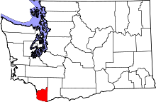 | |
| Town | ||
| CDPs | ||
| Other unincorporated communities | ||
| Footnotes | ‡This populated place also has portions in an adjacent county or counties | |