Lewisville, Washington
| Lewisville, Washington | |
|---|---|
| Census-designated place | |
 Location of Lewisville, Washington | |
| Coordinates: 45°48′33″N 122°31′30″W / 45.80917°N 122.52500°WCoordinates: 45°48′33″N 122°31′30″W / 45.80917°N 122.52500°W | |
| Country | United States |
| State | Washington |
| County | Clark |
| Area | |
| • Total | 5.6 sq mi (14.6 km2) |
| • Land | 5.6 sq mi (14.5 km2) |
| • Water | 0.04 sq mi (0.1 km2) |
| Elevation | 413 ft (126 m) |
| Population (2010) | |
| • Total | 1,722 |
| • Density | 307/sq mi (118.6/km2) |
| Time zone | Pacific (PST) (UTC-8) |
| • Summer (DST) | PDT (UTC-7) |
| FIPS code | 53-39212[1] |
| GNIS feature ID | 1852948[2] |
Lewisville is a census-designated place (CDP) in Clark County, Washington, United States. The population was 1,722 at the 2010 census.[3]
Geography
Lewisville is located in central Clark County at 45°48′33″N 122°31′30″W / 45.80917°N 122.52500°W (45.809255, -122.524912).[4] It is bordered to the southeast by Venersborg, to the southwest by the city of Battle Ground, and for a small distance on the west by Cherry Grove.
According to the United States Census Bureau, the Lewisville CDP has a total area of 5.6 square miles (14.6 km2), of which 5.6 square miles (14.5 km2) is land and 0.04 square miles (0.1 km2), or 0.70%, is water.[3]
Demographics
As of the census[1] of 2000, there were 1,688 people, 552 households, and 476 families residing in the CDP. The population density was 276.9 people per square mile (106.8/km²). There were 563 housing units at an average density of 92.4/sq mi (35.6/km²). The racial makeup of the CDP was 95.97% White, 0.24% African American, 0.53% Native American, 0.41% Asian, 0.36% Pacific Islander, 1.54% from other races, and 0.95% from two or more races. Hispanic or Latino of any race were 1.78% of the population. 19.5% were of German, 13.9% English, 8.2% Norwegian, 7.5% Irish, 7.5% American, 6.8% Swedish and 5.9% Finnish ancestry according to Census 2000.
There were 552 households out of which 39.9% had children under the age of 18 living with them, 79.2% were married couples living together, 4.9% had a female householder with no husband present, and 13.6% were non-families. 10.0% of all households were made up of individuals and 3.8% had someone living alone who was 65 years of age or older. The average household size was 3.06 and the average family size was 3.27.
In the CDP the age distribution of the population shows 29.6% under the age of 18, 7.0% from 18 to 24, 25.1% from 25 to 44, 29.6% from 45 to 64, and 8.7% who were 65 years of age or older. The median age was 39 years. For every 100 females there were 102.2 males. For every 100 females age 18 and over, there were 98.8 males.
The median income for a household in the CDP was $65,221, and the median income for a family was $62,031. Males had a median income of $48,816 versus $38,068 for females. The per capita income for the CDP was $23,175. About 2.0% of families and 1.1% of the population were below the poverty line, including none of those under age 18 and 9.1% of those age 65 or over.
References
- 1 2 "American FactFinder". United States Census Bureau. Archived from the original on September 11, 2013. Retrieved 2008-01-31.
- ↑ "US Board on Geographic Names". United States Geological Survey. 2007-10-25. Retrieved 2008-01-31.
- 1 2 "Geographic Identifiers: 2010 Demographic Profile Data (G001): Lewisville CDP, Washington". U.S. Census Bureau, American Factfinder. Retrieved September 3, 2015.
- ↑ "US Gazetteer files: 2010, 2000, and 1990". United States Census Bureau. 2011-02-12. Retrieved 2011-04-23.
Municipalities and communities of Clark County, Washington, United States | ||
|---|---|---|
| Cities | 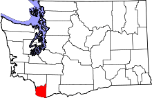 | |
| Town | ||
| CDPs | ||
| Other unincorporated communities | ||
| Footnotes | ‡This populated place also has portions in an adjacent county or counties | |