Clark County, Washington
| Clark County, Washington | |
|---|---|
.jpg) Clark County Courthouse | |
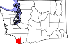 Location in the U.S. state of Washington | |
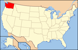 Washington's location in the U.S. | |
| Founded | August 20, 1845 |
| Named for | William Clark |
| Seat | Vancouver |
| Largest city | Vancouver |
| Area | |
| • Total | 656 sq mi (1,699 km2) |
| • Land | 629 sq mi (1,629 km2) |
| • Water | 27 sq mi (70 km2), 4.1% |
| Population (est.) | |
| • (2015) | 459,495 |
| • Density | 717/sq mi (277/km²) |
| Congressional district | 3rd |
| Time zone | Pacific: UTC-8/-7 |
| Website |
www |
Clark County is a county in the southwestern part of the U.S. state of Washington. As of the 2010 census, the population was 425,363,[1] making it Washington's fifth-most populous county. Its county seat and largest city is Vancouver.[2] It was the first county in Washington, named after William Clark of the Lewis and Clark Expedition. It was created by the provisional government of Oregon Territory on August 20, 1845, and at that time covered the entire present-day state.[3]
Clark County is part of the Portland-Vancouver-Hillsboro, OR-WA Metropolitan Statistical Area. It is across the Columbia River from Portland.
History
Clark County began as the District of Vancouver on July 27, 1844. It included all the land north of the Columbia River, west of the Rocky Mountains, and south of Alaska. In 1845 the provisional government changed its name to Vancouver County. At that time it stretched from the Columbia River to 54 degrees 40 minutes North Latitude in British Columbia. On June 15, 1846 the United States Senate approved the present boundary between the U.S. and Canada at the 49th Parallel.
On August 13, 1848, President James K. Polk signed an act creating the entire region as the Oregon Territory. On September 3, 1849, the Oregon Territorial Legislature modified the borders again and changed its name to Clarke County in honor of explorer William Clark. At this time it included all of present-day Washington and continued to be divided and subdivided until reaching its present area in 1880. It was not until 1925 that the spelling was corrected to its present form.[4]
In September 1902 the Yacolt Burn, the largest fire in state history, began in neighboring Skamania County and swept west along a 12-mile front to Yacolt, nearly engulfing the town. Salvaging the remaining timber was a lucrative industry for a time.
On November 24, 1971 a man who went by D.B. Cooper highjacked Northwest Orient Airlines flight 305. He ordered the plane to land in Seattle. He ordered 200,000 dollars in ransom money, and a parachute. His demands were met. He than allowed everyone off the plane, except one flight attendant, the captain, the first officer, and the flight engineer. Cooper ordered the plane to a certain area of the tarmac. A fuel truck then came to refuel the 727. There were complications, as some of the fuel had high amounts of water. The problem was quickly fixed, and the 727 was refueled. The 727 then made its way back to a runway. Cooper said he wanted the 727 to take off with its aft (rear) stairs open. The captain convinced Cooper it was to unsafe. Once in the air Cooper told the Captin to fly to Mexico. However Cooper made the captain fly just above stall speed, and ordered the landing gear remain down. The caption told him with this configuration the 727 would need to refuel. Cooper and the crew agreed to refuel in Reno, Nevada at Reno International Airport. However Cooper quickly left the cockpit with money and a parachute. A light in the cockpit alerted the crew that the aft (rear) stairs was open. Cooper than supposedly jumped at an altitude of around 10,000 feet. Flight 305 landed safely and without any further incident. Upon landing the 727 was surrounded by state and local police, and the FBI. Law enforcement checked the plane and confirmed Cooper was gone. Cooper is believed to have jumped over somewhere in Clark County, Washington or Cowlitz County, Washington. A massive and thorough manhunt was launched, but Cooper has never been found.
Years after the incident a 727 aft stairs guide was found in a creek near Lake Merwin. Money was also found that has been confirmed as part of the ransom money. The money was the ransom money because the money had the correct serial number on them. As of August 16, 2016 the man claiming to be D.B. Cooper has never been founded, although the FBI has received a number of tips. The FBI announced in July 2016 that they were essentially closing the case, citing more important cases to be looked at. However the FBI said the case file remains open, making it the only unsolved highjacking in the United States.
Geography and climate
According to the U.S. Census Bureau, the county has a total area of 656 square miles (1,700 km2), of which 629 square miles (1,630 km2) is land and 27 square miles (70 km2) (4.1%) is water.[5] It is the fifth-smallest county in Washington by land area.
Clark County is surrounded on two sides by the Columbia River and on the north by the North Fork of the Lewis River. The East Fork of the Lewis River and the Washougal River cut across the county. The largest stream arising solely within the county is Salmon Creek, which terminates at Vancouver Lake before eventually flowing into the Columbia River.
Like most of Oregon and Washington south of Puget Sound into the Willamette Valley the landscape and climate of Clark County are determined by its placement between the volcanic Pacific Coast and Cascade Ranges, where glaciation helped form a U-shaped valley which meets the river valley of the Columbia River as it leaves the Columbia River Gorge. Volcanic andisol soils are common, with fertile mollisols in the lower areas. The central and southwest areas of the county are generally flat floodplains, sculpted by torrents of prehistoric Lake Missoula. A series of dramatic floods known as the Missoula Floods took place 15,000 - 13,000 years ago, as several ice dams melted, forming a series of low steps such as the "Heights", "Mill Plain", "Fourth Plain" and "Fifth Plain". Clark County's Köppen climate classification is "Csb."
Many lakes border the river in the lowlands near Ridgefield, including Vancouver Lake. Eastern and northern Clark County contain forested foothills of the Cascade Mountains, rising to an elevation of 4,000 feet (1,200 m) on the border with Skamania County. Larch Mountain is the county's highest free-standing peak.
Flora and fauna of the region include the normal ecological succession from lowland big leaf maple and western red cedar through Garry oak on up through fire-dependent species such as lodgepole pine and Douglas fir, as well as grand fir, silver fir and other species common to Gifford Pinchot National Forest. In addition to a wide variety of birds including great blue heron, raptors such as barred owl, osprey, red-tailed hawk and bald eagle, corvids (raven, crow, California scrub and Steller's jay) and others, the native streams are home to various species of salmon and the Vancouver Trout Hatchery. Larger mammals include black-tailed deer, coyote, raccoon, skunk and invasive opossum; with sightings of lynx, bobcat, black bear, cougar and elk not uncommon, especially in the northern parts of the county. Common foods used by the indigenous people such as the Klickitat tribe and Chinook included salmon, huckleberry and Camassia quamash (after which the city of Camas, Washington is named).
Mount Hood, Mount Saint Helens and Mount Adams are all visible from Clark County, and cold winter winds through the Columbia River Gorge often bring freezing rain and a coating of glaze ice or clear ice known locally as a "silver thaw," especially in southeastern areas of the county closest to the gorge. The counterpart to this are warm winds from the southwest known locally as the "Pineapple Express".
Spring thaws can often swell county waterways, with two of the more destructive floods being those of the Columbia River in June 1894 and May, 1948. The 1948 Memorial Day flood almost topped the Interstate Bridge's support piers and completely destroyed nearby Vanport, Oregon. Construction of The Dalles Dam and destruction of Celilo Falls are credited with a decrease in such floods.
Significant windstorms in Clark County include the Columbus Day windstorm of October 12, 1962, and an April 6, 1972 tornado which rated F3 on the Fujita scale, striking a local school. A "Friday the 13th" storm in November 1981 brought winds up to 70 miles per hour (110 km/h), with other storms including the inauguration day storm of January 20, 1993, the Guadalupe Day storm of December 12, 1995 (with winds up to 95 miles per hour (153 km/h) at Washougal, Washington) and small tornado on January 10, 2008, which destroyed a boathouse at Vancouver Lake and caused damage to buildings in Hazel Dell before dissolving near Hockinson.[6]
Geographic features
|
|
Major highways
 Interstate 5
 Interstate 205
 State Route 14
 State Route 500
 State Route 501
 State Route 502
 State Route 503
Former major highway
Adjacent counties
- Cowlitz County - north
- Skamania County - east
- Multnomah County, Oregon - south
- Columbia County, Oregon - southwest
National protected areas
- Fort Vancouver National Historic Site (part)
- Gifford Pinchot National Forest (part)
- Ridgefield National Wildlife Refuge
- Steigerwald Lake National Wildlife Refuge
Demographics
| Historical population | |||
|---|---|---|---|
| Census | Pop. | %± | |
| 1850 | 643 | — | |
| 1860 | 2,384 | 270.8% | |
| 1870 | 3,081 | 29.2% | |
| 1880 | 5,490 | 78.2% | |
| 1890 | 11,709 | 113.3% | |
| 1900 | 13,419 | 14.6% | |
| 1910 | 26,115 | 94.6% | |
| 1920 | 32,805 | 25.6% | |
| 1930 | 40,316 | 22.9% | |
| 1940 | 49,852 | 23.7% | |
| 1950 | 85,307 | 71.1% | |
| 1960 | 93,809 | 10.0% | |
| 1970 | 128,454 | 36.9% | |
| 1980 | 192,227 | 49.6% | |
| 1990 | 238,053 | 23.8% | |
| 2000 | 345,238 | 45.0% | |
| 2010 | 425,363 | 23.2% | |
| Est. 2015 | 459,495 | [7] | 8.0% |
| U.S. Decennial Census[8] 1790–1960[9] 1900–1990[10] 1990–2000[11] 2010–2015[1] | |||
2000 census
As of the census[12] of 2000, there were 345,238 people, 127,208 households, and 90,953 families residing in the county. The population density was 550 people per square mile (212/km²). There were 134,030 housing units at an average density of 213 per square mile (82/km²). The racial makeup of the county was 88.82% White, 1.68% Black or African American, 0.84% Native American, 3.21% Asian, 0.37% Pacific Islander, 1.99% from other races, and 3.08% from two or more races. 4.71% of the population were Hispanic or Latino of any race. 17.7% were of German, 10.2% English, 8.6% Irish, 8.6% United States and 5.1% Norwegian ancestry according to the 2000 census. 88.8% spoke only English at home; 3.6% spoke Spanish and 1.9% Russian.
There were 127,208 households out of which 37.20% had children under the age of 18 living with them, 56.80% were married couples living together, 10.30% had a female householder with no husband present, and 28.50% were non-families. 21.80% of all households were made up of individuals and 6.80% had someone living alone who was 65 years of age or older. The average household size was 2.69 and the average family size was 3.15.
In the county, the population was spread out with 28.70% under the age of 18, 8.40% from 18 to 24, 30.80% from 25 to 44, 22.60% from 45 to 64, and 9.50% who were 65 years of age or older. The median age was 34 years. For every 100 females there were 98.50 males. For every 100 females age 18 and over, there were 95.90 males.
The median income for a household in the county was $48,376, and the median income for a family was $54,016. Males had a median income of $41,337 versus $28,537 for females. The per capita income for the county was $21,448. About 6.90% of families and 9.10% of the population were below the poverty line, including 11.70% of those under age 18 and 6.80% of those age 65 or over.
2010 census
As of the 2010 United States Census, there were 425,363 people, 158,099 households, and 110,672 families residing in the county.[13] The population density was 676.2 inhabitants per square mile (261.1/km2). There were 167,413 housing units at an average density of 266.2 per square mile (102.8/km2).[14] The racial makeup of the county was 85.4% white, 4.1% Asian, 2.0% black or African American, 0.9% American Indian, 0.6% Pacific islander, 2.9% from other races, and 4.0% from two or more races. Those of Hispanic or Latino origin made up 7.6% of the population.[13] In terms of ancestry, 24.4% were German, 13.1% were Irish, 13.1% were English, 5.7% were Norwegian, and 4.3% were American.[15]
Of the 158,099 households, 36.3% had children under the age of 18 living with them, 53.6% were married couples living together, 11.3% had a female householder with no husband present, 30.0% were non-families, and 23.1% of all households were made up of individuals. The average household size was 2.67 and the average family size was 3.15. The median age was 36.7 years.[13]
The median income for a household in the county was $58,262 and the median income for a family was $67,352. Males had a median income of $52,160 versus $38,167 for females. The per capita income for the county was $27,828. About 7.8% of families and 10.9% of the population were below the poverty line, including 14.9% of those under age 18 and 7.2% of those age 65 or over.[16]
Law enforcement
The Clark County Sheriff's Office is the local, county-level law enforcement agency serving Clark County, Washington. The sheriff's office was established in 1849 and is the oldest law enforcement organization in the state of Washington. Sheriff Chuck Atkins and Undersheriff Mike Cooke lead the Clark County Sheriff's Office.[17]

Politics
Clark County is a swing county in U.S. presidential elections that recently has voted slightly more Republican than the state and nation as a whole. For example, while President Obama carried Clark County by a few hundred votes representing a fraction of a percent, he ran behind his national showing of a 3% margin. George W. Bush carried the county twice, by 52% to 47% over John Kerry in 2004 and by 49% to 46% over Al Gore in 2000. Clark County usually votes for the winning presidential candidate. It voted for Ronald Reagan twice and for Bill Clinton twice. The last three presidential elections where Clark County did not vote for the national winner were 1968, when it voted for Humphrey over Nixon, and 1988, when it voted for Dukakis over Bush, aswell as in 2016 when the county narrowly voted for Democratic nominee Hillary Clinton over Republican nominee and winner of the election Donald Trump.
The current elected officials are;
Assessor - Peter Van Nortwick (R)
Auditor - Greg Kimsey (R)
Clerk - Scott Weber (R)
Councilors -County Chair(At Large) Marc Boldt (NP)
-District 1 Jeanne Stewart(R)
-District 2 Julie Olson(R)
-District 3 David Madore(R)
-District 4 Tom Mielke(R)
Prosecuting Attorney - Tony Golik (D)
Sheriff - Chuck E. Atkins (R)
Treasurer - Doug Lasher (D).
Clark County Youth Commission
The Clark County Youth Commission (CCYC) is a citizen advisory board to the Clark County Board of Commissioners (BOCC) in Clark County, Washington. The Youth Commission consists of approximately thirty 11- to 19-year-old youth from around the county, each school district in the county having two representatives. Since its establishment in 1998, the CCYC has given input to the BOCC and other county departments and organizations on various issues important to youth. In the past, the group worked on a fireworks policy and an economic development plan for the county.
In addition to helping shape county policy, the Youth Commission takes on a youth-driven project each year to promote or combat an issue. Past youth-driven projects include a Civil Rights Open House at the Youth House, a benefit concert for Invisible Children, and Freedom's Answer. Each year, the Youth Commission also hosts a Clark County Youth Achievement Celebration at Skyview High School to honor youth around the county.[18]
Communities
Cities
- Battle Ground
- Camas
- La Center
- Ridgefield
- Vancouver (county seat)
- Washougal
- Woodland (partly in Cowlitz County)
Towns
Census-designated places
Unincorporated communities
- Chelatchie
- Heisson
- Mill Plain
See also
- National Register of Historic Places listings in Clark County, Washington
- The Vancouver Voice
- Washington State University Vancouver
References
- 1 2 "State & County QuickFacts". United States Census Bureau. Retrieved January 7, 2014.
- ↑ "Find a County". National Association of Counties. Archived from the original on 2011-05-31. Retrieved 2011-06-07.
- ↑ "Milestones for Washington State History — Part 1: Prehistory to 1850". HistoryLink.org. March 5, 2003.
- 1 2 Hanable, William S. (February 4, 2004). "Clark County — Thumbnail History".
- ↑ "2010 Census Gazetteer Files". United States Census Bureau. August 22, 2012. Retrieved July 4, 2015.
- ↑ "Region has long history of damaging windstorms," by Don Hamilton, The Columbian, January 11, 2008, p. A5.
- ↑ "County Totals Dataset: Population, Population Change and Estimated Components of Population Change: April 1, 2010 to July 1, 2015". Retrieved July 2, 2016.
- ↑ "U.S. Decennial Census". United States Census Bureau. Archived from the original on May 11, 2015. Retrieved January 7, 2014.
- ↑ "Historical Census Browser". University of Virginia Library. Retrieved January 7, 2014.
- ↑ "Population of Counties by Decennial Census: 1900 to 1990". United States Census Bureau. Retrieved January 7, 2014.
- ↑ "Census 2000 PHC-T-4. Ranking Tables for Counties: 1990 and 2000" (PDF). United States Census Bureau. Retrieved January 7, 2014.
- ↑ "American FactFinder". United States Census Bureau. Archived from the original on 2013-09-11. Retrieved 2011-05-14.
- 1 2 3 "DP-1 Profile of General Population and Housing Characteristics: 2010 Demographic Profile Data". United States Census Bureau. Retrieved 2016-03-01.
- ↑ "Population, Housing Units, Area, and Density: 2010 - County". United States Census Bureau. Retrieved 2016-03-01.
- ↑ "DP02 SELECTED SOCIAL CHARACTERISTICS IN THE UNITED STATES – 2006-2010 American Community Survey 5-Year Estimates". United States Census Bureau. Retrieved 2016-03-01.
- ↑ "DP03 SELECTED ECONOMIC CHARACTERISTICS – 2006-2010 American Community Survey 5-Year Estimates". United States Census Bureau. Retrieved 2016-03-01.
- ↑ "Sheriff - Clark County Washington." Clark County Washington - government services. Clark County, Washington, n.d. Web. 10 July 2010. <http://www.co.clark.wa.us/sheriff/index.html>.
- ↑ Youth Commission - Youth Program - Community Services - Clark County Washington
Further reading
- Alley, B.F. (1885). History of Clarke County, Washington Territory : compiled from the most authentic sources : also biographical sketches of its pioneers and prominent citizens. Washington Pub. Available online through the Washington State Library's Classics in Washington History collection
External links
- Official county website
- Clark County place name histories.
- Clark County Historic Photographs
- Guide to Clark County Washington
 |
Cowlitz County | | ||
| |
Skamania County | |||
| ||||
| | ||||
| Columbia County, Oregon | Multnomah County, Oregon |
Municipalities and communities of Clark County, Washington, United States | ||
|---|---|---|
| Cities | | |
| Town | ||
| CDPs | ||
| Other unincorporated communities | ||
| Footnotes | ‡This populated place also has portions in an adjacent county or counties | |
Coordinates: 45°46′N 122°29′W / 45.77°N 122.48°W