Browns Valley, California
Coordinates: 39°14′32″N 121°24′33″W / 39.24222°N 121.40917°W
| Browns Valley | |
|---|---|
| Unincorporated community | |
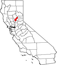
 Browns Valley  Browns Valley Location in California | |
| Coordinates: 39°14′32″N 121°24′33″W / 39.24222°N 121.40917°W | |
| Country | United States |
| State | California |
| County | Yuba County |
| Elevation[1] | 269 ft (82 m) |
| ZIP code | 95918 |
| Area code(s) | 530 |
Browns Valley (also, Brown's Valley) is an unincorporated community in Yuba County, California. It lies at an elevation of 269 feet (82 m). Browns Valley is located 12 miles (19 km) northeast of Marysville and is home to Collins Lake.[2] The name was in honor of a settler who arrived in 1850 and discovered gold here.[2]
A post office was established at Browns Valley in 1864.[2]
References
This article is issued from Wikipedia - version of the 7/5/2016. The text is available under the Creative Commons Attribution/Share Alike but additional terms may apply for the media files.