Apache Creek, New Mexico
| Apache Creek, New Mexico | |
|---|---|
| Census-designated place | |
 Apache Creek Location within the state of New Mexico | |
| Coordinates: 33°49′59″N 108°37′30″W / 33.83306°N 108.62500°WCoordinates: 33°49′59″N 108°37′30″W / 33.83306°N 108.62500°W[1] | |
| Country | United States |
| State | New Mexico |
| County | Catron |
| Area | |
| • Total | 8.22 sq mi (21.28 km2) |
| • Land | 8.20 sq mi (21.24 km2) |
| • Water | 0.02 sq mi (0.04 km2) |
| Population (2010) | |
| • Total | 67 |
| • Density | 8/sq mi (3.2/km2) |
| Time zone | Mountain (MST) (UTC-5) |
| • Summer (DST) | MDT (UTC) |
| Area code(s) | 575 |
Apache Creek is a census-designated place in Catron County, New Mexico, United States. As of the 2010 census it had a population of 67.[2] Located 3 miles (5 km) northeast of Cruzville, it is situated at the confluence of Apache Creek and the Tularosa River. The Apache Creek Pueblo, also called the "Apache Creek Ruin", is near the town. It was listed by the New Mexico Historic Preservation Commission in 1969.[3]
History
Apache leaders Mangas Coloradas, Victorio, Geronimo, Chato and Cochise carried on guerrilla warfare against United States settlers in this area. Cochise's infamous Alma Massacre was carried out from this area, as well. Originally the Apache were friendly to the explorers and colonists, but when their land and water was taken over by the pioneers they fought back. The warfare came to an end after the surrender of Geronimo in 1886.[4][5]
From 1928 to 1958 Apache Creek had its own post office, and since then mail has gone to Aragon.
Present
Apache Creek has a cemetery that dates from 1900 through the 1960s.[6]
Apache Creek Pueblo
The Apache Creek Pueblo is located north of the town of Apache Creek. It was listed by the New Mexico Historic Preservation Commission in 1969 as the "Apache Creek Ruin".[3] The site has been identified as an Upland Mogollon pueblo with pit-houses occupied between 1150-1300 A.D.[7] The pueblo had between 25 and 50 rooms with masonry construction throughout.[8]
References
- ↑ U.S. Geological Survey Geographic Names Information System: Apache Creek, New Mexico
- ↑ "Geographic Identifiers: 2010 Demographic Profile Data (G001): Apache Creek CDP, New Mexico". U.S. Census Bureau, American Factfinder. Retrieved October 16, 2014.
- 1 2 (2007) Properties By County. New Mexico Historic Preservation Commission. Retrieved 6/14/07.
- ↑ Banks, P.H. (nd) Cruzville, Apache Creek, Aragon and Old Horse Springs — NM Hwy12 from Reserve to Datil Archived June 8, 2007, at the Wayback Machine.. SouthernNewMexico.com. Retrieved 6/13/07.
- ↑ Apache Creek. New Mexico Entertainment. Retrieved 6/13/07.
- ↑ Martineau, N. (1999) Apache Creek. USGenWeb. Retrieved 6/13/07.
- ↑ Federal Register: July 22, 1998 (Volume 63, Number 140). National Park Service. Retrieved 6/14/07.
- ↑ Hegmon, M., Nelson, M. and Ruth, S. (1998). "Abandonment and Reorganization in the Mimbres Region of the American Southwest." American Anthropologist. 100(1) March. pp. 152.
Municipalities and communities of Catron County, New Mexico, United States | ||
|---|---|---|
| Village | 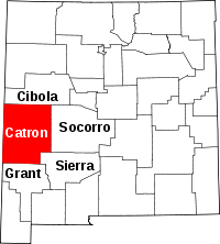 | |
| CDPs | ||
| Other unincorporated communities | ||
| Ghost towns |
| |