Annandale, New Jersey
| Annandale, New Jersey | |
|---|---|
| Census-designated place | |
|
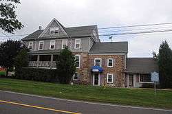
Jones Tavern | |
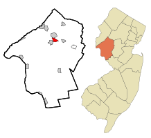 Map of Annandale CDP in Hunterdon County. Inset: Location of Hunterdon County in New Jersey. | |
| Coordinates: 40°38′49″N 74°53′17″W / 40.646838°N 74.888177°WCoordinates: 40°38′49″N 74°53′17″W / 40.646838°N 74.888177°W | |
| Country |
|
| State |
|
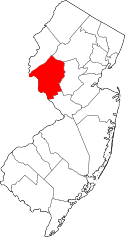
| County | Hunterdon |
| Township | Clinton |
| Area[1] | |
| • Total | 1.452 sq mi (3.760 km2) |
| • Land | 1.452 sq mi (3.760 km2) |
| • Water | 0.000 sq mi (0.000 km2) 0.00% |
| Elevation[2] | 423 ft (129 m) |
| Population (2010 Census)[3] | |
| • Total | 1,695 |
| • Density | 1,167.6/sq mi (450.8/km2) |
| Time zone | Eastern (EST) (UTC-5) |
| • Summer (DST) | Eastern (EDT) (UTC-4) |
| ZIP code | 08801[4][5] |
| Area code(s) | 908 |
| FIPS code | 3401480[1][6] |
| GNIS feature ID | 02389137[1][7] |
Annandale is an unincorporated community and census-designated place (CDP) located within Clinton Township, in Hunterdon County, New Jersey, United States.[8] As of the 2010 United States Census, the CDP's population was 1,695.[3]
Geography
According to the United States Census Bureau, Annandale had a total area of 1.452 square miles (3.760 km2), all of which was land.[1][9]
Demographics
| Historical population | |||
|---|---|---|---|
| Census | Pop. | %± | |
| 1990 | 1,074 | — | |
| 2000 | 1,276 | 18.8% | |
| 2010 | 1,695 | 32.8% | |
| Population sources: 2000[10] 2010[3] | |||
Census 2010
At the 2010 United States Census, there were 1,695 people, 658 households, and 454.7 families residing in the CDP. The population density was 1,167.6 per square mile (450.8/km2). There were 692 housing units at an average density of 476.7 per square mile (184.1/km2). The racial makeup of the CDP was 86.61% (1,468) White, 2.48% (42) Black or African American, 0.35% (6) Native American, 7.32% (124) Asian, 0.00% (0) Pacific Islander, 0.77% (13) from other races, and 2.48% (42) from two or more races. Hispanics or Latinos of any race were 4.66% (79) of the population.[3]
There were 658 households, of which 38.8% had children under the age of 18 living with them, 56.4% were married couples living together, 9.6% had a female householder with no husband present, and 30.9% were non-families. 25.2% of all households were made up of individuals, and 7.8% had someone living alone who was 65 years of age or older. The average household size was 2.58 and the average family size was 3.15.[3]
In the CDP, 27.7% of the population were under the age of 18, 5.7% from 18 to 24, 27.3% from 25 to 44, 31.3% from 45 to 64, and 8.1% who were 65 years of age or older. The median age was 39.1 years. For every 100 females there were 92.2 males. For every 100 females age 18 and over, there were 94.3 males.[3]
Census 2000
As of the 2000 United States Census[6] there were 1,276 people, 451 households, and 354 families residing in the CDP. The population density was 339.8/km2 (880.0/mi2). There were 472 housing units at an average density of 125.7/km2 (325.5/mi2). The racial makeup of the CDP was 96.47% White, 0.63% African American, 2.19% Asian, 0.63% from other races, and 0.08% from two or more races. Hispanic or Latino of any race were 1.72% of the population.[10]
There were 451 households out of which 43.2% had children under the age of 18 living with them, 68.7% were married couples living together, 6.7% had a female householder with no husband present, and 21.5% were non-families. 16.4% of all households were made up of individuals and 7.5% had someone living alone who was 65 years of age or older. The average household size was 2.83 and the average family size was 3.23.[10]
In the CDP the population was spread out with 29.0% under the age of 18, 4.7% from 18 to 24, 32.1% from 25 to 44, 25.7% from 45 to 64, and 8.5% who were 65 years of age or older. The median age was 38 years. For every 100 females there were 96.9 males. For every 100 females age 18 and over, there were 97.4 males.[10]
The median income for a household in the CDP was $80,738, and the median income for a family was $104,009. Males had a median income of $65,814 versus $37,171 for females. The per capita income for the CDP was $30,176. None of the families and 1.0% of the population were living below the poverty line, including no under eighteens and 8.0% of those over 64.[10]
Education
Immaculate Conception School (PreK-8) operates under the supervision of Roman Catholic Diocese of Metuchen.[11]
References
- 1 2 3 4 Gazetteer of New Jersey Places, United States Census Bureau. Accessed July 21, 2016.
- ↑ U.S. Geological Survey Geographic Names Information System: Annandale Census Designated Place, Geographic Names Information System. Accessed November 11, 2012.
- 1 2 3 4 5 6 DP-1 - Profile of General Population and Housing Characteristics: 2010 Demographic Profile Data for Annandale CDP, New Jersey, United States Census Bureau. Accessed November 15, 2012.
- ↑ Look Up a ZIP Code for Annandale, NJ, United States Postal Service. Accessed November 15, 2012.
- ↑ Zip Codes, State of New Jersey. Accessed August 26, 2013.
- 1 2 American FactFinder, United States Census Bureau. Accessed September 4, 2014.
- ↑ US Board on Geographic Names, United States Geological Survey. Accessed September 4, 2014.
- ↑ New Jersey: 2010 - Population and Housing Unit Counts - 2010 Census of Population and Housing (CPH-2-32), United States Census Bureau, August 2012. Accessed November 15, 2012.
- ↑ US Gazetteer files: 2010, 2000, and 1990, United States Census Bureau. Accessed September 4, 2014.
- 1 2 3 4 5 DP-1 - Profile of General Demographic Characteristics: 2000 from the Census 2000 Summary File 1 (SF 1) 100-Percent Data for Annandale CDP, New Jersey, United States Census Bureau. Accessed November 15, 2012.
- ↑ Find a school, Roman Catholic Diocese of Metuchen. Accessed September 11, 2012.