Bloomsbury, New Jersey
| Bloomsbury, New Jersey | |
|---|---|
| Borough | |
| Borough of Bloomsbury | |
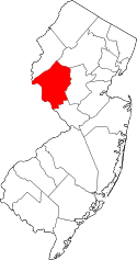
 Map of Bloomsbury in Hunterdon County. Inset: Location of Hunterdon County highlighted in the State of New Jersey. | |
 Census Bureau map of Bloomsbury, New Jersey | |
| Coordinates: 40°39′18″N 75°04′49″W / 40.655107°N 75.080197°WCoordinates: 40°39′18″N 75°04′49″W / 40.655107°N 75.080197°W[1][2] | |
| Country |
|
| State |
|
| County | Hunterdon |
| Incorporated | March 30, 1905 |
| Government[3] | |
| • Type | Borough |
| • Body | Borough Council |
| • Mayor | Martha Tersigni (R, term ends December 31, 2019)[4] |
| • Administrator / Clerk | Lisa A. Burd Reindel[5] |
| Area[1] | |
| • Total | 0.910 sq mi (2.358 km2) |
| • Land | 0.877 sq mi (2.272 km2) |
| • Water | 0.033 sq mi (0.086 km2) 3.64% |
| Area rank |
513th of 566 in state 24th of 26 in county[1] |
| Elevation[6] | 335 ft (102 m) |
| Population (2010 Census)[7][8][9] | |
| • Total | 870 |
| • Estimate (2015)[10] | 848 |
| • Rank |
539th of 566 in state 25th of 26 in county[11] |
| • Density | 991.9/sq mi (383.0/km2) |
| • Density rank |
383rd of 566 in state 11th of 26 in county[11] |
| Time zone | Eastern (EST) (UTC-5) |
| • Summer (DST) | Eastern (EDT) (UTC-4) |
| ZIP code | 08804[12][13] |
| Area code(s) | 908 exchange: 479[14] |
| FIPS code | 3401906370[1][15][16] |
| GNIS feature ID | 0885162[1][17] |
| Website | Borough website |
Bloomsbury is a borough in Hunterdon County, New Jersey, United States. As of the 2010 United States Census, the borough's population was 870,[7][8][9] reflecting a decline of 16 (-1.8%) from the 886 counted in the 2000 Census, which had in turn declined by 4 (-0.4%) from the 890 counted in the 1990 Census.[18]
Bloomsbury was incorporated as a borough by an act of the New Jersey Legislature on March 30, 1905, from portions of Bethlehem Township.[19]
The Borough of Bloomsbury was once known as "Johnson's Iron Works", owned by Robert Johnson, on the north bank of the river. The current name is derived either from the Bloom family, influential in the early history of the town, or from the iron ore processed into "blooms," masses of wrought iron.[20]
Geography
According to the United States Census Bureau, the borough had a total area of 0.910 square miles (2.358 km2), including 0.877 square miles (2.272 km2) of land and 0.033 square miles (0.086 km2) of water (3.64%).[1][2]
The borough borders Bethlehem Township in Hunterdon County, as well as the townships of Franklin, Greenwich and Pohatcong all within Warren County. Bloomsbury is located on the south side of the Musconetcong River in the northwest corner of Hunterdon County and is the third-smallest municipality in Hunterdon County.[20]
Demographics
| Historical population | |||
|---|---|---|---|
| Census | Pop. | %± | |
| 1910 | 600 | — | |
| 1920 | 650 | 8.3% | |
| 1930 | 639 | −1.7% | |
| 1940 | 704 | 10.2% | |
| 1950 | 722 | 2.6% | |
| 1960 | 838 | 16.1% | |
| 1970 | 879 | 4.9% | |
| 1980 | 864 | −1.7% | |
| 1990 | 890 | 3.0% | |
| 2000 | 886 | −0.4% | |
| 2010 | 870 | −1.8% | |
| Est. 2015 | 848 | [10][21] | −2.5% |
| Population sources: 1910-1920[22] 1910[23] 1910-1930[24] 1930-1990[25] 2000[26][27] 2010[7][8][9] | |||
Census 2010
At the 2010 United States Census, there were 870 people, 337 households, and 236.9 families residing in the borough. The population density was 991.9 per square mile (383.0/km2). There were 358 housing units at an average density of 408.1 per square mile (157.6/km2). The racial makeup of the borough was 95.40% (830) White, 1.03% (9) Black or African American, 0.00% (0) Native American, 1.84% (16) Asian, 0.00% (0) Pacific Islander, 0.34% (3) from other races, and 1.38% (12) from two or more races. Hispanics or Latinos of any race were 4.02% (35) of the population.[7]
There were 337 households, of which 38.6% had children under the age of 18 living with them, 57.3% were married couples living together, 8.3% had a female householder with no husband present, and 29.7% were non-families. 24.0% of all households were made up of individuals, and 6.8% had someone living alone who was 65 years of age or older. The average household size was 2.58 and the average family size was 3.09.[7]
In the borough, 27.0% of the population were under the age of 18, 5.3% from 18 to 24, 26.9% from 25 to 44, 31.6% from 45 to 64, and 9.2% who were 65 years of age or older. The median age was 40.1 years. For every 100 females there were 105.2 males. For every 100 females age 18 and over, there were 101.6 males.[7]
The Census Bureau's 2006-2010 American Community Survey showed that (in 2010 inflation-adjusted dollars) median household income was $98,571 (with a margin of error of +/- $19,026) and the median family income was $106,324 (+/- $11,687). Males had a median income of $71,000 (+/- $9,149) versus $50,417 (+/- $7,595) for females. The per capita income for the borough was $42,141 (+/- $6,038). About 2.6% of families and 4.1% of the population were below the poverty line, including 6.3% of those under age 18 and 7.3% of those age 65 or over.[28]
Census 2000
As of the 2000 United States Census[15] there were 886 people, 322 households, and 252 families residing in the borough. The population density was 975.5 people per square mile (375.9/km2). There were 342 housing units at an average density of 376.6 per square mile (145.1/km2). The racial makeup of the borough was 98.19% White, 0.34% African American, 0.23% Native American, 0.34% Asian, 0.11% from other races, and 0.79% from two or more races. Hispanic or Latino of any race were 1.47% of the population.[26][27]
There were 322 households out of which 45.7% had children under the age of 18 living with them, 66.1% were married couples living together, 9.0% had a female householder with no husband present, and 21.7% were non-families. 15.8% of all households were made up of individuals and 5.3% had someone living alone who was 65 years of age or older. The average household size was 2.74 and the average family size was 3.11.[26][27]
In the borough the population was spread out with 29.8% under the age of 18, 3.8% from 18 to 24, 38.4% from 25 to 44, 17.9% from 45 to 64, and 10.0% who were 65 years of age or older. The median age was 36 years. For every 100 females there were 93.0 males. For every 100 females age 18 and over, there were 93.8 males.[26][27]
The median income for a household in the borough was $64,375, and the median income for a family was $67,500. Males had a median income of $51,053 versus $33,750 for females. The per capita income for the borough was $26,392. About 4.8% of families and 3.8% of the population were below the poverty line, including 3.1% of those under age 18 and 8.9% of those age 65 or over.[26][27]
Government
Local government
Bloomsbury is governed under the Borough form of New Jersey municipal government. The governing body consists of a Mayor and a Borough Council comprising six council members, with all positions elected at-large on a partisan basis as part of the November general election. A Mayor is elected directly by the voters to a four-year term of office. The Borough Council consists of six members elected to serve three-year terms on a staggered basis, with two seats coming up for election each year in a three-year cycle.[3] The Borough form of government used by Bloomsbury, the most common system used in the state, is a "weak mayor / strong council" government in which council members act as the legislative body with the mayor presiding at meetings and voting only in the event of a tie. The mayor can veto ordinances subject to an override by a two-thirds majority vote of the council. The mayor makes committee and liaison assignments for council members, and most appointments are made by the mayor with the advice and consent of the council.[29][30]
As of 2016, the Mayor of Bloomsbury is Republican Martha Tersigni, whose term of office ends December 31, 2019. Members of the Borough Council are Deputy Mayor Al Stiehler (2017), Chris James (R, 2016), Kathleen Jordan (R, 2018), Vicky Papics (R, 2016), Chris Smith (R, 2018) and Eric Weger (R, 2017).[20][31][32][33][34][35][36]
Federal, state and county representation
Bloomsbury is located in the 7th Congressional District[37] and is part of New Jersey's 23rd state legislative district.[8][38][39]
New Jersey's Seventh Congressional District is represented by Leonard Lance (R, Clinton Township).[40] New Jersey is represented in the United States Senate by Cory Booker (D, Newark, term ends 2021)[41] and Bob Menendez (D, Paramus, 2019).[42][43]
For the 2016–2017 session (Senate, General Assembly), the 23rd Legislative District of the New Jersey Legislature is represented in the State Senate by Michael J. Doherty (R, Washington Township, Warren County) and in the General Assembly by John DiMaio (R, Hackettstown) and Erik Peterson (R, Franklin Township, Hunterdon County).[44] The Governor of New Jersey is Chris Christie (R, Mendham Township).[45] The Lieutenant Governor of New Jersey is Kim Guadagno (R, Monmouth Beach).[46]
Hunterdon County is governed by a five-member Board of Chosen Freeholders, who serve three-year terms of office at-large on a staggered basis, with either one or two seats up for election each year on a partisan basis as part of the November general election. At an annual reorganization meeting held each January, the freeholders select one member to serve as the board's Director and another to serve as Deputy Director.[47] As of 2015, Hunterdon County's Freeholders are Freeholder Director John King (R; Raritan Township, 2015),[48] Freeholder Deputy Director Suzanne Lagay (R; Holland Township, 2016),[49] J. Matthew Holt (R; Clinton Town, 2015),[50] John E. Lanza (R; Flemington, 2016)[51] and Robert G. Walton (R; Hampton, 2017).[52][53] Constitutional officers elected on a countywide basis are County Clerk Mary H. Melfi (R; Flemington, 2017),[54] Sheriff Fredrick W. Brown (R; Alexandria Township, 2016)[55] and Surrogate Susan J. Hoffman (R; Kingwood Township, 2018).[56][57][58]
Politics
As of March 23, 2011, there were a total of 546 registered voters in Bloomsbury, of which 120 (22.0%) were registered as Democrats, 227 (41.6%) were registered as Republicans and 199 (36.4%) were registered as Unaffiliated. There were no voters registered to other parties.[59]
In the 2012 presidential election, Republican Mitt Romney received 55.3% of the vote (223 cast), ahead of Democrat Barack Obama with 42.7% (172 votes), and other candidates with 2.0% (8 votes), among the 404 ballots cast by the borough's 561 registered voters (1 ballot was spoiled), for a turnout of 72.0%.[60][61] In the 2008 presidential election, Republican John McCain received 55.0% of the vote (254 cast), ahead of Democrat Barack Obama with 42.6% (197 votes) and other candidates with 1.7% (8 votes), among the 462 ballots cast by the borough's 551 registered voters, for a turnout of 83.8%.[62] In the 2004 presidential election, Republican George W. Bush received 64.1% of the vote (302 ballots cast), outpolling Democrat John Kerry with 33.5% (158 votes) and other candidates with 1.6% (9 votes), among the 471 ballots cast by the borough's 563 registered voters, for a turnout percentage of 83.7.[63]
In the 2013 gubernatorial election, Republican Chris Christie received 73.0% of the vote (189 cast), ahead of Democrat Barbara Buono with 25.1% (65 votes), and other candidates with 1.9% (5 votes), among the 260 ballots cast by the borough's 551 registered voters (1 ballot was spoiled), for a turnout of 47.2%.[64][65] In the 2009 gubernatorial election, Republican Chris Christie received 62.1% of the vote (210 ballots cast), ahead of Democrat Jon Corzine with 22.2% (75 votes), Independent Chris Daggett with 12.4% (42 votes) and other candidates with 1.8% (6 votes), among the 338 ballots cast by the borough's 549 registered voters, yielding a 61.6% turnout.[66]
Education
The Bloomsbury School District serves students in pre-Kindergarten through eighth grade at Bloomsbury Public School. As of the 2011-12 school year, the district's one school had an enrollment of 152 students and 13.3 classroom teachers (on an FTE basis), for a student–teacher ratio of 11.43:1.[67]
The district participates in the Interdistrict Public School Choice Program, having been approved on November 2, 1999, as one of the first ten districts statewide to participate in the program.[68] Seats in the program for non-resident students are specified by the district and are allocated by lottery, with tuition paid for participating students by the New Jersey Department of Education.[69]
Public school students from Bloomsbury in ninth through twelfth grades attend Phillipsburg High School in Phillipsburg in Warren County, as part of a sending/receiving relationship with the Phillipsburg School District. The high school also serves students from four other sending communities: Alpha, Greenwich Township, Lopatcong Township and Pohatcong Township.[70][71][72]
Transportation
As of May 2010, the borough had a total of 6.77 miles (10.90 km) of roadways, of which 4.99 miles (8.03 km) were maintained by the municipality, 0.49 miles (0.79 km) by Hunterdon County and 1.29 miles (2.08 km) by the New Jersey Department of Transportation.[73]
Several major roads run through the borough. Interstate 78 / U.S. Route 22 pass through the north and connects Bloomsbury at Exit 7 with Route 173.
The major county road that passes through is CR 579.
Norfolk Southern Railway's Lehigh Line (formerly the mainline of the Lehigh Valley Railroad), runs through the southwest part of Bloomsbury along the border with Bethlehem Township on its way to Phillipsburg, New Jersey.
Notable people
People who were born in, residents of, or otherwise closely associated with Bloomsbury include:
- John T. Bird (1829–1911), represented New Jersey's 3rd congressional district from 1869 to 1873.[74]
- Kevin Papics (born 1984), pro wrestler.
References
- 1 2 3 4 5 6 2010 Census Gazetteer Files: New Jersey County Subdivisions, United States Census Bureau. Accessed May 21, 2015.
- 1 2 US Gazetteer files: 2010, 2000, and 1990, United States Census Bureau. Accessed September 4, 2014.
- 1 2 2012 New Jersey Legislative District Data Book, Rutgers University Edward J. Bloustein School of Planning and Public Policy, March 2013, p. 103.
- ↑ 2016 New Jersey Mayors Directory, New Jersey Department of Community Affairs. Accessed June 14, 2016.
- ↑ Home Page, Borough of Bloomsbury. Accessed July 7, 2016.
- ↑ U.S. Geological Survey Geographic Names Information System: Borough of Bloomsbury, Geographic Names Information System. Accessed March 4, 2013.
- 1 2 3 4 5 6 DP-1 - Profile of General Population and Housing Characteristics: 2010 for Bloomsbury borough, Hunterdon County, New Jersey, United States Census Bureau. Accessed November 14, 2012.
- 1 2 3 4 Municipalities Grouped by 2011-2020 Legislative Districts, New Jersey Department of State, p. 10. Accessed January 6, 2013.
- 1 2 3 Profile of General Demographic Characteristics: 2010 for Bloomsbury borough, New Jersey Department of Labor and Workforce Development. Accessed November 14, 2012.
- 1 2 PEPANNRES - Annual Estimates of the Resident Population: April 1, 2010 to July 1, 2015 - 2015 Population Estimates for New Jersey municipalities, United States Census Bureau. Accessed May 22, 2016.
- 1 2 GCT-PH1 Population, Housing Units, Area, and Density: 2010 - State -- County Subdivision from the 2010 Census Summary File 1 for New Jersey, United States Census Bureau. Accessed November 14, 2012.
- ↑ Look Up a ZIP Code for Bloomsbury, NJ, United States Postal Service. Accessed November 14, 2012.
- ↑ Zip Codes, State of New Jersey. Accessed August 21, 2013.
- ↑ Area Code Lookup - NPA NXX for Bloomsbury, NJ, Area-Codes.com. Accessed February 12, 2015.
- 1 2 American FactFinder, United States Census Bureau. Accessed September 4, 2014.
- ↑ A Cure for the Common Codes: New Jersey, Missouri Census Data Center. Accessed October 27, 2012.
- ↑ US Board on Geographic Names, United States Geological Survey. Accessed September 4, 2014.
- ↑ Table 7. Population for the Counties and Municipalities in New Jersey: 1990, 2000 and 2010, New Jersey Department of Labor and Workforce Development, February 2011. Accessed November 14, 2012.
- ↑ Snyder, John P. The Story of New Jersey's Civil Boundaries: 1606-1968, Bureau of Geology and Topography; Trenton, New Jersey; 1969. p. 154. Accessed October 25, 2012.
- 1 2 3 Borough of Bloomsbury, Hunterdon County, New Jersey. Accessed July 7, 2016.
- ↑ Census Estimates for New Jersey April 1, 2010 to July 1, 2015, United States Census Bureau. Accessed May 22, 2016.
- ↑ Compendium of censuses 1726-1905: together with the tabulated returns of 1905, New Jersey Department of State, 1906. Accessed August 21, 2013.
- ↑ Thirteenth Census of the United States, 1910: Population by Counties and Minor Civil Divisions, 1910, 1900, 1890, United States Census Bureau, p. 337. Accessed November 13, 2012.
- ↑ Fifteenth Census of the United States : 1930 - Population Volume I, United States Census Bureau, p. 716. Accessed November 13, 2012.
- ↑ New Jersey Resident Population by Municipality: 1930 - 1990, Workforce New Jersey Public Information Network. Accessed June 28, 2015.
- 1 2 3 4 5 Census 2000 Profiles of Demographic / Social / Economic / Housing Characteristics for Bloomsbury borough, New Jersey, United States Census Bureau. Accessed November 14, 2012.
- 1 2 3 4 5 DP-1: Profile of General Demographic Characteristics: 2000 - Census 2000 Summary File 1 (SF 1) 100-Percent Data for Bloomsbury borough, Hunterdon County, New Jersey, United States Census Bureau. Accessed November 14, 2012.
- ↑ DP03: Selected Economic Characteristics from the 2006-2010 American Community Survey 5-Year Estimates for Bloomsbury borough, Hunterdon County, New Jersey, United States Census Bureau. Accessed November 14, 2012.
- ↑ Cerra, Michael F. "Forms of Government: Everything You've Always Wanted to Know, But Were Afraid to Ask", New Jersey State League of Municipalities. Accessed November 30, 2014.
- ↑ "Forms of Municipal Government in New Jersey", p. 6. Rutgers University Center for Government Studies. Accessed June 3, 2015.
- ↑ Borough Council, Borough of Bloomsbury. Accessed July 8, 2016.
- ↑ 2016 County and Municipal Directory, Hunterdon County, New Jersey. Accessed July 7, 2016.
- ↑ 2014 Municipal Data Sheet, Borough of Bloomsbury. Accessed January 14, 2015.
- ↑ Hunterdon County District Canvass November 3, 2015, Hunterdon County, New Jersey, updated November 5, 2015. Accessed July 7, 2016. See p. 41 for mayoral voting results.
- ↑ Hunterdon County Statement of Vote November 4, 2014, Hunterdon County, New Jersey, updated November 6, 2014. Accessed July 7, 2016.
- ↑ Hunterdon County Statement of Vote November 5, 2013, Hunterdon County, New Jersey, updated November 12, 2013. Accessed July 7, 2016.
- ↑ Plan Components Report, New Jersey Redistricting Commission, December 23, 2011. Accessed January 6, 2013.
- ↑ 2016 New Jersey Citizen's Guide to Government, p. 55, New Jersey League of Women Voters. Accessed July 20, 2016.
- ↑ Districts by Number for 2011-2020, New Jersey Legislature. Accessed January 6, 2013.
- ↑ Directory of Representatives: New Jersey, United States House of Representatives. Accessed January 5, 2012.
- ↑ About Cory Booker, United States Senate. Accessed January 26, 2015. "He now owns a home and lives in Newark's Central Ward community."
- ↑ Biography of Bob Menendez, United States Senate, January 26, 2015. "He currently lives in Paramus and has two children, Alicia and Robert."
- ↑ Senators of the 114th Congress from New Jersey. United States Senate. Accessed January 26, 2015. "Booker, Cory A. - (D - NJ) Class II; Menendez, Robert - (D - NJ) Class I"
- ↑ Legislative Roster 2016-2017 Session, New Jersey Legislature. Accessed January 17, 2016.
- ↑ "About the Governor". State of New Jersey. Retrieved 2010-01-21.
- ↑ "About the Lieutenant Governor". State of New Jersey. Retrieved 2010-01-21.
- ↑ About the Board, Hunterdon County, New Jersey. Accessed January 8, 2015.
- ↑ John King, Hunterdon County, New Jersey. Accessed January 8, 2015.
- ↑ Suzanne Lagay, Hunterdon County, New Jersey. Accessed January 8, 2015.
- ↑ J. Matthew Holt, Hunterdon County, New Jersey. Accessed January 8, 2015.
- ↑ John E. Lanza, Hunterdon County, New Jersey. Accessed January 8, 2015.
- ↑ Robert G. Walton, Hunterdon County, New Jersey. Accessed January 8, 2015.
- ↑ Hunterdon County Board of Chosen Freeholders, Hunterdon County, New Jersey. Accessed January 8, 2015.
- ↑ Hunterdon County Clerk Mary H. Melfi, Hunterdon County, New Jersey. Accessed January 8, 2015.
- ↑ Frederick W. Brown; Hunterdon County Sheriff, Hunterdon County, New Jersey. Accessed January 8, 2015.
- ↑ Surrogate Susan J. Hoffman, Hunterdon County, New Jersey. Accessed January 8, 2015.
- ↑ 2014 Elected Officials, Hunterdon County, New Jersey. Accessed January 8, 2015.
- ↑ 2014 County and Municipal Guide ... Hunterdon County Now, Hunterdon County, New Jersey. Accessed January 8, 2015.
- ↑ Voter Registration Summary - Hunterdon, New Jersey Department of State Division of Elections, March 23, 2011. Accessed November 14, 2012.
- ↑ "Presidential General Election Results - November 6, 2012 - Hunterdon County" (PDF). New Jersey Department of Elections. March 15, 2013. Retrieved December 24, 2014.
- ↑ "Number of Registered Voters and Ballots Cast - November 6, 2012 - General Election Results - Hunterdon County" (PDF). New Jersey Department of Elections. March 15, 2013. Retrieved December 24, 2014.
- ↑ 2008 Presidential General Election Results: Hunterdon County, New Jersey Department of State Division of Elections, December 23, 2008. Accessed November 14, 2012.
- ↑ 2004 Presidential Election: Hunterdon County, New Jersey Department of State Division of Elections, December 13, 2004. Accessed November 14, 2012.
- ↑ "Governor - Hunterdon County" (PDF). New Jersey Department of Elections. January 29, 2014. Retrieved December 24, 2014.
- ↑ "Number of Registered Voters and Ballots Cast - November 5, 2013 - General Election Results - Hunterdon County" (PDF). New Jersey Department of Elections. January 29, 2014. Retrieved December 24, 2014.
- ↑ 2009 Governor: Hunterdon County, New Jersey Department of State Division of Elections, December 31, 2009. Accessed November 14, 2012.
- ↑ District information for Bloomsbury School District, National Center for Education Statistics. Accessed June 11, 2014.
- ↑ Interdistrict Public School Choice Program: Approved Choice Districts, New Jersey Department of Education. Accessed June 19, 2008.
- ↑ For Parents and Students, New Jersey Department of Education. Accessed November 20, 2016.
- ↑ Phillipsburg High School 2015 Report Card Narrative, New Jersey Department of Education. Accessed June 1, 2016. "At the secondary level, the district serves not only students from the town of Phillipsburg which makes up 37.6% of the high school population, but also students from the surrounding boroughs of Alpha and Bloomsbury, as well as the townships of Greenwich, Lopatcong, and Pohatcong."
- ↑ About PSD, Phillipsburg School District. Accessed June 1, 2016. "The district serves students from the Town of Phillipsburg and five sending communities at the secondary level: Alpha, Bloomsbury, Greenwich, Lopatcong and Pohatcong Townships."
- ↑ Municipal Guide to Public School Districts, Warren County, New Jersey. Accessed June 1, 2016.
- ↑ Hunterdon County Mileage by Municipality and Jurisdiction, New Jersey Department of Transportation, May 2010. Accessed July 18, 2014.
- ↑ John Taylor Bird, Biographical Directory of the United States Congress. Accessed August 17, 2007.
External links
- Bloomsbury Borough website
- Hunterdon County web page for Bloomsbury
- Bloomsbury School District
- Bloomsbury School District's 2014–15 School Report Card from the New Jersey Department of Education
- School Data for the Bloomsbury School District, National Center for Education Statistics
- Phillipsburg High School