Álvaro Obregón Municipality
| Álvaro Obregón | |
|---|---|
| Municipality | |
 Location of Álvaro Obregón in Michoacán | |
|
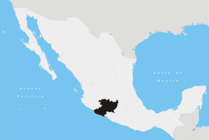
Álvaro Obregón Location of Álvaro Obregón in Mexico | |
| Coordinates: 19°48′N 101°02′W / 19.800°N 101.033°WCoordinates: 19°48′N 101°02′W / 19.800°N 101.033°W | |
| Country |
|
| State | Michoacán |
| Established | 8 February 1930 |
| Municipal seat | Álvaro Obregón |
| Area | |
| • Total | 162.64 km2 (62.80 sq mi) |
| Elevation | 1,800 m (5,900 ft) |
| Population | |
| • Total | 18,696 |
| • Density | 110/km2 (300/sq mi) |
| Time zone | CST (UTC-6) |
| • Summer (DST) | CDT (UTC-5) |
Álvaro Obregón is one of the 113 municipalities that make up the state of Michoacán in Mexico. It is located north of the state and about 26 kilometres (16 mi) from the city of Morelia. It has an area of 162.64 square kilometres (62.80 sq mi) and had a population of 18,696 inhabitants as of 2005. The municipality is named in honor of Álvaro Obregón, the President of Mexico from 1920 to 1924.
The municipality contains 35 localities, which include Álvaro Obregón, Tzintzimeo, El Calvario, Felipe Carrillo Puerto, and Lázaro Cárdenas.
References
This article is issued from Wikipedia - version of the 9/25/2015. The text is available under the Creative Commons Attribution/Share Alike but additional terms may apply for the media files.