Yurécuaro
| Yurécuaro | ||
|---|---|---|
| town | ||
| ||
| Coordinates: 20°16′55″N 102°19′55″W / 20.28194°N 102.33194°W | ||
| Government | ||
| • Mayor | Jaime Perez | |
| Population (2005) | ||
| • Total | 30,487 | |
| Time zone | CST (UTC-6) | |
| • Summer (DST) | CDT (UTC-5) | |
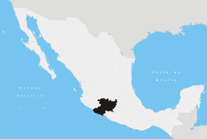
Yurécuaro is a town and a municipality in the region of the Chapala cienega at the north-west in the Mexican state of Michoacán, at a height of 1530 meters (5065 ft) above sea level. Its limits to the north with the state of Jalisco separated by the Lerma river, at west with La Piedad, at south with Ecuandureo and to the southeast with Tanhuato. The distance to the state capital Morelia is 125 miles and to Guadalajara is 85 miles.
Etymology
Yurécuaro comes from the purepecha iorekuarhu means "River side" or "Place of growing" "lugar junto al rio" o "Lugar de crecientes".
History
The city was founded May 22 of 1559 by Viceroy Don Luis de Velasco.
Transportation
You can go to yurecuaro thru road or train
- Road state 110 east to La Piedad west La Barca
- Road Yurecuaro-La concepcion Jalisco
- soon tollway Zamora-Yurecuaro
- Train Mexico-Guadalajara and Yurecuaro-Zamora
External links
This article is issued from Wikipedia - version of the 9/10/2016. The text is available under the Creative Commons Attribution/Share Alike but additional terms may apply for the media files.