Ynys Cantwr
 Ynys Cantwr from Ramsey Island | |
 Ynys Cantwr | |
| Geography | |
|---|---|
| Coordinates | 51°51′7.16″N 5°20′1.64″W / 51.8519889°N 5.3337889°WCoordinates: 51°51′7.16″N 5°20′1.64″W / 51.8519889°N 5.3337889°W |
| Administration | |
|
Wales | |
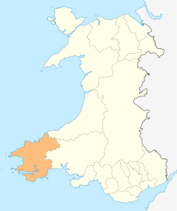
| County | Pembrokeshire |
| Demographics | |
| Population | 0 |
Ynys Cantwr is a small tidal island south of Ramsey Island, Pembrokeshire, Wales. Its highest point is 54 metres.[1]
Etymology
The island's name in Welsh means precentor's Island, because it was formerly owned by the precentors of St David's.[2]
See also
References
- ↑ Ynys Cantwr on www.hill-bagging.co.uk
- ↑ David Mills (2011). A Dictionary of British Place-Names. Oxford University Press. p. 517. ISBN 9780199609086.
External links
![]() Media related to Ynys Cantwr at Wikimedia Commons
Media related to Ynys Cantwr at Wikimedia Commons
This article is issued from Wikipedia - version of the 11/11/2016. The text is available under the Creative Commons Attribution/Share Alike but additional terms may apply for the media files.