Cosheston
| Cosheston | |
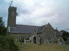 Parish church of St Michael |
|
 Cosheston |
|
| Population | 828 |
|---|---|
| OS grid reference | SN004037 |
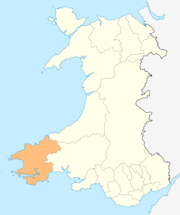
| Principal area | Pembrokeshire |
| Country | Wales |
| Sovereign state | United Kingdom |
| Post town | Haverfordwest |
| Postcode district | SA62 |
| Dialling code | 01646 |
| Police | Dyfed-Powys |
| Fire | Mid and West Wales |
| Ambulance | Welsh |
| EU Parliament | Wales |
| UK Parliament | Carmarthen West and South Pembrokeshire |
| Welsh Assembly | Carmarthen West and South Pembrokeshire |
|
|
Coordinates: 51°41′49″N 4°53′17″W / 51.697°N 4.888°W
Cosheston is a village and parish in Pembrokeshire, Wales. It is situated on an inlet of the Daugleddau estuary, 3 km north-east of Pembroke. The northern part of the parish is in the Pembrokeshire Coast National Park. Together with the parishes of Upton and Nash, it constitutes the community of Cosheston, which had a population of 713 in 2001, increasing to 828 at the 2011 Census.[1]
Name
The placename means "Constantine's farm".[2] and being part of Little England beyond Wales, the area has been essentially English-speaking for 900 years.

Parish
The parish had an area of 813 Ha. Its census populations were: 401 (1801): 551 (1851): 556 (1901): 381 (1951): 593 (1981): 828 (2011).[3]
The parish church is dedicated to St Michael and had a spire in the 19th century.[4]
The percentage of Welsh speakers was 4.9 (1891): 4.3 (1931): 2.6 (1971): 10.7 (2011).[5]
Governance
Cosheston, together with Lamphey, forms an electoral ward. The total ward population taken at the 2011 Census was 1,671.[6]
References
- ↑ "Community population 2011". Retrieved 19 April 2015.
- ↑ Charles, B. G., The Placenames of Pembrokeshire, National Library of Wales, Aberystwyth, 1992, ISBN 0-907158-58-7, pp 686
- ↑ Census 2011 http://www.nomisweb.co.uk/census/2011/qs206wa Table QS206WA
- ↑ "GENUKI: Cosheston". Retrieved 5 March 2016.
- ↑ Census 2011 http://www.nomisweb.co.uk/census/2011/qs206wa Table QS206WA
- ↑ "Ward population 2011". Retrieved 19 April 2015.
External links
- Historical information and links on GENUKI
- Photos of Cosheston and surrounding area on geograph.org.uk