Wildlife Trust for Bedfordshire, Cambridgeshire and Northamptonshire
The Wildlife Trust for Bedfordshire, Cambridgeshire and Northamptonshire (WTBCN, formerly the Wildlife Trust for Bedfordshire, Cambridgeshire, Northamptonshire and Peterborough) is a wildlife trust covering the counties of Bedfordshire, Cambridgeshire and Northamptonshire in England.
The Trust manages 126 nature reserves covering 3,945 hectares of land, and it has over 35,000 members. All of the reserves are free to visit, and 95% of the population of Bedfordshire, Cambridgeshire and Northamptonshire live within five miles of one of its reserves.[1][2]
The Trust is working to protect and increase the numbers and diversity of native wild plants and animals in our countryside.
The charity's name was changed in October 2011 from the Wildlife Trust for Bedfordshire, Cambridgeshire, Northamptonshire and Peterborough to Wildlife Trust for Bedfordshire, Cambridgeshire and Northamptonshire. However the trust still covers Peterborough.
Reserves include: Summer Leys, Pitsford Water and Old Sulehay in Northamptonshire; Grafham Water, Gamlingay Wood and Brampton Wood in Cambridgeshire and Pegsdon Hills, Begwary Brook and Flitwick Moor in Bedfordshire. Some reserves, such as The Riddy in Sandy, Bedfordshire are managed by the Trust despite being owned by other bodies, such as local town or parish councils.[3]
Education centres and services
The Wildlife Trust has three environmental education centres, and works with local communities across the three counties, offering a range of opportunities to learn more about wildlife. This includes tailored learning for early years to sixth formers, under the ‘Really Wild Days Out’ programme linked to the national curriculum; project work for higher and further education students; teacher training sessions on environmental education for today’s teachers; learning opportunities and practical work for a variety of community groups; and family learning events enabling families with children to learn about wildlife together.
Classifications
- CAONB = Chilterns Area of Outstanding Natural Beauty
- LNR = Local Nature Reserve
- NNR = National Nature Reserve
- NT = National Trust
- SSSI = Site of Special Scientific Interest
Bedfordshire reserves
| Site | Photograph | Area[lower-alpha 1] | Location[lower-alpha 1] | Classifications | Description |
|---|---|---|---|---|---|
| Arlesey Old Moat and Glebe Meadows[4] |  |
4.3 hectares (11 acres) | Arlesey 52°01′16″N 0°16′08″W / 52.021°N 0.269°W TL189373 |
Frogs, toads and newts spawn in the moat, and dragonflies lay their eggs in it. The meadows have a range of wild flowers, and woodland, which is managed by coppicing, provides a habitat for nesting warblers.[4] | |
| Barton Gravel Pit[5] |  |
1.1 hectares (2.7 acres) | Barton-le-Clay 51°57′25″N 0°24′11″W / 51.957°N 0.403°W TL098299 |
This former gravel pit has been partially filled in to become flower-rich chalk grassland. Plants include knotted hedge-parsley, common poppy and great pignut. Mature beech trees provide a habitat for the white helleborine orchid.[5] | |
| Begwary Brook[6] |  |
0.8 hectares (2.0 acres) | Begwary 52°11′38″N 0°17′24″W / 52.194°N 0.290°W TL169564 |
Gravel extraction has created a small lake and several smaller pools and marshland. The pools are surrounded by willow trees, and plants include common fleabane and marsh woundwort. Dragonflies and damselflies are common over the marsh in the summer.[6] | |
| Blow's Downs[7] |  |
62.3 hectares (154 acres) | Dunstable 51°53′13″N 0°29′24″W / 51.887°N 0.490°W TL040220 |
SSSI[8] | The site has varied habitats with a large area of unimproved grassland, which cattle help to maintain. Features include a disused quarry and medieval cultivation terraces. It has nationally rare plant, Bunium bulbocastanum, and a nationally rare beetle, odontaeus armiger.[8] |
| Cooper's Hill[9] |  |
12.5 hectares (31 acres) | Ampthill 52°01′37″N 0°30′11″W / 52.027°N 0.503°W TL028376 |
SSSI[10] | The site is described by Natural England as the best surviving example in Bedfordshire of heathland on the thin acidic soils of the Lower Greensand Ridge. It also has areas of marsh and woodland.[10] |
| Cople Pits[11] |  |
2.0 hectares (4.9 acres) | Cople 52°07′48″N 0°23′24″W / 52.130°N 0.390°W TL103492 |
The site has eleven long water-filled pits from gravel extraction in the 1930s, which are now surrounded by willow and hawthorn scrub. The pits have been colonised by aquatic plants. Fauna include dragonflies, kingfishers and woodpeckers, and there is also a wildflower meadow.[11] | |
| Cut-throat Meadow[12] | 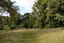 |
1.5 hectares (3.7 acres) | Ampthill 52°01′55″N 0°29′06″W / 52.032°N 0.485°W TL039380 |
The reserve is in three separate areas. There is a steeply sloping meadow where Meadow saxifrage and field woodrush flower in the spring, a beech and scots pine wood, and a pond which has reedmace and celery-leaved buttercup, and water boatmen and pond skaters on the surface.[12] | |
| Dropshort Marsh[13] |  |
2.0 hectares (4.9 acres) | Toddington 51°56′17″N 0°32′13″W / 51.938°N 0.537°W TL007276 |
SSSI[14] | This marsh has a variety of habitats, including a scarce quaking bog. Many species are now uncommon due to changes in agricultural practices. it has several springs, with floating sweet-grass and brooklime and areas dominated by rushes.[14] |
| Fancott Woods and Meadows[15] |  |
12.9 hectares (32 acres) | Fancott 51°56′13″N 0°30′36″W / 51.937°N 0.510°W TL025275 |
SSSI[16] | The meadows are mainly ancient ridge and furrow, and are unimproved neutral grassland traditionally managed for hay and grazing. The woodland is mainly ash, with other species including pedunculate oak and alder. There is also a small pond.[16] |
| Felmersham Gravel Pits[17] |  |
21.0 hectares (52 acres) | Felmersham 52°12′54″N 0°33′04″W / 52.215°N 0.551°W SP991584 |
SSSI[18] | The site has flooded gravel pits, neutral grassland, scrub and broadleaved woodland.[18] It is described by the Wildlife Trust as one of the best sites in Bedfordshire for dragonflies and damselflies.[17] |
| Flitwick Moor (& Folly Wood)[19] |  |
66.6 hectares (165 acres) | Flitwick 52°00′25″N 0°28′37″W / 52.007°N 0.477°W TL046354 |
SSSI[20] | This is a rich valley mire, and the largest area of wetland in Bedfordshire. Eight species of sphagnum bog moss have been recorded, including one which is nationally rare. The site has areas of woodland as well as wet grassland.[20] |
| King's Wood and Rammamere Heath[21] |  |
104.0 hectares (257 acres) | Heath and Reach 51°57′22″N 0°39′47″W / 51.956°N 0.663°W SP920294 |
SSSI[22] NNR[22] | The site has the largest remaining area of woodland in Bedfordshire, together with lowland heath, acidic grassland and some small ponds. There are a number of rare plant species, including great woodrush, wood vetch and saw-wort.[22] |
| Lancot Meadow[23] | 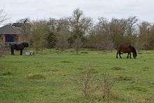 |
2.0 hectares (4.9 acres) | Dunstable 51°53′06″N 0°32′38″W / 51.885°N 0.544°W TL003217 |
The site is a grassland remnant on chalk soil, and a remnant of flower-rich meadows in the area. Flora include common spotted-orchids, ox-eye daisys and bird's foot trefoils. There are fauna such as song thrushes and marbled white butterflies.[23] | |
| Landpark Wood[24] |  |
3.6 hectares (8.9 acres) | Whipsnade 51°51′18″N 0°31′34″W / 51.855°N 0.526°W TL016184 |
This wood has mature beech trees, hornbeam, oak and ash. The understorey is hazel and hawthorn, with bluebells, yellow archangel and woodruff. Birds include woodpeckers and nuthatches.[24] | |
| Old Warden Tunnel[25] |  |
3.8 hectares (9.4 acres) | Old Warden 52°05′20″N 0°22′34″W / 52.089°N 0.376°W TL113446 |
The site has oak and ash woodland with mature blackthorn and hawthorn bushes, and a steep cutting with grassland and scrub. Flowers include dwarf thistle and pyramidal orchid, and the scrub provides nesting sites for birds.[25] | |
| Pavenham Osier Beds[26] |  |
1.3 hectares (3.2 acres) | Pavenham 52°11′06″N 0°33′11″W / 52.185°N 0.553°W SP990551 |
This is a wet meadow next to the River Great Ouse, which has the uncommon flower meadow-rue. Osier is a type of willow which is continually cut, stimulating its growth and supplying material for basket weavers. The Trust is continuing the tradition by planting more osiers.[26] | |
| Pegsdon Hills and Hoo Bit[27] |  |
79.0 hectares (195 acres) | Pegsdon 51°57′11″N 0°22′19″W / 51.953°N 0.372°W TL120295 |
SSSI,[28] CAONB[27] | The site has wildflower meadows in chalk hills, including orchids and moschatels. There are butterflies such as dingy and grizzled skippers, Birds include wheatears and skylarks, and herbs such as marjoram and wild thyme. Hoo Bit is a flower meadow surrounded by woodland.[27] |
| Riddy, TheThe Riddy[29] |  |
7.7 hectares (19 acres) | Sandy 52°07′30″N 0°17′46″W / 52.125°N 0.296°W TL165487 |
LNR[30] | This water meadow is one of the few surviving areas of flood plain of the River Ivel. Aquatic plants include celery leaved buttercup and water plantain, and there are birds such as lapwings, fieldfares and redwings. Water voles are found along the river.[30] |
| Sallowsprings[31] |  |
1.3 hectares (3.2 acres) | Whipsnade 51°51′14″N 0°32′17″W / 51.854°N 0.538°W TL008183 |
This site was formerly a caravan park, and it is now a traditional hay meadow. A rich variety of flowers includes common knapweed, bluebells and cowslips. An ancient hedgerow has diverse shrubs such as holly.[31] | |
| Sewell Cutting[32] |  |
3.6 hectares (8.9 acres) | Dunstable 51°53′38″N 0°32′49″W / 51.894°N 0.547°W TL005226 |
The banks of this former railway cutting provide a rich habitat for chalk grassland flowers, such as common spotted orchids and cowslips. The south-facing slope has deep rooted plants such as hawkweed and scabious, while the sheltered north-facing slope has lush grasses. There are many species of butterflies.[32] | |
| Sharnbrook Summit[33] |  |
9.0 hectares (22 acres) | Sharnbrook 52°15′00″N 0°34′37″W / 52.250°N 0.577°W SP972622 |
The site is a mile long narrow strip above a rail tunnel. The reserve is grassland, grazed by rabbits, on limestone deposited during the construction of the railway. The dominant plant is tor-grass, and flowers include dyer's greenweed and wild liquorice. Scattered scrub provides food and shelter from kestrels and buzzards for small mammals and nesting birds.[33] | |
| Totternhoe[34] |  |
31.0 hectares (77 acres) | Totternhoe 51°53′06″N 0°34′08″W / 51.885°N 0.569°W SP986217 |
SSSI,[35] LNR,[36] CAONB,[37] NT[36] | Part of the site was formerly quarry workings for Totternhoe stone, a strong chalk that was used in Westminster Abbey. It is now grassland with a rich variety of plant species, including some that are now rare. There are a number of orchids and a wide variety of invertebrates, including butterflies such as the common blue, chalkhill blue, and the scarce small blue and Duke of Burgundy.[34][35][36] |
| Wymington Meadow[33] |  |
1.0 hectare (2.5 acres) | Wymington 52°15′32″N 0°35′46″W / 52.259°N 0.596°W SP958632 |
The site is a triangular meadow in the corner where two railway lines merge. It was cut off when the railways were constructed in the 1850s, and at the northern end there are traces of the ancient ridge and furrow method of ploughing. The site has a wide range of flowers, such as cowslip, salad burnet and quaking grass. A small stream and hedgerows provide additional habitats for wildlife.[33] |
Cambridgeshire reserves
| Site | Photograph | Area[lower-alpha 1] | Location[lower-alpha 1] | Classifications | Description |
|---|---|---|---|---|---|
| Arthur's Meadow[38] |  |
0.8 hectares (2.0 acres) | Hemingford Grey 52°18′22″N 0°06′29″W / 52.306°N 0.108°W TL292692 |
SSSI[39] | The site is calcareous clay pasture with a wide variety of plant species, including the herbs oxeye daisy and yellow rattle. There are orchids such as common twayblades and common spotteds.[40] |
| Beechwoods[41] |  |
10 hectares (25 acres) | Cambridge 52°10′16″N 0°10′12″E / 52.171°N 0.170°E TL485547 |
LNR | |
| Brampton Wood[42] |  |
132 hectares (330 acres) | Brampton 52°18′58″N 0°16′12″W / 52.316°N 0.27°W TL184698 |
SSSI | |
| Buff Wood[43] |  |
16 hectares (40 acres) | Hatley 52°08′10″N 0°07′48″W / 52.136°N 0.13°W TL281503 |
SSSI | |
| Cambourne[44] |  |
90 hectares (220 acres) | Cambourne 52°13′05″N 0°04′30″W / 52.218°N 0.075°W TL316595 |
||
| Cherry Hinton Chalk Pits[45] |  |
10 hectares (25 acres) | Cambridge 52°10′48″N 0°10′05″E / 52.18°N 0.168°E TL483557 |
LNR,[46] SSSI[47] | These former chalk quarries have a variety of habitats, including grassland and woodland with ash trees, field maple and cherries. The site was designated an SSSI because it has four rare plants, three of which are listed in the British Red List of Threatened Species. These are great pignut, moon carrot and grape hyacinth.[47] |
| Chettisham Meadow[48] | 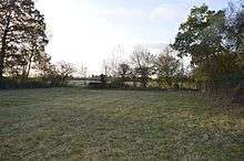 |
0.7 hectares (1.7 acres) | Chettisham 52°25′23″N 0°15′54″E / 52.423°N 0.265°E TL541830 |
SSSI[49] | The site is grassland on calcareous clay, and evidence survives of ridge and furrow medieval farming. Flowering plants include adder's tongue, cowslip and the uncommon green-winged orchid.[49] |
| Doghouse Grove[50] |  |
0.8 hectares (2.0 acres) | Wilburton 52°20′56″N 0°10′19″E / 52.349°N 0.172°E TL480745 |
In the medieval period this was a series of monastic fishponds, which can still be seen in wetter periods. It is now an ash wood, with flowers including bluebells and lords-and-ladies.[50] | |
| Dogsthorpe Star Pit[51] |  |
37.2 hectares (92 acres) | Peterborough 52°36′29″N 0°12′36″W / 52.608°N 0.21°W TF213026 |
LNR, SSSI | |
| Fordham Woods[52] |  |
10 hectares (25 acres) | Fordham 52°18′14″N 0°23′31″E / 52.304°N 0.392°E TL632700 |
SSSI[53] | This wet woodland site has semi-natural alder coppice, with ash, crack willow and silver birch. The ground flora has tall fens, together with herbs such as marsh marigold and yellow flag.[53] |
| Fulbourn Fen[54] |  |
31 hectares (77 acres) | Fulbourn 52°10′41″N 0°13′48″E / 52.178°N 0.230°E TL526557 |
SSSI | |
| Gamlingay Cinques[55] | 3.4 hectares (8.4 acres) | Gamlingay 52°09′40″N 0°12′32″W / 52.161°N 0.209°W TL226529 |
|||
| Gamlingay Wood[56] | 70 hectares (170 acres) | Gamlingay 52°10′01″N 0°11′13″W / 52.167°N 0.187°W TL240537 |
SSSI | ||
| Gamsey Wood[57] |  |
4 hectares (9.9 acres) | Woodwalton 52°25′08″N 0°12′04″W / 52.419°N 0.201°W TL225 816 |
The main trees in this wood are ash and field maple, but there are also several wild service trees. Spring flowers include bluebells, wood anemones and yellow archangels, and there are birds such as fieldfares and nightingales.[57] | |
| Godmanchester[58] | 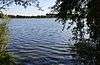 |
59 hectares (150 acres) | Godmanchester 52°19′44″N 0°09′14″W / 52.329°N 0.154°W TL258717 |
The site has four former gravel pits which are now lakes, together with areas of grassland, willow woodland and reedbeds. Birds include wigeons, tufted ducks, teals and great crested grebes, and there are insects such as dragonflies and butterflies.[58] | |
| Grafham Water[59] | 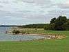 |
114 hectares (280 acres) | Grafham 52°17′24″N 0°19′34″W / 52.290°N 0.326°W TL143 671 |
SSSI | |
| Great Fen[60] | 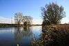 |
1,184 hectares (2,930 acres) | Holme 52°29′10″N 0°13′26″W / 52.486°N 0.224°W TL207890 |
This is a large wetland project which covers National Nature Reserves run by Natural England, and areas managed by the WTBCN. The fields of New Decoy Farm are being made wildlife friendly with new ditches and scrapes, and grazing cattle. Rymes Reedbeds is also being restored with new reedbeds on open water. Kesters Docking is being sown as species-poor grassland, and it will also have areas of open water and reedbeds.[61] | |
| Hardwick Wood[62] |  |
15 hectares (37 acres) | Caldecote 52°12′14″N 0°01′02″W / 52.204°N 0.0172°W TL356580 |
SSSI[63] | This medieval wood is now managed by coppicing. It is mainly ash and field maple, while the oldest parts have pedunculate oak with an understorey of hazel and hawthorn, while ground flora include early-purple orchid and yellow archangel.[62][63] |
| Hayley Wood[64] | 52 hectares (130 acres) | Great Gransden 52°09′36″N 0°06′47″W / 52.160°N 0.113°W TL292530 |
NCR, SSSI | ||
| Houghton Meadows[65] |  |
8 hectares (20 acres) | Houghton 52°19′41″N 0°06′14″W / 52.328°N 0.104°W TL293717 |
SSSI | |
| Lady's Wood[66] |  |
7.1 hectares (18 acres) | Upwood 52°25′37″N 0°10′23″W / 52.427°N 0.173°W TL243826 |
This wood was a traditional coppice, but many of the trees were cut down in the 1950s. Birds include blackcaps, fieldfares and green woodpeckers and there are invertebrates such as orange-tip butterflies and azure damselflies.[66] | |
| Lattersey[67] |  |
11.3 hectares (28 acres) | Whittlesey 52°33′07″N 0°06′40″W / 52.552°N 0.111°W TL282966 |
LNR | |
| Lower Wood[68] | 9 hectares (22 acres) | Weston Colville 52°09′00″N 0°22′26″E / 52.150°N 0.374°E TL625528 |
|||
| Norwood Road[69] |  |
2.6 hectares (6.4 acres) | March 52°33′40″N 0°05′20″E / 52.561°N 0.089°E TL417980 |
This site has a deep pond, marshland and hawthorn scrub. There are wetland birds such as coots, moorhens and mallards, and other wildlife includes noctule bats and weasels.[69] | |
| Ouse Washes[70] |  |
186 hectares (460 acres) | Little Downham 52°27′07″N 0°09′43″E / 52.452°N 0.162°E TL470860 |
NCR, Ramsar, SAC, SPA, SSSI | |
| Overhall Grove[71] |  |
17 hectares (42 acres) | Knapwell 52°15′00″N 0°02′35″W / 52.250°N 0.043°W TL337631 |
NCR,[72] SSSI[73] | This site is the largest elm woodland in the county. It was seriously affected by Dutch elm disease, but many trees have regenerated from their bases, and the mixture of new growth and dead wood provides a very good habitat for insects and birds.[71] |
| Pingle Wood and Cutting[74] |  |
7.4 hectares (18 acres) | Warboys 52°24′58″N 0°04′16″W / 52.416°N 0.071°W TL313815 |
This ancient semi-natural wood has ash and maple, and there is also a disused railway cutting. There are flora such as common spotted-orchids, twayblades, ramsons, salad burnets and early purple orchids.[74] | |
| Raveley Wood[75] |  |
5.6 hectares (14 acres) | Upwood 52°25′08″N 0°10′19″W / 52.419°N 0.172°W TL244817 |
Trees in this wood include oak, ash and field maple, together with some elms, although many were killed by Dutch elm disease. Invertebrates include the rare white-spotted pinion moth, which depends on elms for food for its larvae, and white-letter hairstreak butterflies. The dead elms provide a habitat for a wide variety of fungi.[75] | |
| Roswell Pits[76] |  |
8 hectares (20 acres) | Ely 52°24′04″N 0°17′10″E / 52.401°N 0.286°E TL556806 |
GCR,[77] SSSI[78][79] | |
| Shepherd's Close[80] | 1.2 hectares (3.0 acres) | Spaldwick 52°19′23″N 0°20′20″W / 52.323°N 0.339°W TL133707 |
|||
| Shepreth L Moor[81] |  |
7.3 hectares (18 acres) | Shepreth 52°06′29″N 0°01′16″E / 52.108°N 0.021°E TL385475 |
SSSI[82] | This is unploughed calcareous grassland which has diverse flora such as horseshoe vetch and felwort in drier areas, and devil's bit scabious and fen bedstraw in wetter ones. The site is regarded by Natural England as valuable for its invertebrates.[81][82] |
| Skaters' Meadow[83] |  |
2 hectares (4.9 acres) | Cambridge 52°11′31″N 0°06′18″E / 52.192°N 0.105°E TL440569 |
||
| Soham Meadow[84] |  |
3.6 hectares (8.9 acres) | Soham 52°19′44″N 0°21′36″E / 52.329°N 0.360°E TL609727 |
SSSI | |
| Southorpe Meadow[85] |  |
2.0 hectares (4.9 acres)[86] | Southorpe 52°36′54″N 0°24′07″W / 52.615°N 0.402°W TF083031 |
SSSI[86] | This is one of the few surviving areas of neutral grassland in the county, where ridge and furrow from medieval ploughing can be seen. There is a rich variety of species, such as red fescue in drier areas, and salad burnet in damper ones.[86] |
| Southorpe Paddock[87] |  |
1.6 hectares (4.0 acres)[88] | Southorpe 52°36′25″N 0°24′04″W / 52.607°N 0.401°W TF084022 |
SSSI[89] | This site is a rare example of unimproved grassland on the Jurassic limestone of eastern England. It has typical limestone plants such as purple milk-vetch and clustered bellflower. Mature hedgerows provide additional habitats for wildlife.[89] |
| Stanground Newt Ponds[90] |  |
0.8 hectares (2.0 acres) | Peterborough 52°32′56″N 0°13′44″W / 52.549°N 0.229°W TL202961 |
This site has ponds and a wet meadow, with smooth and great crested newts. Other fauna include common frogs, damselflies and dragonflies.[90] | |
| Stanground Wash[91] |  |
26 hectares (64 acres) | Peterborough 52°33′43″N 0°13′08″W / 52.562°N 0.219°W TL208975 |
The site is sandwiched between the East Coast Main Line railway line and Back River, a tributary of the River Nene. It is grassland which is flooded in winter, providing a refuge for waterbirds, and is grazed in the summer. It has a variety of birds such as snipe, redshanks and sandpipers, and ditches with rare beetles.[91] | |
| Thorpe Wood[92] |  |
10 hectares (25 acres) | Peterborough 52°34′16″N 0°17′31″W / 52.571°N 0.292°W TL158983 |
This is ancient woodland on heavy clay, with mature oak and ash trees, and an understorey of hazel and field maple. The ground flora is diverse, including wild garlic, wood anemones and bluebells.[92] | |
| Trumpington Meadows[93] |  |
58 hectares (140 acres) | Trumpington 52°10′12″N 0°06′11″E / 52.170°N 0.103°E TL439545 |
This site has flower meadows, woodland, ponds, and is adjacent to the River Cam and Byron's Pool, where Lord Byron once swam. Fauna include otters, brown hares, muntjac deer, skylarks, lapwings, yellowhammers and meadow pipits.[93] | |
| Upwood Meadows[94] |  |
6 hectares (15 acres) | Upwood 52°25′34″N 0°09′43″W / 52.426°N 0.162°W TL251825 |
NCR,[95] NNR,[96] SSSI[97] | The site has three fields on calcareous clay with poor drainage, a type of pasture now very rare, and was described by Derek Ratcliffe as having "an outstandingly rich and diverse flora".[95] Other habitats are mature hedgerows, ponds and scrub. One of the fields is agriculturally unimproved, and the evidence of medieval ridge and furrow still survives. Flowering plants include pepper saxifrage and green-winged orchid.[98] |
| Wansford Pasture & Standen's Pasture[99] |  |
7.3 hectares (18 acres)[99] | Wansford 52°34′55″N 0°25′26″W / 52.582°N 0.424°W TL069994 |
SSSI[100] | This is a south-facing slope, with Jurassic limestone grassland and a flush lower down which has a wide variety of wet-loving plants, including some which are rare in the county. The ecology is maintained by avoiding the use of fertilisers and herbicides, and by grazing.[100] |
| Waresley and Gransden Woods[101] |  |
50 hectares (120 acres) | Waresley 52°10′37″N 0°09′25″W / 52.177°N 0.157°W TL261548 |
SSSI | |
| Wistow Wood[102] |  |
8.5 hectares (21 acres) | Wistow 52°25′16″N 0°05′46″W / 52.421°N 0.096°W TL296820 |
SSSI[103] | This wood has many old ash coppices, most of which were cut at ground level in the 1920s and left to re-grow. There are flowering plants such as meadowsweet and ragged-robin, and butterflies include purple hairstreaks and red admirals.[102] |
| Woodston Ponds[104] |  |
10 hectares (25 acres) | Peterborough 52°33′58″N 0°16′05″W / 52.566°N 0.268°W TL175979 |
LNR[105] | The site was formerly settling ponds to remove washings from sugar beet. The east side has a lake with water birds such as grey herons, tufted ducks and pochards. In the west there is a reedbed which has pools and channels, with great crested newts and unusual species of water beetle.[104] |
| Woodwalton Marsh[106] |  |
1 hectare (2.5 acres) | Woodwalton 52°24′50″N 0°13′08″W / 52.414°N 0.219°W TL212811 |
SSSI |
| Wikimedia Commons has media related to Wildlife Trust for Bedfordshire, Cambridgeshire and Northamptonshire. |
Notes
References
- ↑ "Our Trust by numbers". Wildlife Trust for Bedfordshire, Cambridgeshire and Northamptonshire. Retrieved 2 December 2015.
- ↑ "About our nature reserves". Wildlife Trust for Bedfordshire, Cambridgeshire and Northamptonshire. Retrieved 2 December 2015.
- ↑ "The Riddy". Sandy Town Council. Archived from the original on 18 January 2014. Retrieved 18 January 2014.
- 1 2 "Arlesey Old Moat and Glebe Meadows". Wildlife Trust for Bedfordshire, Cambridgeshire and Northamptonshire. Retrieved 21 March 2016.
- 1 2 "Barton Gravel Pit". Wildlife Trust for Bedfordshire, Cambridgeshire and Northamptonshire. Retrieved 20 December 2015.
- 1 2 "Begwary Brook". Wildlife Trust for Bedfordshire, Cambridgeshire and Northamptonshire. Retrieved 16 December 2015.
- ↑ "Blow's Downs". Wildlife Trust for Bedfordshire, Cambridgeshire and Northamptonshire. Retrieved 24 August 2015.
- 1 2 "Blow's Down citation" (PDF). Sites of Special Scientific Interest. Natural England. Retrieved 24 August 2015.
- ↑ "Cooper's Hill". Wildlife Trust for Bedfordshire, Cambridgeshire and Northamptonshire. Retrieved 24 August 2015.
- 1 2 "Cooper's Hill citation" (PDF). Sites of Special Scientific Interest. Natural England. Retrieved 24 August 2015.
- 1 2 "Cople Pits". Wildlife Trust for Bedfordshire, Cambridgeshire and Northamptonshire. Retrieved 15 December 2015.
- 1 2 "Cut-throat Meadow". Wildlife Trust for Bedfordshire, Cambridgeshire and Northamptonshire. Retrieved 22 September 2015.
- ↑ "Dropshort Marsh". Wildlife Trust for Bedfordshire, Cambridgeshire and Northamptonshire. Retrieved 25 August 2015.
- 1 2 "Dropshort Marsh citation" (PDF). Sites of Special Scientific Interest. Natural England. Retrieved 25 August 2015.
- ↑ "Fancott Woods and Meadows". Wildlife Trust for Bedfordshire, Cambridgeshire and Northamptonshire. Retrieved 25 August 2015.
- 1 2 "Fancott Woods and Meadows citation" (PDF). Sites of Special Scientific Interest. Natural England. Retrieved 25 August 2015.
- 1 2 "Felmersham Gravel Pits". Wildlife Trust for Bedfordshire, Cambridgeshire and Northamptonshire. Retrieved 26 August 2015.
- 1 2 "Felmersham Gravel Pits citation" (PDF). Sites of Special Scientific Interest. Natural England. Retrieved 26 August 2015.
- ↑ "Flitwick Moor (& Folly Wood)". Wildlife Trust for Bedfordshire, Cambridgeshire and Northamptonshire. Retrieved 26 August 2015.
- 1 2 "Flitwick Moor citation" (PDF). Sites of Special Scientific Interest. Natural England. Retrieved 26 August 2015.
- ↑ "King's Wood and Rammamere Heath". Wildlife Trust for Bedfordshire, Cambridgeshire and Northamptonshire. Retrieved 27 August 2015.
- 1 2 3 "Kings and Bakers Woods and Heaths citation" (PDF). Sites of Special Scientific Interest. Natural England. Retrieved 27 August 2015.
- 1 2 "Lancot Meadow". Wildlife Trust for Bedfordshire, Cambridgeshire and Northamptonshire. Retrieved 6 December 2015.
- 1 2 "Landpark Wood". Wildlife Trust for Bedfordshire, Cambridgeshire and Northamptonshire. Retrieved 6 December 2015.
- 1 2 "Old Warden Tunnel". Wildlife Trust for Bedfordshire, Cambridgeshire and Northamptonshire. Retrieved 23 March 2016.
- 1 2 "Pavenham Osier Beds (In Memory of Horace Church)". Wildlife Trust for Bedfordshire, Cambridgeshire and Northamptonshire. Retrieved 23 March 2016.
- 1 2 3 "Pegsdon Hills and Hoo Bit". Wildlife Trust for Bedfordshire, Cambridgeshire and Northamptonshire. Retrieved 16 December 2015.
- ↑ "Map of Deacon Hill". Sites of Special Scientific Interest. Natural England. Retrieved 8 March 2015.
- ↑ "The Riddy". Wildlife Trust for Bedfordshire, Cambridgeshire and Northamptonshire. Retrieved 23 March 2016.
- 1 2 "The Riddy". Local Nature Reserves. Natural England. 19 February 2015. Retrieved 4 October 2015.
- 1 2 "Sallowsprings". Wildlife Trust for Bedfordshire, Cambridgeshire and Northamptonshire. Retrieved 6 December 2015.
- 1 2 "Sewell Cutting". Wildlife Trust for Bedfordshire, Cambridgeshire and Northamptonshire. Retrieved 10 September 2015.
- 1 2 3 4 "Sharnbrook Summit and Wymington Meadow". Wildlife Trust for Bedfordshire, Cambridgeshire and Northamptonshire. Retrieved 26 November 2015.
- 1 2 "Totternhoe". Wildlife Trust for Bedfordshire, Cambridgeshire and Northamptonshire. Retrieved 10 September 2015.
- 1 2 "Totternhoe Knolls citation" (PDF). Sites of Special Scientific Interest. Natural England. Retrieved 10 September 2015.
- 1 2 3 "Totternhoe Knolls". Local Nature Reserves. Natural England. Retrieved 10 September 2015.
- ↑ "Totternhoe Knolls". Chilterns Conservation Board. Retrieved 26 March 2016.
- ↑ "Arthur's Meadow". Wildlife Trust for Bedfordshire, Cambridgeshire and Northamptonshire. Retrieved 27 July 2016.
- ↑ "Hemingford Grey Meadow citation" (PDF). Sites of Special Scientific Interest. Natural England. Retrieved 8 September 2016.
- ↑ "Hemingford Grey Meadow citation" (PDF). Sites of Special Scientific Interest. Natural England. Retrieved 13 September 2016.
- ↑ "Beechwoods". Wildlife Trust for Bedfordshire, Cambridgeshire and Northamptonshire. Retrieved 27 July 2016.
- ↑ "Brampton Wood". Wildlife Trust for Bedfordshire, Cambridgeshire and Northamptonshire. Retrieved 27 July 2016.
- ↑ "Buff Wood". Wildlife Trust for Bedfordshire, Cambridgeshire and Northamptonshire. Retrieved 27 July 2016.
- ↑ "Cambourne". Wildlife Trust for Bedfordshire, Cambridgeshire and Northamptonshire. Retrieved 27 July 2016.
- ↑ "Cherry Hinton Chalk Pits". Wildlife Trust for Bedfordshire, Cambridgeshire and Northamptonshire. Retrieved 27 July 2016.
- ↑ "East Pit". Local Nature Reserves. Natural England. 20 February 2013. Retrieved 30 November 2016.
- 1 2 "Cherry Hinton Pit citation" (PDF). Sites of Special Scientific Interest. Natural England. Retrieved 30 November 2016.
- ↑ "Chettisham Meadow". Wildlife Trust for Bedfordshire, Cambridgeshire and Northamptonshire. Retrieved 28 July 2016.
- 1 2 "Chettisham Meadow citation" (PDF). Sites of Special Scientific Interest. Natural England. Retrieved 14 November 2016.
- 1 2 "Doghouse Grove". Wildlife Trust for Bedfordshire, Cambridgeshire and Northamptonshire. Retrieved 28 July 2016.
- ↑ "Dogsthorpe Star Pit". Wildlife Trust for Bedfordshire, Cambridgeshire and Northamptonshire. Retrieved 28 July 2016.
- ↑ "Fordham Woods". Wildlife Trust for Bedfordshire, Cambridgeshire and Northamptonshire. Retrieved 28 July 2016.
- 1 2 "Brackland Rough citation" (PDF). Sites of Special Scientific Interest. Natural England. Retrieved 28 July 2016.
- ↑ "Fulbourn Fen". Wildlife Trust for Bedfordshire, Cambridgeshire and Northamptonshire. Retrieved 28 July 2016.
- ↑ "Gamlingay Cinques". Wildlife Trust for Bedfordshire, Cambridgeshire and Northamptonshire. Retrieved 28 July 2016.
- ↑ "Gamlingay Wood". Wildlife Trust for Bedfordshire, Cambridgeshire and Northamptonshire. Retrieved 28 July 2016.
- 1 2 "Gamsey Wood". Wildlife Trust for Bedfordshire, Cambridgeshire and Northamptonshire. Retrieved 28 July 2016.
- 1 2 "Godmanchester". Wildlife Trust for Bedfordshire, Cambridgeshire and Northamptonshire. Retrieved 28 July 2016.
- ↑ "Grafham Water". Wildlife Trust for Bedfordshire, Cambridgeshire and Northamptonshire. Retrieved 28 July 2016.
- ↑ "Great Fen". Wildlife Trust for Bedfordshire, Cambridgeshire and Northamptonshire. Retrieved 28 July 2016.
- ↑ "Great Fen". Wildlife Trust for Bedfordshire, Cambridgeshire and Northamptonshire. Retrieved 18 November 2016.
- 1 2 "Hardwick Wood". Wildlife Trust for Bedfordshire, Cambridgeshire and Northamptonshire. Retrieved 28 July 2016.
- 1 2 "Hardwick Wood citation" (PDF). Sites of Special Scientific Interest. Natural England. Retrieved 1 October 2016.
- ↑ "Hayley Wood". Wildlife Trust for Bedfordshire, Cambridgeshire and Northamptonshire. Retrieved 28 July 2016.
- ↑ "Houghton Meadows". Wildlife Trust for Bedfordshire, Cambridgeshire and Northamptonshire. Retrieved 28 July 2016.
- 1 2 "Lady's Wood". Wildlife Trust for Bedfordshire, Cambridgeshire and Northamptonshire. Retrieved 28 July 2016.
- ↑ "Lattersey". Wildlife Trust for Bedfordshire, Cambridgeshire and Northamptonshire. Retrieved 28 July 2016.
- ↑ "Lower Wood". Wildlife Trust for Bedfordshire, Cambridgeshire and Northamptonshire. Retrieved 28 July 2016.
- 1 2 "Norwood Road". Wildlife Trust for Bedfordshire, Cambridgeshire and Northamptonshire. Retrieved 28 July 2016.
- ↑ "Ouse Washes". Wildlife Trust for Bedfordshire, Cambridgeshire and Northamptonshire. Retrieved 28 July 2016.
- 1 2 "Overhall Grove". Wildlife Trust for Bedfordshire, Cambridgeshire and Northamptonshire. Retrieved 28 July 2016.
- ↑ Ratcliffe, Derek, ed. (1977). A Nature Conservation Review. 2. Cambridge, UK: Cambridge University Press. p. 61. ISBN 0521 21403 3.
- ↑ "Overhall Grove citation" (PDF). Sites of Special Scientific Interest. Natural England. Retrieved 28 November 2016.
- 1 2 "Pingle Wood and Cutting". Wildlife Trust for Bedfordshire, Cambridgeshire and Northamptonshire. Retrieved 28 July 2016.
- 1 2 "Raveley Wood". Wildlife Trust for Bedfordshire, Cambridgeshire and Northamptonshire. Retrieved 28 July 2016.
- ↑ "Roswell Pits". Wildlife Trust for Bedfordshire, Cambridgeshire and Northamptonshire. Retrieved 28 July 2016.
- ↑ "Roswell Pits, Ely (Jurassic - Cretaceous Reptilia)". Joint Nature Conservation Committee. Retrieved 1 December 2016.
- ↑ "Ely Pits and Meadows citation" (PDF). Sites of Special Scientific Interest. Natural England. Retrieved 28 July 2016.
- ↑ "Map of Ely Pits and Meadows". Sites of Special Scientific Interest. Natural England. Retrieved 28 July 2016.
- ↑ "Shepherd's Close". Wildlife Trust for Bedfordshire, Cambridgeshire and Northamptonshire. Retrieved 28 July 2016.
- 1 2 "Shepreth L Moor". Wildlife Trust for Bedfordshire, Cambridgeshire and Northamptonshire. Retrieved 28 July 2016.
- 1 2 "L-Moor, Shepreth citation" (PDF). Sites of Special Scientific Interest. Natural England. Retrieved 2 October 2016.
- ↑ "Skaters' Meadow". Wildlife Trust for Bedfordshire, Cambridgeshire and Northamptonshire. Retrieved 28 July 2016.
- ↑ "Soham Meadow". Wildlife Trust for Bedfordshire, Cambridgeshire and Northamptonshire. Retrieved 28 July 2016.
- ↑ "Southorpe Meadow". Wildlife Trust for Bedfordshire, Cambridgeshire and Northamptonshire. Retrieved 28 July 2016.
- 1 2 3 "Southorpe Meadow citation" (PDF). Sites of Special Scientific Interest. Natural England. Retrieved 30 August 2016.
- ↑ "Southorpe Paddock". Wildlife Trust for Bedfordshire, Cambridgeshire and Northamptonshire. Retrieved 28 July 2016.
- ↑ "Designated Sites View: Southorpe Paddock". Sites of Special Scientific Interest. Natural England. Retrieved 30 August 2016.
- 1 2 "Southorpe Paddock citation" (PDF). Sites of Special Scientific Interest. Natural England. Retrieved 30 August 2016.
- 1 2 "Stanground Newt Ponds". Wildlife Trust for Bedfordshire, Cambridgeshire and Northamptonshire. Retrieved 28 July 2016.
- 1 2 "Stanground Wash". Wildlife Trust for Bedfordshire, Cambridgeshire and Northamptonshire. Retrieved 28 July 2016.
- 1 2 "Thorpe Wood". Wildlife Trust for Bedfordshire, Cambridgeshire and Northamptonshire. Retrieved 28 July 2016.
- 1 2 "Trumpington Meadows". Wildlife Trust for Bedfordshire, Cambridgeshire and Northamptonshire. Retrieved 28 July 2016.
- ↑ "Upwood Meadows". Wildlife Trust for Bedfordshire, Cambridgeshire and Northamptonshire. Retrieved 28 July 2016.
- 1 2 Ratcliffe, Derek (1977). A Nature Conservation Review. 2. Cambridge, UK: Cambridge University Press. p. 139. ISBN 0521 21403 3.
- ↑ "Cambridgeshire's National Nature Reserves". Natural England. 31 October 2008. Retrieved 21 November 2016.
- ↑ "Upwood Meadows citation" (PDF). Sites of Special Scientific Interest. Natural England. Retrieved 21 November 2016.
- ↑ "Upwood Meadows citation" (PDF). Sites of Special Scientific Interest. Natural England. Retrieved 21 November 2016.
- 1 2 "Wansford Pasture & Standen's Pasture". Wildlife Trust for Bedfordshire, Cambridgeshire and Northamptonshire. Retrieved 28 July 2016.
- 1 2 "Wansford Pasture citation" (PDF). Sites of Special Scientific Interest. Natural England. Retrieved 28 August 2016.
- ↑ "Waresley and Gransden Woods". Wildlife Trust for Bedfordshire, Cambridgeshire and Northamptonshire. Retrieved 28 July 2016.
- 1 2 "Wistow Wood". Wildlife Trust for Bedfordshire, Cambridgeshire and Northamptonshire. Retrieved 28 July 2016.
- ↑ "Warboys and Wistow Woods citation" (PDF). Sites of Special Scientific Interest. Natural England. Retrieved 4 December 2016.
- 1 2 "Woodston Ponds". Wildlife Trust for Bedfordshire, Cambridgeshire and Northamptonshire. Retrieved 28 July 2016.
- ↑ "Woodston Ponds". Local Nature Reserves. Natural England. 21 February 2013. Retrieved 20 November 2016.
- ↑ "Woodwalton Marsh". Wildlife Trust for Bedfordshire, Cambridgeshire and Northamptonshire. Retrieved 28 July 2016.