Whiterocks, Utah
| Whiterocks, Utah | |
|---|---|
| CDP | |
| Nickname(s): The Ghetto | |
 Location in Uintah County and the state of Utah | |
| Coordinates: 40°28′3″N 109°55′47″W / 40.46750°N 109.92972°WCoordinates: 40°28′3″N 109°55′47″W / 40.46750°N 109.92972°W | |
| Country | United States |
| State | Utah |
| County | Uintah |
| Founded | 1868 |
| Named for | Whiterocks River |
| Area | |
| • Total | 2.4 sq mi (6.1 km2) |
| • Land | 2.4 sq mi (6.1 km2) |
| • Water | 0.0 sq mi (0.0 km2) |
| Elevation | 6,033 ft (1,839 m) |
| Population (2000) | |
| • Total | 341 |
| • Density | 145.1/sq mi (56.0/km2) |
| Time zone | Mountain (MST) (UTC-7) |
| • Summer (DST) | MDT (UTC-6) |
| ZIP code | 84085 |
| Area code(s) | 435 |
| FIPS code | 49-84160[1] |
| GNIS feature ID | 1434208[2] |
Whiterocks is a census-designated place (CDP) in Uintah County, Utah, United States. The population was 341 at the 2000 census, a slight increase over the 1990 population of 312.
Geography
Whiterocks is located at 40°28′3″N 109°55′47″W / 40.46750°N 109.92972°W (40.467560, -109.929607).[3]
According to the United States Census Bureau, the CDP has a total area of 2.3 square miles (6.1 km²), all land.
Demographics
| Historical population | |||
|---|---|---|---|
| Census | Pop. | %± | |
| 1910 | 1,349 | — | |
| 1920 | 232 | −82.8% | |
| 1930 | 784 | 237.9% | |
| 1940 | 601 | −23.3% | |
| 1950 | 481 | −20.0% | |
| 1990 | 312 | — | |
| 2000 | 341 | 9.3% | |
| 2010 | 289 | −15.2% | |
| Source: U.S. Census Bureau[4] | |||
As of the census[1] of 2000, there were 341 people, 92 households, and 78 families residing in the CDP. The population density was 145.1 people per square mile (56.0/km²). There were 96 housing units at an average density of 40.8/sq mi (15.8/km²). The racial makeup of the CDP was 5.57% White, 93.84% Native American, and 0.59% from two or more races. Hispanic or Latino of any race were 0.88% of the population.
There were 92 households out of which 47.8% had children under the age of 18 living with them, 31.5% were married couples living together, 47.8% had a female householder with no husband present, and 15.2% were non-families. 10.9% of all households were made up of individuals and 1.1% had someone living alone who was 65 years of age or older. The average household size was 3.71 and the average family size was 4.03.
In the CDP the population was spread out with 41.6% under the age of 18, 13.2% from 18 to 24, 25.8% from 25 to 44, 15.8% from 45 to 64, and 3.5% who were 65 years of age or older. The median age was 22 years. For every 100 females there were 80.4 males. For every 100 females age 18 and over, there were 76.1 males.
The median income for a household in the CDP was $10,417, and the median income for a family was $15,156. Males had a median income of $21,750 versus $15,833 for females. The per capita income for the CDP was $3,920. About 63.4% of families and 70.9% of the population were below the poverty line, including 81.1% of those under age 18 and 90.0% of those age 65 or over.
See also
References
- 1 2 "American FactFinder". United States Census Bureau. Retrieved 2008-01-31.
- ↑ "US Board on Geographic Names". United States Geological Survey. 2007-10-25. Retrieved 2008-01-31.
- ↑ "US Gazetteer files: 2010, 2000, and 1990". United States Census Bureau. 2011-02-12. Retrieved 2011-04-23.
- ↑ "Census of Population and Housing". U.S. Census Bureau. Retrieved November 18, 2011.
Municipalities and communities of Uintah County, Utah, United States | ||
|---|---|---|
| Cities | 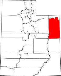 | |
| Town | ||
| CDPs | ||
| Unincorporated communities | ||
| Indian reservation | ||
| Ghost town | ||
| Footnotes | ‡This populated place also has portions in an adjacent county or counties | |