Ballard, Utah
| Ballard, Utah | |
|---|---|
| Town | |
 Location in Uintah County and the state of Utah | |
| Coordinates: 40°17′42″N 109°57′30″W / 40.29500°N 109.95833°WCoordinates: 40°17′42″N 109°57′30″W / 40.29500°N 109.95833°W | |
| Country | United States |
| State | Utah |
| County | Uintah |
| Settled | c. 1905 |
| Named for | Melvin J. Ballard |
| Area | |
| • Total | 14.0 sq mi (36.3 km2) |
| • Land | 14.0 sq mi (36.3 km2) |
| • Water | 0.0 sq mi (0.0 km2) |
| Elevation | 5,049 ft (1,539 m) |
| Population (2012) | |
| • Total | 868 |
| • Density | 14.0/sq mi (5.4/km2) |
| Time zone | MST (UTC-7) |
| • Summer (DST) | MDT (UTC-6) |
| ZIP code | 84066 |
| Area code(s) | 435 |
| FIPS code | 49-03345[1] |
| GNIS feature ID | 1455969[2] |
Ballard is a town in Uintah County, Utah, United States. The population was 566 at the 2000 census, a decrease of 78 persons from the 1990 population of 644.
Geography
According to the United States Census Bureau, the town has a total area of 14.0 square miles (36.3 km²), all of it land.
Demographics
| Historical population | |||
|---|---|---|---|
| Census | Pop. | %± | |
| 1980 | 558 | — | |
| 1990 | 644 | 15.4% | |
| 2000 | 566 | −12.1% | |
| 2010 | 801 | 41.5% | |
| Est. 2015 | 1,106 | [3] | 38.1% |
As of the census[1] of 2000, there were 566 people, 181 households, and 146 families residing in the town. The population density was 40.4 people per square mile (15.6/km²). There were 196 housing units at an average density of 14.0 per square mile (5.4/km²). The racial makeup of the town was 95.41% White, 0.18% African American, 3.00% Native American, 0.53% from other races, and 0.88% from two or more races. Hispanic or Latino of any race were 1.41%.
There were 181 households out of which 47.0% had children under the age of 18 living with them, 70.7% were married couples living together, 3.9% had a female householder with no husband present, and 19.3% were non-families. 18.2% of all households were made up of individuals and 7.7% had someone living alone who was 65 years of age or older. The average household size was 3.13 and the average family size was 3.58.
In the town the population was spread out with 34.6% under the age of 18, 10.2% from 18 to 24, 26.5% from 25 to 44, 20.3% from 45 to 64, and 8.3% who were 65 years of age or older. The median age was 30 years. For every 100 females there were 108.9 males.
The median income for a household in the town was $35,278, and the median income for a family was $36,484. Males had a median income of $29,875 versus $17,361 for females. The per capita income for the town was $12,620. About 7.7% of families and 8.5% of the population were below the poverty line, including 6.8% of those under age 18 and 17.0% of those age 65 or over.
References
- 1 2 "American FactFinder". United States Census Bureau. Archived from the original on September 11, 2013. Retrieved 2008-01-31.
- ↑ "US Board on Geographic Names". United States Geological Survey. 2007-10-25. Retrieved 2008-01-31.
- ↑ "Annual Estimates of the Resident Population for Incorporated Places: April 1, 2010 to July 1, 2015". Retrieved July 2, 2016.
- ↑ "Census of Population and Housing". Census.gov. Archived from the original on May 11, 2015. Retrieved June 4, 2015.
 |
Ashley National Forest |
Ashley National Forest |
Ashley National Forest / Manila | |
| Roosevelt | |
Vernal Naples | ||
| ||||
| | ||||
| Myton | Green River / Green River | Green River / |
Municipalities and communities of Uintah County, Utah, United States | ||
|---|---|---|
| Cities | 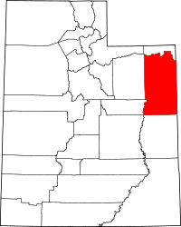 | |
| Town | ||
| CDPs | ||
| Unincorporated communities | ||
| Indian reservation | ||
| Ghost town | ||
| Footnotes | ‡This populated place also has portions in an adjacent county or counties | |