White Signal, New Mexico
| White Signal, New Mexico | |
|---|---|
| Census-designated place | |
 White Signal, New Mexico | |
| Coordinates: 32°33′21″N 108°21′58″W / 32.55583°N 108.36611°WCoordinates: 32°33′21″N 108°21′58″W / 32.55583°N 108.36611°W | |
| Country | United States |
| State | New Mexico |
| County | Grant |
| Area[1] | |
| • Total | 6.442 sq mi (16.68 km2) |
| • Land | 6.433 sq mi (16.66 km2) |
| • Water | 0.009 sq mi (0.02 km2) |
| Elevation | 5,978 ft (1,822 m) |
| Population (2010)[1] | |
| • Total | 181 |
| • Density | 28/sq mi (11/km2) |
| Time zone | Mountain (MST) (UTC-7) |
| • Summer (DST) | MDT (UTC-6) |
| Area code(s) | 575 |
| GNIS feature ID | 899990[2] |
White Signal is a census-designated place in Grant County, New Mexico, United States. Its population was 181 as of the 2010 census.[1] New Mexico State Road 90 passes through the community.
White Signal was named for a nearby outcropping of reflective white quartz; early residents thought the reflected sunlight resembled a signal. The community had a post office from 1909 to 1933.[3]
Geography
White Signal is located at 32°34′04″N 108°20′57″W / 32.567728°N 108.349028°W. According to the U.S. Census Bureau, the community has an area of 6.442 square miles (16.68 km2); 6.433 square miles (16.66 km2) of its area is land and 0.009 square miles (0.023 km2) is water.[1]
References
- 1 2 3 4 "2010 Census Gazetteer Files - Places: New Mexico". U.S. Census Bureau. Retrieved August 22, 2014.
- ↑ "White Signal". Geographic Names Information System. United States Geological Survey.
- ↑ Julyan, Robert Hixson (January 1, 1996). The Place Names of New Mexico. UNM Press. p. 379. ISBN 9780826316899.
Municipalities and communities of Grant County, New Mexico, United States | ||
|---|---|---|
| City | 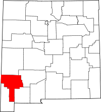 | |
| Towns | ||
| Village | ||
| CDPs | ||
| Other unincorporated communities | ||
| Ghost towns | ||
This article is issued from Wikipedia - version of the 8/22/2014. The text is available under the Creative Commons Attribution/Share Alike but additional terms may apply for the media files.