Separ, New Mexico
| Separ | |
|---|---|
| Unincorporated community | |
 Separ  Separ Location within the state of New Mexico | |
| Coordinates: 32°12′03″N 108°25′20″W / 32.20083°N 108.42222°WCoordinates: 32°12′03″N 108°25′20″W / 32.20083°N 108.42222°W | |
| Country | United States |
| State | New Mexico |
| County | Grant |
| Elevation[1] | 4,501 ft (1,372 m) |
| Time zone | Mountain (MST) (UTC-7) |
| • Summer (DST) | MDT (UTC-6) |
| ZIP codes | 88045 |
| Area code(s) | 575 |
| GNIS feature ID | 899905 |
Separ is an unincorporated community in Grant County in the bootheel of southwestern New Mexico, in the southwestern United States. Although it currently has a small population, it is considered a ghost town.[2] Separ lies in the endorheic Guzmán Basin; as a result the continental divide passes both to the west and east of it. Located alongside the tracks of the Union Pacific, it flouished in the late 19th and early 20th century as a watering station and livestock transfer point. Separ is located alongside Interstate 10, about 20 miles southeast of Lordsburg and 48 miles west of Deming. Today it is a "service point for truck and car traffic."[3]
History
Separ was a watering and overnight stop on the Janos Trail, that conveyed copper ore south to smelters in Chihuahua and mining equipment and trade goods north to the copper mines.[2] It was originally called Sepas.[2][4] When the railroad came through in the 1880s, it became a loading station for cattle.
At about 8:00 pm, on July 20, 1896, the outlaw Black Jack Christian and his High Five Gang robbed a general store in Separ belonging to John D. Weems. Bob Hayes and Bob Christian probably waited outside to watch the horses and keep a lookout while Black Jack, George Musgrave and Code Young went in with masks over their faces. The bandits took about $300 dollars in cash and merchandise, including a large Navajo blanket, six wool blankets, three boxes of cigars, and some cigars. A couple of months later, the Navajo blanket was located at a residence in the foothills of the Chiricahua Mountains. Code Young had given it away.[5]
In March 1905, George and Edwin Gates, two infamous outlaws, were killed in Separ.[6]
Notes
- ↑ U.S. Geological Survey Geographic Names Information System: Separ, New Mexico
- 1 2 3 Julyan, Robert (1998) "Separ" The Place Names of New Mexico (revised edition) University of New Mexico Press, Albuquerque, New Mexico, page 331, ISBN 0-8263-1689-1
- ↑ Julyan, Robert; Till, Tom and Stone, William (2001) New Mexico's Continental Divide Trail: The Official Guide Westcliffe Publishers, Englewood, Colorado, page 75, ISBN 1-56579-331-5
- ↑ Pearce, T. M. (1965) "Separ" New Mexico place names; a geographical dictionary University of New Mexico Press, Albuquerque, New Mexico, page 153, OCLC 420847
- ↑ http://www.jcs-group.com/oldwest/outlaw/musgrave.html
- ↑ Burton, Jeffrey (2009) The deadliest outlaws: the Ketchum gang and the Wild Bunch (second edition) University of North Texas Press, Denton, Texas, page 450, ISBN 978-1-57441-270-3
External links
Municipalities and communities of Grant County, New Mexico, United States | ||
|---|---|---|
| City | 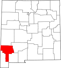 | |
| Towns | ||
| Village | ||
| CDPs | ||
| Other unincorporated communities | ||
| Ghost towns |
| |