Wendell, Massachusetts
| Wendell, Massachusetts | ||
|---|---|---|
| Town | ||
|
Wendell Meetinghouse | ||
| ||
 Location in Franklin County in Massachusetts | ||
| Coordinates: 42°32′53″N 72°23′50″W / 42.54806°N 72.39722°WCoordinates: 42°32′53″N 72°23′50″W / 42.54806°N 72.39722°W | ||
| Country | United States | |
| State | Massachusetts | |
| County | Franklin | |
| Settled | 1754 | |
| Incorporated | 1781 | |
| Government | ||
| • Type | Open town meeting | |
| Area | ||
| • Total | 32.2 sq mi (83.4 km2) | |
| • Land | 31.9 sq mi (82.5 km2) | |
| • Water | 0.4 sq mi (1.0 km2) | |
| Elevation | 1,164 ft (355 m) | |
| Population (2010) | ||
| • Total | 848 | |
| • Density | 26/sq mi (10/km2) | |
| Time zone | Eastern (UTC-5) | |
| • Summer (DST) | Eastern (UTC-4) | |
| ZIP code | 01379 | |
| Area code(s) | 351 / 978 | |
| FIPS code | 25-74525 | |
| GNIS feature ID | 0618178 | |
| Website |
www | |


Wendell is a town in Franklin County, Massachusetts, United States. The population was 848 at the 2010 census.[1] It is part of the Springfield, Massachusetts Metropolitan Statistical Area.
History
Wendell was first settled in 1754 and was officially incorporated in 1781. It was named after Judge Oliver Wendell of Boston.[2] The town center has been listed as a historic district on the National Register of Historic Places.
On July 11, 2006, a strong F2 tornado moved through town, starting near Wickett Pond, traveling about 2.9 miles (4.7 km), and ending about a half mile east of New Salem Road. The path varied in width from 100 to 300 yards (91 to 274 m). The tornado knocked down trees, including an old maple tree, whose falling damaged gravestones in a historic cemetery in Wendell Center. While trees were downed and some structures damaged, no one was injured.[3]
Geography
According to the United States Census Bureau, the town has a total area of 32.2 square miles (83.4 km2), of which 31.9 square miles (82.5 km2) is land and 0.39 square miles (1.0 km2), or 1.15%, is water.[4]
The town has two post offices.[5] One (zip code 01379) is located approximately one mile south of the town center on Lockes Village Road, the other is listed as "Wendell Depot" (zip code 01380) -- near the location of the old train station in the days of passenger rail -- and the town is often listed as such on maps.
Wendell State Forest

Located south of the Millers River, Wendell State Forest covers 7,566 acres of rolling forested hills, streams, ponds, and trails. Purchased in the 1920s the area had been heavily burned during the early 1900s. Some of the park development and most of the road systems are attributed to Civilian Conservation Corps activities in the 1930s. Ruggles Pond is the main day-use area. This 10 acre pond offers crystal clear water for swimming and fishing. Picnic sites and a ball field with a pavilion are located nearby. There is a small boat launching ramp located at the Northern end of Wickett Pond. The Metacomet-Monadnock Trail traverses the forest boundaries and offers a small Adirondack shelter for trail users.[6]
Events
- Wendell Old Home Day. Every summer, the Wendell community celebrates their wonderful, unique and creative community! The day kicks of with the kids parade then a full day of events including crafts and tag sales, a farmer's market, kids games and lots of great food booths. Throughout the afternoon enjoy musical events featuring gifted local musicians. [7]
- Wendell Full Moon Coffee House. The longest running Non-Profit venue in New England, where Every Show is for the Benefit of Local Environmental and Service Organizations.[8]
- Mount Mineral Music Festival. World Music Festival 1st week of June in the Hills of Wendell, Ma.[9]
- Deja Brew. A local brew pub with frequent musical events. [10]
- The Shadow Twisters. Top area Classic Rock combo headquartered in Wendell, plays at the Brew the first Saturday of every month. [11]
- North Quabbin Garlic and Arts Festival. Held in nearby Orange, MA The Garlic and Arts Festival is a weekend of fun, food, and fantastic community. Peace, Love and Garlic![13]
Demographics
| Historical population | ||
|---|---|---|
| Year | Pop. | ±% |
| 1840 | 844 | — |
| 1850 | 920 | +9.0% |
| 1860 | 704 | −23.5% |
| 1870 | 539 | −23.4% |
| 1880 | 465 | −13.7% |
| 1890 | 505 | +8.6% |
| 1900 | 492 | −2.6% |
| 1910 | 502 | +2.0% |
| 1920 | 346 | −31.1% |
| 1930 | 353 | +2.0% |
| 1940 | 391 | +10.8% |
| 1950 | 342 | −12.5% |
| 1960 | 292 | −14.6% |
| 1970 | 405 | +38.7% |
| 1980 | 694 | +71.4% |
| 1990 | 899 | +29.5% |
| 2000 | 986 | +9.7% |
| 2010 | 848 | −14.0% |
Source: United States Census records and Population Estimates Program data.[14][15][16][17][18][19][20][21][22][23] | ||
As of the census[24] of 2000, there were 986 people, 378 households, and 224 families residing in the town. The population density was 30.8 people per square mile (11.9/km²). There were 439 housing units at an average density of 13.7 per square mile (5.3/km²). The racial makeup of the town was 92.49% White, 3.45% African American, 0.41% Asian, 1.32% from other races, and 2.33% from two or more races. Hispanic or Latino of any race were 1.42% of the population.
There were 378 households out of which 27.0% had children under the age of 18 living with them, 43.7% were married couples living together, 10.6% had a female householder with no husband present, and 40.5% were non-families. 28.6% of all households were made up of individuals and 3.7% had someone living alone who was 65 years of age or older. The average household size was 2.35 and the average family size was 2.88.
In the town the population was spread out with 25.7% under the age of 18, 7.3% from 18 to 24, 30.6% from 25 to 44, 31.8% from 45 to 64, and 4.6% who were 65 years of age or older. The median age was 38 years. For every 100 females there were 106.7 males. For every 100 females age 18 and over, there were 102.5 males.
The median income for a household in the town was $43,846, and the median income for a family was $60,147. Males had a median income of $32,639 versus $27,375 for females. The per capita income for the town was $19,701. About 5.8% of families and 10.2% of the population were below the poverty line, including 8.2% of those under age 18 and 17.6% of those age 65 or over.
References
- ↑ "Profile of General Population and Housing Characteristics: 2010 Demographic Profile Data (DP-1): Wendell town, Franklin County, Massachusetts". U.S. Census Bureau, American Factfinder. Retrieved August 29, 2012.
- ↑ "Profile for Wendell, Massachusetts". ePodunk. Retrieved 2010-05-03.
- ↑ "Officials confirm tornado struck town of Wendell". The Republican. July 13, 2006.
- ↑ "Geographic Identifiers: 2010 Demographic Profile Data (G001): Wendell town, Franklin County, Massachusetts". U.S. Census Bureau, American Factfinder. Retrieved August 29, 2012.
- ↑ https://tools.usps.com/go/POLocatorDetailsAction!input?longitude=-72.401019&state=MA&address2=&tollFree=800-ASK-USPS%26reg%3B%26nbsp%3B(800-275-8777)&address1=59+LOCKES+VILLAGE+RD&locationName=WENDELL&locationID=1386902&city=WENDELL&radius=60&latitude=42.5417496&zip5=01379&locationType=po&zip4=9998&address=01944
- ↑ http://www.mass.gov/eea/agencies/dcr/massparks/region-central/wendell-state-forest.html
- ↑ http://www.wendellmass.us/index.php/community/groups-organizations-and-spaces/old-home-day.html
- ↑ http://www.wendellfullmoon.org/
- ↑ https://www.facebook.com/MountMineralMusicFestival/info/?tab=overview
- ↑ http://dejabrewpub.com/
- ↑ https://www.theshadowtwisters.com
- ↑ http://www.wendellmass.us/index.php/community.html
- ↑ https://garlicandarts.org/
- ↑ "TOTAL POPULATION (P1), 2010 Census Summary File 1". American FactFinder, All County Subdivisions within Massachusetts. United States Census Bureau. 2010.
- ↑ "Massachusetts by Place and County Subdivision - GCT-T1. Population Estimates". United States Census Bureau. Retrieved July 12, 2011.
- ↑ "1990 Census of Population, General Population Characteristics: Massachusetts" (PDF). US Census Bureau. December 1990. Table 76: General Characteristics of Persons, Households, and Families: 1990. 1990 CP-1-23. Retrieved July 12, 2011.
- ↑ "1980 Census of the Population, Number of Inhabitants: Massachusetts" (PDF). US Census Bureau. December 1981. Table 4. Populations of County Subdivisions: 1960 to 1980. PC80-1-A23. Retrieved July 12, 2011.
- ↑ "1950 Census of Population" (PDF). Bureau of the Census. 1952. Section 6, Pages 21-10 and 21-11, Massachusetts Table 6. Population of Counties by Minor Civil Divisions: 1930 to 1950. Retrieved July 12, 2011.
- ↑ "1920 Census of Population" (PDF). Bureau of the Census. Number of Inhabitants, by Counties and Minor Civil Divisions. Pages 21-5 through 21-7. Massachusetts Table 2. Population of Counties by Minor Civil Divisions: 1920, 1910, and 1920. Retrieved July 12, 2011.
- ↑ "1890 Census of the Population" (PDF). Department of the Interior, Census Office. Pages 179 through 182. Massachusetts Table 5. Population of States and Territories by Minor Civil Divisions: 1880 and 1890. Retrieved July 12, 2011.
- ↑ "1870 Census of the Population" (PDF). Department of the Interior, Census Office. 1872. Pages 217 through 220. Table IX. Population of Minor Civil Divisions, &c. Massachusetts. Retrieved July 12, 2011.
- ↑ "1860 Census" (PDF). Department of the Interior, Census Office. 1864. Pages 220 through 226. State of Massachusetts Table No. 3. Populations of Cities, Towns, &c. Retrieved July 12, 2011.
- ↑ "1850 Census" (PDF). Department of the Interior, Census Office. 1854. Pages 338 through 393. Populations of Cities, Towns, &c. Retrieved July 12, 2011.
- ↑ "American FactFinder". United States Census Bureau. Retrieved 2008-01-31.
External links
| Wikimedia Commons has media related to Wendell, Massachusetts. |
Municipalities and communities of Franklin County, Massachusetts, United States | ||
|---|---|---|
| City | 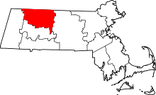 | |
| Towns | ||
| CDPs | ||
| Other villages | ||
| Former inhabited places | ||