Leyden, Massachusetts
| Leyden, Massachusetts | ||
|---|---|---|
| Town | ||
|
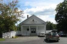
Frizzell Hill, looking west towards the town center | ||
| ||
 Location in Franklin County in Massachusetts | ||
| Coordinates: 42°41′54″N 72°37′39″W / 42.69833°N 72.62750°W | ||
| Country | United States | |
| State | Massachusetts | |
| County | Franklin | |
| Settled | 1738 | |
| Incorporated | 1809 | |
| Government | ||
| • Type | Open town meeting | |
| Area | ||
| • Total | 18.0 sq mi (46.7 km2) | |
| • Land | 17.9 sq mi (46.4 km2) | |
| • Water | 0.1 sq mi (0.3 km2) | |
| Elevation | 928 ft (283 m) | |
| Population (2010) | ||
| • Total | 711 | |
| • Density | 39/sq mi (15/km2) | |
| Time zone | Eastern (UTC-5) | |
| • Summer (DST) | Eastern (UTC-4) | |
| ZIP code | 01301/01337 | |
| Area code(s) | 413 | |
| FIPS code | 25-35285 | |
| GNIS feature ID | 0618169 | |
| Website |
www | |


Leyden is a town in Franklin County, Massachusetts, United States. The population was 711 at the 2010 census.[1] It is part of the Springfield, Massachusetts Metropolitan Statistical Area.
History
Leyden was first settled in 1737 as part of "Fall Town", which also included Bernardston and Colrain. The town was set off from Bernardston in 1784, but it was not incorporated until February 22, 1809. The town was named for the city of Leiden, Netherlands, refuge of the Pilgrims before colonizing the Americas.[2] Leyden had several small industries in the eighteenth century, including grist mills, wood product mills, and dairying, but today the largest industry is maple sugar production. The town also has a reservoir which supplies the town of Greenfield.[3] The Brotherhood of the Spirit commune was founded in Leyden in 1968.
Geography
According to the United States Census Bureau, the town has a total area of 18.0 square miles (46.7 km2), of which 17.9 square miles (46.4 km2) is land and 0.12 square miles (0.3 km2), or 0.66%, is water.[4] Leyden lies on the northern Massachusetts border, south of Windham County, Vermont. The town is bordered by Guilford, Vermont, to the north, Bernardston to the east, Greenfield to the south, and Colrain to the west. The town center lies 9 miles (14 km) north of Greenfield, 47 miles (76 km) north of Springfield, and 96 miles (154 km) west-northwest of Boston.
Leyden lies along the eastern edge of the Berkshires, with the town mostly lying along the valleys of the Green River (which also forms the western border) and the branches of Glen Brook. The majority of the town away from the brooks is forested, and the town has a small state forest and a wildlife management area within its borders. The confluence of the main and east branches of Glen Brook is dammed to form the Greenfield Reservoir, before the brook flows southward into Greenfield and meets the Green River.
Leyden is one of only a handful of towns in Massachusetts which does not have any state routes (nearly half of such towns are on the islands of Nantucket, Martha's Vineyard and the Elizabeth Islands). There are state routes, U.S. routes and interstates in the neighboring towns, with Interstate 91 passing to the south and east of town. The nearest bus and passenger train service is in Greenfield, and the nearest small air service in Turners Falls. The nearest national air service is at Bradley International Airport in Windsor Locks, Connecticut.
Demographics
| Historical population | ||
|---|---|---|
| Year | Pop. | ±% |
| 1840 | 646 | — |
| 1850 | 2,253 | +248.8% |
| 1860 | 606 | −73.1% |
| 1870 | 518 | −14.5% |
| 1880 | 507 | −2.1% |
| 1890 | 407 | −19.7% |
| 1900 | 379 | −6.9% |
| 1910 | 363 | −4.2% |
| 1920 | 330 | −9.1% |
| 1930 | 261 | −20.9% |
| 1940 | 260 | −0.4% |
| 1950 | 306 | +17.7% |
| 1960 | 343 | +12.1% |
| 1970 | 376 | +9.6% |
| 1980 | 498 | +32.4% |
| 1990 | 662 | +32.9% |
| 2000 | 772 | +16.6% |
| 2010 | 711 | −7.9% |
Source: United States Census records and Population Estimates Program data.[5][6][7][8][9][10][11][12][13][14] | ||
As of the census[15] of 2000, there were 772 people, 277 households, and 219 families residing in the town. By population, Leyden ranked 22nd out of the 26 towns in Franklin County, and 333rd out of 351 cities and towns in Massachusetts. The population density was 42.9 people per square mile (16.6/km²), which ranked 18th in the county and 316th in the Commonwealth. There were 306 housing units at an average density of 17.0 per square mile (6.6/km²). The racial makeup of the town was 98.45% White, 0.39% African American, 0.26% Native American, 0.13% Asian, and 0.78% from two or more races. Hispanic or Latino of any race were 0.26% of the population.
There were 277 households out of which 37.5% had children under the age of 18 living with them, 68.2% were married couples living together, 6.1% had a female householder with no husband present, and 20.6% were non-families. 16.2% of all households were made up of individuals and 4.7% had someone living alone who was 65 years of age or older. The average household size was 2.78 and the average family size was 3.08.
In the town the population was spread out with 26.9% under the age of 18, 6.1% from 18 to 24, 28.5% from 25 to 44, 30.7% from 45 to 64, and 7.8% who were 65 years of age or older. The median age was 40 years. For every 100 females there were 102.1 males. For every 100 females age 18 and over, there were 102.2 males.
The median income for a household in the town was $50,385, and the median income for a family was $53,750. Males had a median income of $40,192 versus $29,659 for females. The per capita income for the town was $26,076. About 3.4% of families and 4.7% of the population were below the poverty line, including 7.7% of those under age 18 and 3.0% of those age 65 or over.
Government
Leyden employs the open town meeting form of government, and is led by a board of selectmen and an administrative assistant. Leyden has its own police and fire departments, as well as a library connected to the regional library network. The nearest hospital, Franklin Medical Center, is in neighboring Greenfield, as are most of the nearest state services.
On the state level, Leyden is represented in the Massachusetts House of Representatives as part of the Second Berkshire district, represented by Paul Mark, which covers central Berkshire County, as well as portions of Hampshire and Franklin Counties. In the Massachusetts Senate, the town is part of the Hampshire and Franklin district, represented by Stan Rosenberg, which includes most of eastern Franklin County and much of eastern Hampshire County.[16] The town is patrolled by the Second (Shelburne Falls) Station of Troop "B" of the Massachusetts State Police.[17]
On the national level, Leyden is represented in the United States House of Representatives as part of Massachusetts's 1st congressional district, by Richard Neal. John Olver of Amherst who represented the town in the House from June 1991 to January 2013, retired when redistricting placed him and Rep. Neal in the same district. Massachusetts is represented in the United States Senate by senior Senator Elizabeth Warren (D) and junior Senator Ed Markey (D), who won a special election in June 2013 to fill the seat vacated by Secretary of State John Kerry.
Education
Leyden is a member of the Pioneer Valley Regional School District, which includes several northern border towns to the east. The district is essentially operated in two portions; the towns each have their own semi-independent elementary schools, with students attending Pioneer Valley Regional School in Northfield from seventh through twelfth grades. Students in Leyden attend the Pearl E. Rhodes Elementary School from pre-kindergarten through sixth grade. There are private, parochial and charter schools in Greenfield and other nearby communities, with the most prominent private school being Deerfield Academy in nearby Deerfield.
The nearest community college, Greenfield Community College, is located in Greenfield. The nearest state college is Massachusetts College of Liberal Arts in North Adams, and the nearest state university is the University of Massachusetts Amherst. The nearest private colleges, including members of the Five Colleges and Seven Sisters, are located southeast in the Northampton area.
Notable residents
- Henry Kirke Brown (1814–1886), sculptor, most notably for the equestrian statues of Winfield Scott in Scott Circle, Washington, D.C., and George Washington at Union Square in New York City
- Charles C. Carpenter (1834–1899), United States Navy rear admiral, rose to command of the Asiatic Squadron
- John Leonard Riddell (1807–1865), noted scientist, author and politician, invented the binocular microscope[18] and was melter and refiner at the New Orleans Mint during the American Civil War
References
- ↑ "Profile of General Population and Housing Characteristics: 2010 Demographic Profile Data (DP-1): Leyden town, Franklin County, Massachusetts". U.S. Census Bureau, American Factfinder. Archived from the original on September 11, 2013. Retrieved August 28, 2012.
- ↑ Gannett, Henry (1905). The Origin of Certain Place Names in the United States. U.S. Government Printing Office. p. 186.
- ↑ Town of Leyden - Franklin County Chamber of Commerce
- ↑ "Geographic Identifiers: 2010 Demographic Profile Data (G001): Leyden town, Franklin County, Massachusetts". U.S. Census Bureau, American Factfinder. Archived from the original on September 11, 2013. Retrieved August 28, 2012.
- ↑ "TOTAL POPULATION (P1), 2010 Census Summary File 1". American FactFinder, All County Subdivisions within Massachusetts. United States Census Bureau. 2010.
- ↑ "Massachusetts by Place and County Subdivision - GCT-T1. Population Estimates". United States Census Bureau. Retrieved July 12, 2011.
- ↑ "1990 Census of Population, General Population Characteristics: Massachusetts" (PDF). US Census Bureau. December 1990. Table 76: General Characteristics of Persons, Households, and Families: 1990. 1990 CP-1-23. Retrieved July 12, 2011.
- ↑ "1980 Census of the Population, Number of Inhabitants: Massachusetts" (PDF). US Census Bureau. December 1981. Table 4. Populations of County Subdivisions: 1960 to 1980. PC80-1-A23. Retrieved July 12, 2011.
- ↑ "1950 Census of Population" (PDF). Bureau of the Census. 1952. Section 6, Pages 21-10 and 21-11, Massachusetts Table 6. Population of Counties by Minor Civil Divisions: 1930 to 1950. Retrieved July 12, 2011.
- ↑ "1920 Census of Population" (PDF). Bureau of the Census. Number of Inhabitants, by Counties and Minor Civil Divisions. Pages 21-5 through 21-7. Massachusetts Table 2. Population of Counties by Minor Civil Divisions: 1920, 1910, and 1920. Retrieved July 12, 2011.
- ↑ "1890 Census of the Population" (PDF). Department of the Interior, Census Office. Pages 179 through 182. Massachusetts Table 5. Population of States and Territories by Minor Civil Divisions: 1880 and 1890. Retrieved July 12, 2011.
- ↑ "1870 Census of the Population" (PDF). Department of the Interior, Census Office. 1872. Pages 217 through 220. Table IX. Population of Minor Civil Divisions, &c. Massachusetts. Retrieved July 12, 2011.
- ↑ "1860 Census" (PDF). Department of the Interior, Census Office. 1864. Pages 220 through 226. State of Massachusetts Table No. 3. Populations of Cities, Towns, &c. Retrieved July 12, 2011.
- ↑ "1850 Census" (PDF). Department of the Interior, Census Office. 1854. Pages 338 through 393. Populations of Cities, Towns, &c. Retrieved July 12, 2011.
- ↑ "American FactFinder". United States Census Bureau. Archived from the original on September 11, 2013. Retrieved 2008-01-31.
- ↑ List of Massachusetts Legislators by City and Town
- ↑ State Police Station B-2, Shelburne Falls
- ↑ Riddell JL (1854). "On the binocular microscope". Quart J Microsc Sci. 2: 18–24.
External links
| Wikimedia Commons has media related to Leyden, Massachusetts. |
Municipalities and communities of Franklin County, Massachusetts, United States | ||
|---|---|---|
| City | 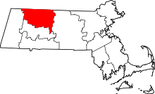 | |
| Towns | ||
| CDPs | ||
| Other villages | ||
| Former inhabited places | ||
Coordinates: 42°42′00″N 72°37′48″W / 42.70000°N 72.63000°W