Weleetka, Oklahoma
| Weleetka, Oklahoma | |
|---|---|
| Town | |
 Location of Weleetka, Oklahoma | |
| Coordinates: 35°20′44″N 96°8′5″W / 35.34556°N 96.13472°WCoordinates: 35°20′44″N 96°8′5″W / 35.34556°N 96.13472°W | |
| Country | United States |
| State | Oklahoma |
| County | Okfuskee |
| Area | |
| • Total | 0.7 sq mi (1.8 km2) |
| • Land | 0.7 sq mi (1.8 km2) |
| • Water | 0.0 sq mi (0.0 km2) |
| Elevation | 725 ft (221 m) |
| Population (2010) | |
| • Total | 998 |
| • Density | 1,425.7/sq mi (554.4/km2) |
| Time zone | Central (CST) (UTC-6) |
| • Summer (DST) | CDT (UTC-5) |
| ZIP code | 74880 |
| Area code(s) | 405 |
| FIPS code | 40-79800[1] |
| GNIS feature ID | 1099475[2] |
Weleetka is a town in Okfuskee County, Oklahoma, United States. It is about 10 miles (16 km) southeast of Okemah, the county seat. The name is a Creek word meaning "running water."[3] The population was 998 at the 2010 census, a decline of 1.6 percent from 1,014 at the 2000 census.[4]
Geography
Weleetka is located at 35°20′44″N 96°8′5″W / 35.34556°N 96.13472°W (35.345626, -96.134592).[5] It is 10 miles (16 km) seutheast of the county seat, Okemah. The townsite is on a horseshoe bend of the North Canadian River.[3]
According to the United States Census Bureau, the town has a total area of 0.7 square miles (1.8 km2), all land.
Demographics
| Historical population | |||
|---|---|---|---|
| Census | Pop. | %± | |
| 1910 | 1,229 | — | |
| 1920 | 1,588 | 29.2% | |
| 1930 | 2,042 | 28.6% | |
| 1940 | 1,904 | −6.8% | |
| 1950 | 1,548 | −18.7% | |
| 1960 | 1,231 | −20.5% | |
| 1970 | 1,199 | −2.6% | |
| 1980 | 1,195 | −0.3% | |
| 1990 | 1,112 | −6.9% | |
| 2000 | 1,014 | −8.8% | |
| 2010 | 998 | −1.6% | |
| Est. 2015 | 987 | [6] | −1.1% |
As of the census[1] of 2000, there were 1,014 people, 368 households, and 235 families residing in the town. The population density was 1,463.7 people per square mile (567.4/km²). There were 450 housing units at an average density of 649.6 per square mile (251.8/km²). The racial makeup of the town was 60.36% White, 6.31% African American, 23.77% Native American, 0.10% Asian, 1.08% from other races, and 8.38% from two or more races. Hispanic or Latino of any race were 2.66% of the population.
There were 368 households out of which 26.9% had children under the age of 18 living with them, 41.0% were married couples living together, 18.2% had a female householder with no husband present, and 36.1% were non-families. 34.2% of all households were made up of individuals and 19.0% had someone living alone who was 65 years of age or older. The average household size was 2.51 and the average family size was 3.20.
In the town the population was spread out with 25.9% under the age of 18, 8.3% from 18 to 24, 22.3% from 25 to 44, 23.4% from 45 to 64, and 20.1% who were 65 years of age or older. The median age was 40 years. For every 100 females there were 90.6 males. For every 100 females age 18 and over, there were 91.6 males.
The median income for a household in the town was $19,141, and the median income for a family was $26,917. Males had a median income of $23,542 versus $15,227 for females. The per capita income for the town was $12,103. About 22.3% of families and 27.9% of the population were below the poverty line, including 32.2% of those under age 18 and 18.7% of those age 65 or over.
History
Weleetka was once a major railroad town, serving as the division point for the Fort Smith and Western Railway. All train crews changed out in Weleetka; the town also housed major shops and repair facilities for the steam locomotives. Headquartered in Fort Smith, Arkansas, the Fort Smith and Western was a railroad that operated in the states of Arkansas and Oklahoma. The railroad's main line extended 217 miles, from Ft. Smith through Weleetka to Guthrie, Oklahoma. The Fort Smith and Western owned a subsidiary, St. Louis, El Reno and Western, which began operating 42 miles between Guthrie and El Reno, Oklahoma in June 1904. The railroad also acquired 32.5 miles of trackage rights over the Missouri-Kansas-Texas Railroad from Fallis, Oklahoma to Oklahoma City.
The railroad supported much of the business and hotels of the city in the first half of the 1900s. Trains entering town from the East were switched and broken down in Weleetka, and dispatched northwest for either Oklahoma City, Guthrie or El Reno. Due to the railroad yard in Weleetka, the single westbound train could thus become two westbound trains. The reverse was true for eastbound trains. Weleetka was vital to the life of the railroad. The railroad provided regular passenger service and at one time boasted through Pullman sleeping cars to and from St. Louis and Oklahoma City. The route of the FS&W served no major population centers, but did serve major coal mining operations in eastern Oklahoma at Coal Creek, Bokoshe, and McCurtain. Other towns served included Crowder, Okemah, Boley, Prague, Vernon, Indianola and Meridian. A major portion of the road's freight traffic was metallurgical-grade coal from San Bois Coal Company mines near McCurtain. As coal traffic declined, an oil discovery near Okemah brought additional traffic, which postponed the abandonment of the railroad. The Missouri-Kansas-Texas Railroad withdrew trackage rights between Fallis and Oklahoma City in January 1939 after FS&W defaulted on rental fees, and when the Fort Smith and Western ceased operations on February 9, 1939, Weleetka lost its major employer.
Notable person
- Weleetka is home to country singer Amber Hayes.[8]
- Ronnie Porter - Appeared on the October 7, 1983 episode of The Tonight Show Starring Johnny Carson discussing his job as the Weleetka police chief. He also made an appearance on Hee Haw and Paul Harvey's radio show.[9]
Weleetka murders
On June 8, 2008, 13-year-old Taylor Paschal-Placker and her best friend, Skyla Jade Whitaker, 11, were shot to death while walking along County Line Road in Weleetka. They were both shot by a .40-caliber Glock 22 pistol.
On December 9, 2011, 25-year-old Kevin Sweat of Henryetta was charged with the murders.[10]
References
- 1 2 "American FactFinder". United States Census Bureau. Archived from the original on 2013-09-11. Retrieved 2008-01-31.
- ↑ "US Board on Geographic Names". United States Geological Survey. 2007-10-25. Retrieved 2008-01-31.
- 1 2 Milbria Anglin."Weleetka." Encyclopedia of Oklahoma History and Culture. "Weleetka." Accessed September 8, 2012.
- ↑ CensusViewer:Weleetka, Oklahoma Population
- ↑ "US Gazetteer files: 2010, 2000, and 1990". United States Census Bureau. 2011-02-12. Retrieved 2011-04-23.
- ↑ "Annual Estimates of the Resident Population for Incorporated Places: April 1, 2010 to July 1, 2015". Retrieved July 2, 2016.
- ↑ "Census of Population and Housing". Census.gov. Archived from the original on May 11, 2015. Retrieved June 4, 2015.
- ↑ Brandy McDonnell, [http://blog.newsok.com/bamsblog/2012/10/25/country-artist-and-oklahoma-native-amber-hayes-releases-sophomore-ep-any-day-is-a-good-day/ "Country artist and Oklahoma native Amber Hayes releases sophomore EP 'Any Day Is a Good Day'", The Oklahoman, October 25, 2012.
- ↑ "Weleetka Chief Now "Hee-Haws' Old Car Problems". The Oklahoman. May 18, 1984. Retrieved February 1, 2016.
- ↑ http://www.foxnews.com/us/2011/12/09/25-year-old-man-charged-with-murder-in-2008-shooting-death-oklahoma-girls/
Further reading
- Poor's Manual of Railroads - 1919, Poor's Publishing Co., New York City.
- Drury, George H. (1985) Historical Guide to North American Railroads, Kalmbach Publishing Co., Milwaukee, Wisconsin. ISBN 0-89024-072-8
- Hull, Clifton E. (1988) Shortline Railroads of Arkansas, UCA Press, Conway, Arkansas. ISBN 0-944436-00-5
- Hofsommer, Donovan L. (1982) Railroads of Oklahoma, Oklahoma Historical Society, Oklahoma City, Oklahoma. ISBN 0-941498-27-1
Municipalities and communities of Okfuskee County, Oklahoma, United States | ||
|---|---|---|
| City | 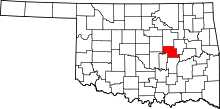 | |
| Towns | ||
| Unincorporated communities |
| |