Paden, Oklahoma
| Paden, Oklahoma | |
|---|---|
| Town | |
 Location of Paden, Oklahoma | |
| Coordinates: 35°30′26″N 96°34′7″W / 35.50722°N 96.56861°WCoordinates: 35°30′26″N 96°34′7″W / 35.50722°N 96.56861°W | |
| Country | United States |
| State | Oklahoma |
| County | Okfuskee |
| Government | |
| • Type | City Council |
| • Mayor | Clonda Rogers |
| Area | |
| • Total | 0.5 sq mi (1.2 km2) |
| • Land | 0.5 sq mi (1.2 km2) |
| • Water | 0.0 sq mi (0.0 km2) |
| Elevation | 997 ft (304 m) |
| Population (2000) | |
| • Total | 446 |
| • Density | 973.8/sq mi (376.0/km2) |
| Time zone | Central (CST) (UTC-6) |
| • Summer (DST) | CDT (UTC-5) |
| ZIP code | 74860 |
| Area code(s) | 405 |
| FIPS code | 40-56800[1] |
| GNIS feature ID | 1096379[2] |
Paden is a town in Okfuskee County, Oklahoma, United States. The population was 461 at the 2010 census. It is named for Paden Tolbert, a U.S. Deputy Marshal who served the area in the early 1900s.
History
It is the only town in the United States to be named for a Deputy U.S. Marshal. Paden can be found in the book "The Grapes Of Wrath" as a pit stop for the Joad family. The town was once a stop on the Fort Smith and Western Railway and was once a big oil boom town. Every June, the volunteer fire department hosts the Paden Fireman's Picnic, or known by the residents as Paden Day. The events include a small parade, barbecue and fish fry, and entertainment and door prizes. Most of the communities events revolve around the school. Paden public schools enroll approximately 200 students, K-12, each year. The mascot is the Pirate and their colors are orange/black. Sports include fall and spring baseball, fast and slow pitch softball, basketball, track, and academic team. The teams are a part of the Little River Conference and are usually in the Class B classification. The Paden Restoration Society and Paden Main Street Organization are two new groups in Paden. Paden has eleven churches in the community. Creek Indians, as well as Choctaw, Cherokee, Sac and Fox, and Seminole Indians, make up much of the population. The town's original land was given by a Creek Indian as part of their allotment. The Paden Indian Community has won the Creek Nations "Nene Hvkoce" walking program the last two years and has received a walking trail.
Geography
Paden, in east central Oklahoma, is located at 35°30′26″N 96°34′7″W / 35.50722°N 96.56861°W (35.507287, -96.568516).[3]
According to the United States Census Bureau, the town has a total area of 0.5 square miles (1.3 km2), all land.
Demographics
| Historical population | |||
|---|---|---|---|
| Census | Pop. | %± | |
| 1910 | 419 | — | |
| 1920 | 600 | 43.2% | |
| 1930 | 595 | −0.8% | |
| 1940 | 620 | 4.2% | |
| 1950 | 426 | −31.3% | |
| 1960 | 417 | −2.1% | |
| 1970 | 442 | 6.0% | |
| 1980 | 448 | 1.4% | |
| 1990 | 400 | −10.7% | |
| 2000 | 446 | 11.5% | |
| 2010 | 461 | 3.4% | |
| Est. 2015 | 459 | [4] | −0.4% |
As of the census[1] of 2010, there were 461 people, 199 households, and 134 families residing in the town. The population density was 973.8 people per square mile (374.4/km²). There were 234 housing units at an average density of 510.9 per square mile (197.3/km²). The racial makeup of the town was 54.68% White, 37.70% Native American, and 7.62% from two or more races. Hispanic or Latino of any race were 0.90% of the population.
There were 199 households out of which 27.6% had children under the age of 18 living with them, 45.7% were married couples living together, 16.6% had a female householder with no husband present, and 32.7% were non-families. 30.2% of all households were made up of individuals and 14.6% had someone living alone who was 65 years of age or older. The average household size was 2.32 and the average family size was 2.81.
In the town the population was spread out with 25.0% under the age of 18, 8.5% from 18 to 24, 28.5% from 25 to 44, 19.7% from 45 to 64, and 15.7% who were 65 years of age or older. The median age was 35 years. For every 100 females there were 89.0 males. For every 100 females age 18 and over, there were 85.6 males.
The median income for a household in the town was $27,321, and the median income for a family was $31,250. Males had a median income of $24,444 versus $20,972 for females. The per capita income for the town was $12,444. About 7.1% of families and 9.0% of the population were below the poverty line, including 10.2% of those under age 18 and 12.7% of those age 65 or over.
Notable people
- Ed Baecht, former major league baseball player, was born in Paden.[6]
- Dan Boren, U.S. Congressman and former resident.
References
- 1 2 "American FactFinder". United States Census Bureau. Retrieved 2008-01-31.
- ↑ "US Board on Geographic Names". United States Geological Survey. 2007-10-25. Retrieved 2008-01-31.
- ↑ "US Gazetteer files: 2010, 2000, and 1990". United States Census Bureau. 2011-02-12. Retrieved 2011-04-23.
- ↑ "Annual Estimates of the Resident Population for Incorporated Places: April 1, 2010 to July 1, 2015". Retrieved July 2, 2016.
- ↑ "Census of Population and Housing". Census.gov. Retrieved June 4, 2015.
- ↑ "Ed Baecht". Baseball-Reference.com. Retrieved August 31, 2012.
Municipalities and communities of Okfuskee County, Oklahoma, United States | ||
|---|---|---|
| City | 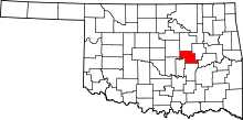 | |
| Towns | ||
| Unincorporated communities |
| |