Wanaku (Chuquisaca)
This article is about the mountain in the Chuquisaca Department, Bolivia. For other uses, see Wanaku.
| Wanaku | |
|---|---|
 Wanaku Location within Bolivia | |
| Highest point | |
| Elevation | 3,844 m (12,612 ft) [1] |
| Coordinates | 19°40′32″S 64°38′45″W / 19.67556°S 64.64583°WCoordinates: 19°40′32″S 64°38′45″W / 19.67556°S 64.64583°W |
| Geography | |
| Location |
Bolivia, Chuquisaca Department |
| Parent range | Andes |
Wanaku (Aymara and Quechua for guanaco,[2][3] also spelled Huanaco) is a 3,844 m (12,612 ft) high mountain in the Bolivian Andes. It is located in the Chuquisaca Department, Azurduy Province, Tarvita Municipality. Wanaku lies south of Wanaku Kimray, northwest of the village of Panti Pampa.[1][4]
References
- 1 2 Bolivian IGM map 1:50,000 Río San José 6634-I
- ↑ Radio San Gabriel, "Instituto Radiofonico de Promoción Aymara" (IRPA) 1993, Republicado por Instituto de las Lenguas y Literaturas Andinas-Amazónicas (ILLLA-A) 2011, Transcripción del Vocabulario de la Lengua Aymara, P. Ludovico Bertonio 1612 (Spanish-Aymara-Aymara-Spanish dictionary)
- ↑ Teofilo Laime Ajacopa, Diccionario Bilingüe Iskay simipi yuyayk'ancha, La Paz, 2007 (Quechua-Spanish dictionary)
- ↑ "Tarvita". INE, Bolivia. Retrieved April 24, 2016.
Capital: Sucre | ||
| Provinces | 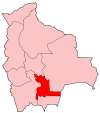 | |
| Municipalities and seats |
| |
This article is issued from Wikipedia - version of the 6/10/2016. The text is available under the Creative Commons Attribution/Share Alike but additional terms may apply for the media files.