Wagontown, Pennsylvania
| Wagontown, Pennsylvania | |
|---|---|
| Unincorporated community | |
 Wagontown | |
| Coordinates: 40°00′38″N 75°50′34″W / 40.01056°N 75.84278°WCoordinates: 40°00′38″N 75°50′34″W / 40.01056°N 75.84278°W | |
| Country | United States |
| State | Pennsylvania |
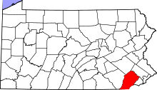
| County | Chester |
| Township | West Caln |
| Elevation | 525 ft (160 m) |
| Time zone | Eastern (EST) (UTC-5) |
| • Summer (DST) | EDT (UTC-4) |
| ZIP code | 19376 |
| Area code(s) | 610 & 484 |
| GNIS feature ID | 1190483[1] |
Wagontown is an unincorporated community in West Caln Township, Chester County, Pennsylvania, United States.[1] Wagontown is located along Pennsylvania Route 340 2.15 miles (3.46 km) north-northwest of Coatesville.[2] Wagontown has a post office with ZIP code 19376.[3] The Hibernia House, which is listed on the National Register of Historic Places, is located near Wagontown.[4]
References
- 1 2 "Wagontown". Geographic Names Information System. United States Geological Survey.
- ↑ Chester County, Pennsylvania General Highway Map (PDF) (Map). Pennsylvania Department of Transportation. 2012. Retrieved December 6, 2012.
- ↑ United States Postal Service (2012). "USPS - Look Up a ZIP Code". Retrieved 2012-02-15.
- ↑ National Park Service (2010-07-09). "National Register Information System". National Register of Historic Places. National Park Service.
This article is issued from Wikipedia - version of the 4/22/2015. The text is available under the Creative Commons Attribution/Share Alike but additional terms may apply for the media files.