Birmingham Township, Chester County, Pennsylvania
| Birmingham Township, Pennsylvania | |
| Township | |
 Birmingham Friends Meeting | |
| Country | United States |
|---|---|
| State | Pennsylvania |
| County | Chester |
| Elevation | 249 ft (75.9 m) |
| Coordinates | 39°54′30″N 75°36′55″W / 39.90833°N 75.61528°WCoordinates: 39°54′30″N 75°36′55″W / 39.90833°N 75.61528°W |
| Area | 6.5 sq mi (16.8 km2) |
| - land | 6.4 sq mi (17 km2) |
| - water | 0.1 sq mi (0 km2), 1.54% |
| Population | 4,208 (2010) |
| Density | 657.5/sq mi (253.9/km2) |
| Timezone | EST (UTC-5) |
| - summer (DST) | EDT (UTC-4) |
| Area code | 610 |
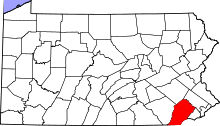
 Location in Chester County and the state of Pennsylvania.
| |
.svg.png) Location of Pennsylvania in the United States
| |
| Website: http://www.birminghamtownship.org | |
Birmingham Township is a township in Chester County, Pennsylvania, United States. The population was 4,208 at the 2010 census.
History
Birmingham Township was the site of the Battle of Brandywine, September 11, 1777, during the American Revolutionary War. Over 18,000 men were engaged. It was, until that time, the largest land battle on the North American continent. Birmingham Friends Meeting, founded in 1690, is the location of a common grave of both American and British casualties. Much of the original battlefield around the meeting is preserved to this day. Birmingham is the oldest township in Chester County. The township was recently rated by Philadelphia magazine as one of the top five Best Places to Live in the suburbs of Philadelphia and as the "Place with the Biggest Paychecks".[1]
The Lenape Bridge, Birmingham Friends Meetinghouse and School, Brinton's Mill, Edward Brinton House, George Brinton House, Daniel Davis House and Barn, Dilworthtown Historic District, Edgewood, Orthodox Meetinghouse, and Sharpless Homestead are listed on the National Register of Historic Places.[2]
Geography
According to the United States Census Bureau, the township has a total area of 6.5 square miles (17 km2), of which 6.4 square miles (17 km2) is land and 0.1 square miles (0.26 km2), or 1.23%, is water. It is mainly composed of farmland and rolling hills, but several small communities also exist. A small non-contiguous piece of land within the great bend of Brandywine Creek is included in the township.[3] It does not include any roads, but does include a railroad, and borders Christiana Hundred in New Castle County, Delaware, on the south and Chadds Ford Township, Delaware County, in all other directions.
Adjacent townships
- Pennsbury Township, Chester County (southwest)
- Pocopson Township, Chester County (west)
- East Bradford Township, Chester County (north)
- Westtown Township, Chester County (northeast)
- Thornbury Township, Chester County (east)
- Thornbury Township, Delaware County (east)
- Chadds Ford Township, Delaware County (south)
Demographics
At the 2010 census, the township was 90.6% non-Hispanic White, 1.4% Black or African American, 5.2% Asian, and 0.8% were two or more races. 2.1% of the population were of Hispanic or Latino ancestry .
As of the census[4] of 2000, there were 4,221 people, 1,391 households, and 1,265 families residing in the township. The population density was 659.3 people per square mile (254.6/km²). There were 1,413 housing units at an average density of 220.7/sq mi (85.2/km²). The racial makeup of the township was 94.39% White, 0.57% African American, 0.05% Native American, 4.07% Asian, 0.05% Pacific Islander, 0.31% from other races, and 0.57% from two or more races. Hispanic or Latino of any race were 1.18% of the population.
There were 1,391 households, out of which 45.5% had children under the age of 18 living with them, 86.4% were married couples living together, 3.2% had a female householder with no husband present, and 9.0% were non-families. 7.4% of all households were made up of individuals, and 1.1% had someone living alone who was 65 years of age or older. The average household size was 3.03 and the average family size was 3.19.
| Historical population | |||
|---|---|---|---|
| Census | Pop. | %± | |
| 1930 | 338 | — | |
| 1940 | 384 | 13.6% | |
| 1950 | 429 | 11.7% | |
| 1960 | 453 | 5.6% | |
| 1970 | 834 | 84.1% | |
| 1980 | 1,584 | 89.9% | |
| 1990 | 2,636 | 66.4% | |
| 2000 | 4,221 | 60.1% | |
| 2010 | 4,208 | −0.3% | |
| http://www.dvrpc.org/data/databull/rdb/db82/appedixa.xls. | |||
In the township the population was spread out, with 30.1% under the age of 18, 4.1% from 18 to 24, 24.3% from 25 to 44, 34.5% from 45 to 64, and 6.9% who were 65 years of age or older. The median age was 41 years. For every 100 females there were 98.0 males. For every 100 females age 18 and over, there were 95.9 males.
The median income for a household in the township was $130,096, and the median income for a family was $132,620. A 2006 study estimates the median household income at $152,516.[1] Males had a median income of $99,678 versus $52,346 for females. The per capita income for the township was $51,756. About 0.4% of families and 0.9% of the population were below the poverty line, including none of those under the age of eighteen or sixty-five or over.
Schooling
Students in the area attend either Chadds Ford Elementary School or Pocopson Elementary School, followed by Charles F. Patton Middle School and Unionville High School, all of which are a part of the Unionville-Chadds Ford School District. Private schools are also available nearby.
References
- 1 2 "Best Places to Live 2006 | Articles". Phillymag.com. 2007-06-20. Retrieved 2013-10-01.
- ↑ National Park Service (2010-07-09). "National Register Information System". National Register of Historic Places. National Park Service.
- ↑ "Township Map". Retrieved 2013-10-01.
- ↑ "American FactFinder". United States Census Bureau. Archived from the original on 2013-09-11. Retrieved 2008-01-31.